Starting point: Jureževa planina (1488 m)
| Latitude/Longitude: | 46,5029°N 13,8254°E |
| |
Walking time: 35 min
Difficulty: easy unmarked way
Elevation gain: 249 m
Elevation difference along the route: 249 m
Map: Kranjska Gora 1:30.000
Recommended equipment (summer):
Recommended equipment (winter): ice axe, crampons
Views: 16.499
 | 3 people like this post |
Access to starting point:
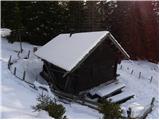
From Kranjska Gora, we drive towards Rateče, but only to the village Podkoren, where we turn right towards the border crossing Korensko sedlo. Just a few hundred meters before the border crossing, a forest road branches off sharply to the right, which we follow past numerous streams to a crossroad. We continue straight (sharply left Jerebikovec). Soon after that, the road makes a sharp right turn and in about 100 meters brings us to the second crossroad, where we continue slightly left (right Brvogi) on the road that starts descending. Then we drive quite some time and come to the third crossroad, where we go slightly right (sharply left Dolič). The road soon after that crosses a torrent, and we follow it a few more hundred meters to the mountain pasture Jureževa planina, where we park at an appropriate place a little above the hunting cottage.
Route description:
From the hunting cottage on Jureževa planina we continue a few more 10 meters on the forest road, then we leave it and continue the ascent left on the ascending and often also muddy cart track. The cart track ascends through a belt of forest and then brings us to the upper grassy slopes of Vošca. Here the path turns to the left and then ascends diagonally towards the summit, which we already see in front of us, and we reach it after approximately 10 minutes of additional walking.
Photos:
 1
1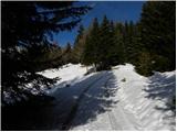 2
2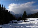 3
3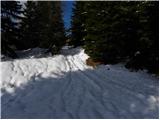 4
4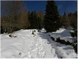 5
5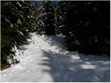 6
6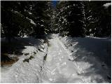 7
7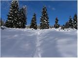 8
8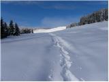 9
9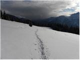 10
10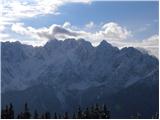 11
11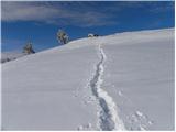 12
12 13
13 14
14
Discussion about the trip Jureževa planina - Vošca
|
| Kriška6. 11. 2006 |
I was on Vošca in the summer, it was a beautiful, clear day, the views were wonderful. Cyclists also accompanied the hikers.
|
|
|
|
| Gost22. 11. 2006 |
The autumn hike to Vošca is also beautiful. Larches in golden color. Definitely recommended to go on foot from Srednji vrh and the wandering can be even nicer since we have more options.
|
|
|
|
| PUHIPUHI24. 10. 2017 |
Does anyone know what the condition of the road to Jureževa planina is like? Normally drivable with a passenger car?
Thanks, LP; P
|
|
|
|
| Majdag29. 10. 2017 |
...Yesterday's ramble with my shaggy little Ira. The forest road is like any other. Sometimes nice, then bumpy with a few deep ditches, but it's passable. For those whose stride doesn't allow longer outings, this road is an opportunity to enjoy beautiful views of the mountains. The larches are still golden and there are plenty of them, it's nice.
http://jelenkamenmajdag.blogspot.si/2017/10/z-avtom-skoraj-do-vosce-in-naprej.html
|
|
|
|
| bostjan858. 05. 2018 |
How is the road to Jureževa planina, thanks.
|
|
|
|
| PUHIPUHI23. 05. 2018 |
I'm also interested if anyone has been to Jureževa planina by car in the last few days. What's the condition of the road?
|
|
|
|
| janez.novak24. 05. 2018 |
I go to Vošca on foot from Srednji vrh. The path is fine. And also: if you drive to Jureževa planina, it's just a walk and not a hike. The other thing is that there are children or hikers who walk with difficulty and this variant brings them closer to what they otherwise couldn't achieve anymore.
|
|
|
|
| Doohan12. 05. 2022 14:41:14 |
We walked on foot along the forest road to Jureževa planina, 8 km. To the top of Vošca we needed good three hours, back good two. Nicely spent five hours in nature with wonderful views of the Julians.
The road is otherwise in very good condition.
|
|
|
To post a comment you must log in:
If you do not yet have a username, you must first
register.