Jezerski vrh - Kärntner Storschitz / Pristovški Storžič (Krainersteig)
Starting point: Jezerski vrh (1218 m)
| Latitude/Longitude: | 46,4188°N 14,5268°E |
| |
Route name: Krainersteig
Walking time: 1 h 30 min
Difficulty: difficult marked way
Elevation gain: 541 m
Elevation difference along the route: 550 m
Map: Karavanke - osrednji del 1:50.000
Recommended equipment (summer): helmet
Recommended equipment (winter): helmet, ice axe, crampons
Views: 67.088
 | 6 people like this post |
Access to starting point:
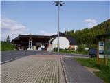
From the Ljubljana–Jesenice motorway, take the Kranj–east exit and follow the road ahead in the direction of Jezersko. From Zgornje Jezersko, we continue driving towards Austria along it to the Jezerski vrh border crossing, where we park on a marked parking lot on the Slovenian or Austrian side.
Route description:
On the Austrian side of the border crossing, we notice yellow hiking signposts, which direct us to a footpath that leads along the national border. The marked path soon joins a mountain road, which gradually turns to the right and brings us in a gentle ascent to a smaller mountain pasture, on which stands a hunting cottage.
At the hunting cottage, we leave the poorer mountain road and head left in the direction of Kranjska pot to Pristovški Storžič (on the sign »Storschitz Krainersteig«). The path that continues along the road leads via a less demanding and somewhat longer route to Pristovški Storžič.
The path from the mountain pasture ahead ascends through a meadow and soon brings us into the forest, where higher it crosses a mountain road, and when we then step on the road again, we follow it to the left. We then leave the road and head right onto an indistinct ridge, along which we ascend on a grassy slope at the edge of the forest. The increasingly steep path leads us along quite steep eastern slopes, where some steel cables also assist us. A steep ascent along the steel cable follows, which brings us with ever more beautiful views to the western slopes of Pristovški Storžič, which are overgrown with dwarf pines. The path then turns back towards the ridge and ascends along the next steel cable. When we reach the ridge, only a few steps of walking separate us from the panoramic summit.

Photos:
 1
1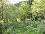 2
2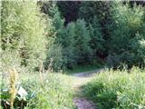 3
3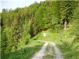 4
4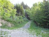 5
5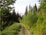 6
6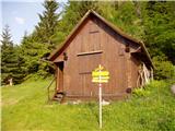 7
7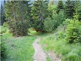 8
8 9
9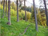 10
10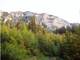 11
11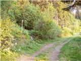 12
12 13
13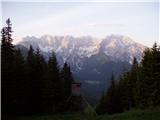 14
14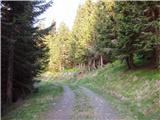 15
15 16
16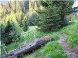 17
17 18
18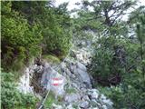 19
19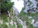 20
20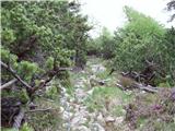 21
21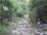 22
22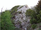 23
23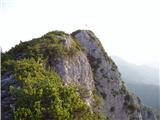 24
24 25
25
Discussion about the trip Jezerski vrh - Kärntner Storschitz / Pristovški Storžič (Krainersteig)
|
| andrej jerina22. 06. 2008 |
Today my son Jošt and I did the above-described trail, descent further via Planina Kepp, past the hunting hut back to the starting point. The trail is excellent, perfectly maintained and marked. Insurance perfect, there's a bit of easy climbing on the trail. Views of the north face from Kočna to Rinka are fantastic, as well as to Storžič, Košuta, Obir,... Highly recommended. Best, Andrej
|
|
|
|
| Kriška10. 09. 2008 |
Path hiked yesterday. Very nicely laid out, well marked, excellently secured, beautiful views, recommended!
|
|
|
|
| enjanez2. 08. 2009 |
Today, 2.9.2009, the Jrainer path was closed:
|
|
|
|
| aljoša122. 08. 2009 |
Is the Krainersteig open?
|
|
|
|
| acjom23. 08. 2009 |
I just got back from the mentioned path, the path is fine, but what about the path to Storžek, if anyone knows, since it's closed.
|
|
|
|
| jelencek24. 10. 2009 |
Is a helmet really necessary?
|
|
|
|
| Kozorog4. 10. 2009 |
A helmet is necessary everywhere there are crumbly rocks and there is a risk of something falling on your head. It is true, however, that people perceive and interpret these things differently. Here the danger is mainly in the last part of the path, admittedly very very small, but it exists.
|
|
|
|
| hribovska24. 10. 2010 |
Yesterday I was on this peak, weather still quite okay, just windy in places, and there's quite a bit of snow 
|
|
|
|
| fpetel117. 06. 2011 |
The path is in the last part occasionally exposed and almost vertical at two or three places. But where can you get the stamp for the Jezersko mountain trail, which also includes this peak?
|
|
|
|
| velkavrh17. 06. 2011 |
I was told that the Jezersko mountain trail booklet can be obtained at Češka koča from the host Mr. Krničar. They say he is a very friendly gentleman. I also plan Storžič for next week, I have already walked Štegovnik and Kozji vrh. There is no stamp at Štegovnik.
|
|
|
|
| Jože.17. 06. 2011 |
Anyone who wants details about the "Jezersko mountain trail" should go to Češka koča. There he will learn everything from the host, and can also get the booklet (I hope he has some in stock). I was at Stegovnik on 19.5., and the stamp was also in the box, as it is on all surrounding peaks (except Pristovski Storžič), which I walked recently. Best regards
|
|
|
|
| @rekar18. 06. 2011 |
Velkavrh, I don't know where you found Štegovnik? Correct is Stegovnik, locals call it Štibovnik.
|
|
|
|
| starakapa18. 06. 2011 |
STANKO KLINAR- Karavanke p.233, no. of ascent description 732
LP Starakapa
|
|
|
|
| velkavrh18. 06. 2011 |
Stanko Klinar informs us about the correct name in his guide Karavanke. The name Stegovnik is inherited from German cartographers who pronounced it correctly in German. Štibovnik is indeed a less established local form of the mountain name.
|
|
|
|
| Shime26. 07. 2011 |
We were up there two days ago. The ascent is nice, but unfortunately it was raining and nothing could be seen. Shame.
I would note that the 'caretaker' in that 'hut' (on the Austrian side of the pass) at the border crossing is extremely bad-tempered towards day hikers.  
|
|
|
|
| Parkeljc15. 10. 2011 |
Judging by the logbook content, the summit isn't crowded, yesterday met just one hiker, wonderful weather, unique views, nice afternoon tour..
|
|
|
|
| jprim16. 10. 2011 |
Today I'd say differently, the summit is quite crowded, but of course most were on the Austrian summit, ... nice, but short.
|
|
|
|
| metod13. 11. 2011 |
Nice trip also for children, to climb the rocks a bit. Today there were quite a few hikers of both nationalities up there.
|
|
|
|
| fpetel113. 11. 2011 |
For slightly older children.
The secured section is indeed quite short, but not too easy. The path is demanding. If wet, caution is needed in the rocky part. The secured section is quite exposed. (This is just my subjective assessment.)
|
|
|
|
| Edi28. 01. 2012 |
Today we were on it. The entire trail is under snow but well trodden. At some spots, especially in shaded areas, caution was required as there was ice underneath and you could slip quickly. I definitely advise against it for those unaccustomed to winter ascents, but recommend crampons for others on the ascent.
|
|
|
|
| Enka29. 07. 2012 |
Beautiful dynamic path. In dry conditions completely safe, as there are fixed protections everywhere needed, and even some more. The climbing section completely easy and not particularly exposed. I myself have fear of heights, but on this path it didn't bother me even once  . In dry certainly suitable path for introducing children to rocks, of course if they've already grabbed some somewhere. . In dry certainly suitable path for introducing children to rocks, of course if they've already grabbed some somewhere.
|
|
|
|
| darh23. 09. 2012 |
Yesterday we ascended the summit via this trail, descending via the easier one over Pasterkov vrh. The views were magnificent, and there were quite a few hikers - to our surprise, mostly Slovenian. More about our impressions and some photos here.
|
|
|
|
| ZOJA27. 12. 2012 |
Hello hikers! Has anyone been to P.Storžič in the last few days...how much snow is left, is it icy...
|
|
|
|
| Janiel7414. 06. 2013 |
@ZOJA: no more snow, not even icy ))
|
|
|
|
| halls27. 10. 2014 |
Has anyone been up there recently?
|
|
|
|
| K828. 10. 2014 |
I was up there on Sunday, 26.10. Nice path, only muddy due to snow melting.
|
|
|
|
| halls28. 10. 2014 |
thanks for the reply, K8! so no problem going through the screes?
|
|
|
|
| tinky28. 10. 2014 |
See current conditions, Karavanke, Pristovški Storžič.
|
|
|
|
| K829. 10. 2014 |
No problem in the chimneys, just a bit more caution due to wet rocks.
|
|
|
|
| K829. 10. 2014 |
No problem in the chimneys, just a bit more caution due to wet rocks.
|
|
|
|
| K829. 10. 2014 |
No problem in the chimneys, just a bit more caution due to wet rocks.
|
|
|
|
| sirt121. 04. 2015 |
Request to Tadej and Rok.
Please start using the Slovenian name Kranjska pot!
German krainer = Slovenian kranjski.
Also for Klagenfurter hutte use the name Celovška koča and not Klagenfurterjeva koča!
|
|
|
|
| Tadej21. 04. 2015 |
Thanks for the warning. I've corrected it. Best regards, Tadej
|
|
|
|
| vshine2. 07. 2015 |
Pristovski Storžič is great. But I'd like to warn about a plant approx. 50m from the parking lot (border crossing) along the trail. It looks like giant hogweed, which is poisonous and causes unpleasant allergic skin reactions. Caution is not superfluous. I didn't have a book with me to verify if it's really giant hogweed. If anyone knows, please let me know. Thanks.
|
|
|
|
| zavratčan5. 10. 2016 |
Stunning views of the northern faces of the Grintovci
|
|
|
|
| TeaR6. 08. 2019 |
Is the path suitable for a dog (mountain-trained)? Interested in the section with cables.
|
|
|
|
| malimiha6. 08. 2019 |
It is suitable. I took two up this path. Regards
|
|
|
|
| m3pisnik12. 02. 2021 |
Has anyone been up there in the last few days?
|
|
|
|
| robbrt29. 06. 2021 21:28:02 |
I'm interested if someone can describe the path in the upper part of the trail. Is the path steep anywhere and does the secured section run through bushes? How about exposure when you step onto the ridge? Thanks and regards
|
|
|
|
| tango25. 10. 2021 14:23:06 |
Excellent day for visiting the summit, especially ideal because it was frozen just enough in the morning so there was no mud, neither on the approach Kranjska pot nor on the other one over which we returned via the summit. Although a beautiful day and still vacation time, we met no one on the circular tour. I recommend for the autumn period, the colors are really wonderful.
|
|
|
|
| Enka15. 08. 2023 16:12:22 |
Path without special features, in good condition. Views still phenomenal, plenty of shade on the path too.
|
|
|
To post a comment you must log in:
If you do not yet have a username, you must first
register.