Jezerski vrh - Kärntner Storschitz / Pristovški Storžič
Starting point: Jezerski vrh (1218 m)
| Latitude/Longitude: | 46,4188°N 14,5268°E |
| |
Walking time: 1 h 50 min
Difficulty: easy marked way
Elevation gain: 541 m
Elevation difference along the route: 570 m
Map: Karavanke - osrednji del 1:50.000
Recommended equipment (summer):
Recommended equipment (winter):
Views: 64.267
 | 3 people like this post |
Access to starting point:
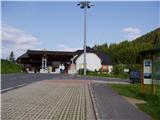
From Jezersko we drive to the border crossing Jezersko (Jezerski vrh). Immediately after the border crossing on the Austrian side, we will notice a smaller parking lot on the left side of the road, on which we park. A smaller parking lot is also on the Slovenian side of the border crossing.
Route description:
At the parking lot there are signposts that direct us to a trail that leads along the state border and then joins the mountain road. The road turns to the right and in a gentle ascent brings us to a smaller mountain pasture, where there is also a hunting cottage. From the mountain pasture we continue ahead on the road, to the left leads a more demanding and somewhat shorter path to Pristovški Storžič.
The path from the mountain pasture then for quite some time runs on the road past some crossroads, which are all well marked. From the right side then joins a marked path from the village Bela / Bad Vellach. Here we leave the mountain road and the path ahead becomes a little steeper, mostly running through the forest. When we come to a smaller meadow, from the right side also joins the path from Trogern / Korte. There follows an ascent through the forest and in the last part through dwarf pines to a panoramic summit.
Photos:
 1
1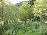 2
2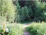 3
3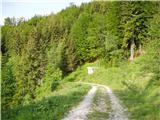 4
4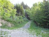 5
5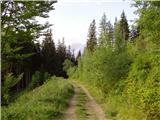 6
6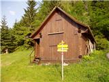 7
7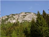 8
8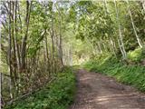 9
9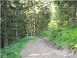 10
10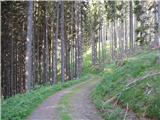 11
11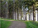 12
12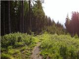 13
13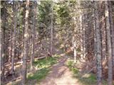 14
14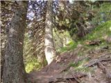 15
15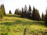 16
16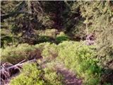 17
17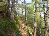 18
18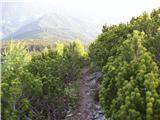 19
19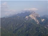 20
20 21
21 22
22
Discussion about the trip Jezerski vrh - Kärntner Storschitz / Pristovški Storžič
|
| ana26. 06. 2008 |
Very nice trail, hiked yesterday, beautiful views from the top.
|
|
|
|
| nevi28. 06. 2008 |
We got lost on the way down from the summit. We went up the left - shorter (Krainersteig) path, down the longer one. It's well marked, but we still managed to stray. At the spot where you come from the forest path to the road (after about half an hour from the summit), there are indeed arrows drawn upwards and not down the road, but those arrows are orange, painted with spray used by foresters, so we didn't believe them and went down and then wandered a bit off path. Well, nothing bad happened, we unnecessarily descended about a hundred meters and were delayed less than an hour.
|
|
|
|
| Kriška10. 09. 2008 |
Yesterday's route - up via Krainerjeva pot, down via this other variant. Compared to the first, this one is somehow tedious, mostly without views.
I don't understand how it's possible to get lost on it, as it is excellently marked. Also at the above-mentioned spot, where there is a multitude of orange foxgloves (on the rocks on the ground, on the trees and rocks along the path, besides them just a few meters further along the path there is also the usual, well-visible marker on the tree to the right of the path, and even signs showing the direction.
|
|
|
|
| klavdy625. 08. 2009 |
Nice afternoon hike on an easier path. Žiga is not at the top nor in the inn at Jezerski vrh. Regards
|
|
|
|
| asde28. 03. 2011 |
Unique trip, wonderful path and exemplarily marked trail. From the saddle where the path from Kort joins to the top there is a lot of snow. Down via Krainerjeva pot which was completely dry. I recommend the trip to everyone.
|
|
|
|
| fpetel18. 05. 2011 |
I was last week on the circular path to P. Storžič - a very nice summit. I wanted to stamp my logbook via Jezerski path, but there's no stamp at the summit - I'm wondering if the stamp even exists and where it is? The summit logbook is arranged though.
|
|
|
|
| Shime26. 07. 2011 |
We were up there two days ago. The ascent is nice, but unfortunately it was raining and nothing could be seen. Shame.
I would note that the 'caretaker' in that 'hut' (on the Austrian side of the pass) at the border crossing is extremely bad-tempered towards day hikers.  
|
|
|
|
| Shime26. 07. 2011 |
We were up there two days ago. The ascent is nice, but unfortunately it was raining and nothing could be seen. Shame.
I would note that the 'caretaker' in that 'hut' (on the Austrian side of the pass) at the border crossing is extremely bad-tempered towards day hikers.
|
|
|
|
| nana7719. 08. 2011 |
Yesterday I was up there. I recommend it to everyone if the weather is nice.
|
|
|
|
| klavdipo27. 08. 2011 |
I'm also doing the Jezersko path, which includes Pristovški Storžič too. Where can one get the stamp for this summit?
|
|
|
|
| barbytek15. 09. 2011 |
I was up there today, wonderful circular path, the stamp is available at the inn at Jezerski vrh, just don't know if you need it  . lp . lp
|
|
|
|
| alzu17. 03. 2012 |
Still snow in shady areas and in the forest, but it's already melting. More and more snow towards the summit from the last saddle (where the path from Kort joins), and especially there (up to the butt and over). Just a bit of snow on the summit. Strong wind today. Descent via Krainerjeva is possibly icy at the beginning (where the steel cables are), but with great caution and some acrobatics - wide straddle, since it's dry at the end, one can get to the bottom. If anyone goes up these days, I recommend gaiters, possibly snowshoes for the easier path because it really sinks in, and possibly crampons for Krainerjeva.
|
|
|
|
| annuskaananas21. 04. 2014 |
Is this trail exposed anywhere or is there any ledge on the trail? I'm interested because I'd like to go on the trail with a child in a backpack. Is the trail suitable or not? Thank you for the answer!
|
|
|
|
| sirt122. 04. 2014 |
You can easily hike this trail with a child on your back. There are no difficult sections. Have a safe journey!
|
|
|
|
| pemi4. 05. 2014 |
Maybe a bit late but anyway, this path is easy, but I don't recommend it yet, the upper part below the summit is covered with snow and poorly marked, so not yet with a child in a backpack, because the other path-more demanding, and not for backpack
|
|
|
|
| sirt17. 05. 2014 |
It's true. I apologize to @annuskaananas if you've already gone up (I commented on the trail, not conditions), if not yet, better wait until the end of May.
|
|
|
|
| pemi7. 05. 2014 |
That's right, otherwise the "more demanding" path is dry, but not for backpack, on this path there's still quite some snow below the summit, crampons recommended
|
|
|
|
| @rekar19. 04. 2015 |
Does anyone have information on what the path is like, is there still any snow on the northern side.
|
|
|
|
| vshine2. 07. 2015 |
Pristovski Storžič is great. But I'd like to warn about a plant approx. 50m from the parking lot (border crossing) along the trail. It looks like giant hogweed, which is poisonous and causes unpleasant allergic skin reactions. Caution is not superfluous. I didn't have a book with me to verify if it's really giant hogweed. If anyone knows, please let me know. Thanks.
|
|
|
|
| AB5. 05. 2016 |
Does anyone know what the trail to Pristovski Storžič (starting point border crossing Jezersko) is like? Is there still a lot of snow? Thanks and have a nice day 
|
|
|
|
| Tanja Sterže 30. 06. 2019 |
Today I was at the summit via this path. Excellently marked, pleasant path.
|
|
|
|
| m3pisnik14. 10. 2020 |
What are the conditions like? A lot of snow?
|
|
|
|
| anazala11. 09. 2022 18:29:07 |
Beautiful and even more beautiful.
|
|
|
|
| anazala11. 09. 2022 18:29:47 |
Fantastic. Moderate path. Not demanding. Upper part 4 m cables. Caution is advised. View of the Košuta ridge. KS Alps. Peca. Perhaps in good weather to the Julian Alps.
|
|
|
|
| Tbs4. 02. 2024 23:14:31 |
Is the stamp available? Where is it?
|
|
|
|
| Fulcrum5. 02. 2024 08:34:39 |
Previously the stamp was in the inn on the Austrian side of the Jezersko border crossing, right after the border. When I was last there (winter 2021) the inn was closed, probably only temporarily due to corona.
|
|
|
To post a comment you must log in:
If you do not yet have a username, you must first
register.