Jezero - Sveti Lovrenc (Jezero)
Starting point: Jezero (290 m)
| Latitude/Longitude: | 45,9711°N 14,4343°E |
| |
Walking time: 5 min
Difficulty: easy unmarked way
Elevation gain: 39 m
Elevation difference along the route: 39 m
Map: Ljubljana - okolica 1:50.000
Recommended equipment (summer):
Recommended equipment (winter):
Views: 4.873
 | 1 person like this post |
Access to starting point:
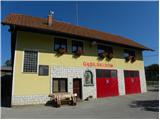
A) From the Ljubljana - Koper highway, take the Brezovica exit, from there continue driving left on the old road towards Vrhnika. Still in Brezovica, notice the signs for Podpeč, which direct us left. We drive through Vnanje and Notranje Gorice to Podpeč, where at the junction we continue left towards the village of Jezero. Follow the road through the village for a few 100 m, after which on the left side we notice the fire station, near which we park in a suitable spot (we park in such a way that we do not obstruct access to the garage doors of the fire station).
B) From Ljubljana, drive to Črna vas, then continue driving towards the place Podpeč, where we join the road from Brezovica. In Podpeč, continue left again (direction Jezero). Drive a few more 100 m, after which on the left side we notice the fire station, near which we park in a suitable spot (we park in such a way that we do not obstruct access to the garage doors of the fire station).
Route description:
From the fire station continue on the asphalt road towards the settlement Tomišelj, but walk along it only a few 10 m, then at the power line pole turn left onto the cart track, which bypasses the nearby residential house on the left side. The cart track then leads onto a scenic grassy slope, across which, with fine views of the Ljubljana Marshes and the hills surrounding them, we walk to the church of St. Lovrenc in a few minutes.
Photos:
 1
1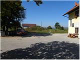 2
2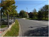 3
3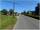 4
4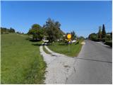 5
5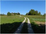 6
6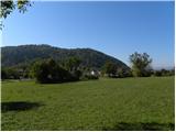 7
7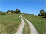 8
8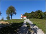 9
9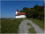 10
10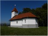 11
11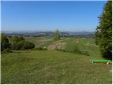 12
12
Discussion about the trip Jezero - Sveti Lovrenc (Jezero)
To post a comment you must log in:
If you do not yet have a username, you must first
register.