Starting point: Jesenovec (485 m)
| Latitude/Longitude: | 46,21°N 14,1261°E |
| |
Walking time: 1 h 30 min
Difficulty: partly demanding marked way
Elevation gain: 526 m
Elevation difference along the route: 535 m
Map: Škofjeloško in Cerkljansko hribovje 1:50.000
Recommended equipment (summer):
Recommended equipment (winter): ice axe, crampons
Views: 4.977
 | 1 person like this post |
Access to starting point:
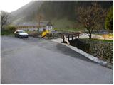
First, we drive to Škofja Loka, and then we continue driving towards Železniki and forward towards Zalem Log. Soon after Železniki (still before Zalem Log), we will get to a smaller crossroads, where to the right across the bridge the road to the hamlet Jesenovec branches off. On the bridge there is also a somewhat larger mountain signpost for Ratitovec. We park on the other side of the bridge, at a suitable place by the confluence of the stream Plenšak and the river Selščica (Selška Sora).
Route description:
From the starting point, we continue on the asphalt road that gently ascends along the stream Plenšak. After a few tens of meters, the blazes direct us to the right between two houses, behind which the path steeply ascends over a short grassy slope. The path soon enters the forest, where it turns left and then ascends diagonally on a relatively steep slope that is especially dangerous for slipping when wet. The poorly beaten and leaf-covered path higher crosses two gullies, over which the passage is quite arduous due to the ruined path and consequently also exposed to slipping. The path ahead still crosses steep slopes for some time, then they gradually flatten somewhat. The path, which continues to ascend relatively steeply, higher brings us to the next somewhat more difficult passage, where along a slightly exposed ledge we cross a rocky ridge. After that, the path turns right and shortly afterwards begins to ascend even more steeply. Higher, the path turns left and noticeably flattens, crossing the last exposed spot. Further on, the moderately steep path quickly brings us to a rough forest road, which past the hunting cottage that we bypass on the right side brings us to extensive grassy hay meadows, from which a nice view of Ratitovec opens up. A short descent follows and the path brings us to an asphalt road, along which we then ascend to the church of Mary Help of Christians on Prtovč in a few minutes.
From the church, we can also walk to the nearby Tourist farm Mohorič Marica.

Photos:
 1
1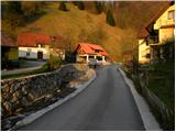 2
2 3
3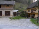 4
4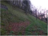 5
5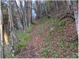 6
6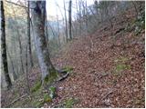 7
7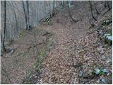 8
8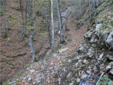 9
9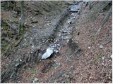 10
10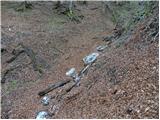 11
11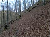 12
12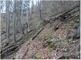 13
13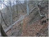 14
14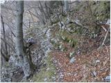 15
15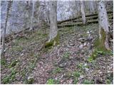 16
16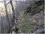 17
17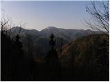 18
18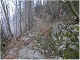 19
19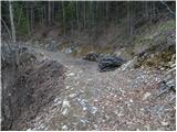 20
20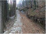 21
21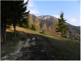 22
22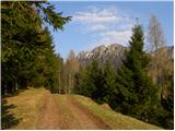 23
23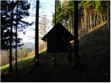 24
24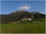 25
25 26
26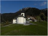 27
27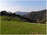 28
28
Discussion about the trip Jesenovec - Prtovč
|
| franci6512. 01. 2020 |
The marked hiking trail is impassable due to tree felling. Stumps have been removed, but all branches left blocking the path. A lot of gymnastics is needed for a hiker to push through the impassable section.
|
|
|
|
| GregorC12. 01. 2020 |
This trail is currently (January 2020) completely closed due to tree felling and timber removal!
|
|
|
|
| ločanka11. 06. 2023 18:48:06 |
The path is no longer closed, there is practically no trace of logging. However, the start of the path is slightly relocated, you step onto the path right at the parking lot, wooden steps are arranged, and two signs warn about the junction.
|
|
|
To post a comment you must log in:
If you do not yet have a username, you must first
register.