Jesenice (Ukova) - Jelenkamen (via Dole)
Starting point: Jesenice (Ukova) (600 m)
| Latitude/Longitude: | 46,4362°N 14,0648°E |
| |
Route name: via Dole
Walking time: 1 h 20 min
Difficulty: easy unmarked way
Elevation gain: 496 m
Elevation difference along the route: 496 m
Map: Karavanke - osrednji del 1:50.000
Recommended equipment (summer):
Recommended equipment (winter): ice axe, crampons
Views: 4.474
 | 2 people like this post |
Access to starting point:
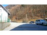
From the Ljubljana-Jesenice highway, take the Lipce exit (Jesenice east), where we turn right towards Jesenice. At the first traffic-light intersection on Slovenski Javornik, we turn left towards the town center. In the second traffic-light intersection (at the gymnasium), we turn sharply right back onto Tomšičeva cesta, past the primary school on the left. Behind the school we drive past the pedestrian crossing and immediately turn into the first (narrower) street on the left. When we ascend it for some 10 meters, on the right we see the marked parking lot - our starting point.
Route description:
From the parking lot, we continue on the road uphill. After some 10 meters on the left we notice the summer swimming pool Ukova, on the right the road which branches off uphill towards the north into the forest.
We head onto it and follow it for a short time, i.e. to the right turn, before which on the same side there is a fenced water catchment. On the other - left side we step onto the path which cuts the double turn of the road we left. Here we also encounter the first marking. Quite quickly we cross the road again and step onto the path which begins to ascend towards the north. Then when it a little higher turns left, it joins the cart track, where we encounter the signpost "Pristava Jelenkamen".
Here we head right on the cart track which quickly brings us to the first small bridge (Ukova stream) and immediately thereafter to the second. Behind it the marked path turns right and a little later left in the southeast direction. Further we moderately ascend for some time on and along the winding, cart-track-like path, where we always keep to the main - left path. When the path flattens, on the right on the tree we notice the sign "kapelica" and a smaller elevation named Kalvarija, on which there are a chapel and a bench. We continue straight on our path, which narrows a bit and turns left. Immediately thereafter we encounter a smaller water catchment with the inscription "Pristava". Here we cross the small (mostly dry) stream bed, on the right we encounter benches with a spring of drinking water. At this point we leave the marked path and head more sharply left towards the north, into the steep valley (gully) between the slopes of the hills Jelenkamen and Lenčkov Špik. Soon after the path ascends we ignore the branch-off of the steep gully on the right and continue on the path which keeps to the edge of the main gully (mentioned valley). The occasionally steep, slightly winding path which leads us in the northeast direction is partly arranged for easier crossing of obstacles. While walking, we are accompanied by the view of the quite steep slope of the neighboring hill from the other, left side of the gully. When crossing one of the smaller gullies from the slope on the right, a small bridge helps us. Higher we ignore the left branch-off to the main gully and continue on our ascending path along the slope on the right. On the section of the path where the gully loses its depth, the path briefly flattens and then steeply ascends again towards the top. When we emerge from the forest we find ourselves at the foot of the steep meadow named Dole. Here the path turns right, back into the forest and soon brings us to a junction on the flat section, where we step onto the marked path and head right (left Dom Pristava, sharply left onto the slope of Lenčkov Špik, Španov vrh..). After a gentle ascent the path on the wide forested ridge of Jelenkamen flattens and occasionally even descends a little. A few minutes before the goal, a less noticeable eastern path joins us from the left, after a gentle ascent we finally arrive at the southern edge of the summit ridge of Jelenkamen, where a beautiful view of Gorenjska opens up. We encounter a bench and a box with the logbook, which is located on the trunk of the tree on the right.

Along the route: Kalvarija (784m)
Photos:
 1
1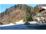 2
2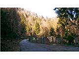 3
3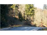 4
4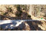 5
5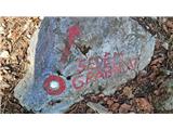 6
6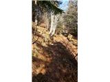 7
7 8
8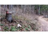 9
9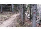 10
10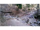 11
11 12
12 13
13 14
14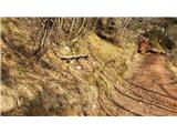 15
15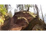 16
16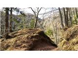 17
17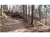 18
18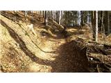 19
19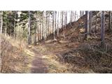 20
20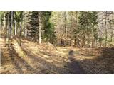 21
21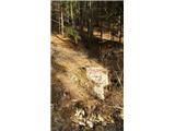 22
22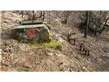 23
23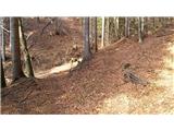 24
24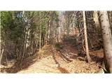 25
25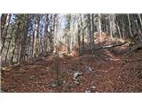 26
26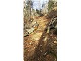 27
27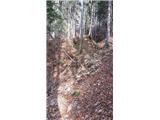 28
28 29
29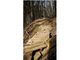 30
30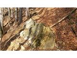 31
31 32
32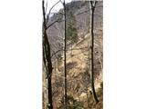 33
33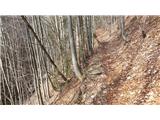 34
34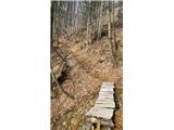 35
35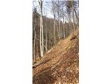 36
36 37
37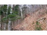 38
38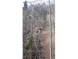 39
39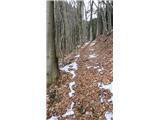 40
40 41
41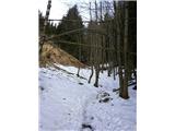 42
42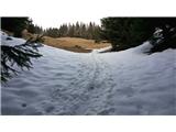 43
43 44
44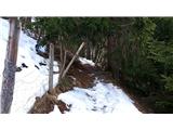 45
45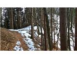 46
46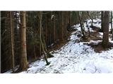 47
47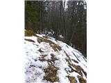 48
48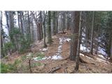 49
49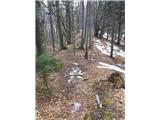 50
50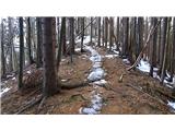 51
51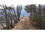 52
52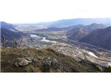 53
53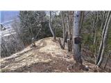 54
54
Discussion about the trip Jesenice (Ukova) - Jelenkamen (via Dole)
|
| Jusk15. 09. 2019 |
Quite a fun steep trail for building and maintaining fitness, I didn't go to Jelenkamen but further to Lenčkov špik, then to Križovc and Planina pod Golico. [I go] on the trim trail towards Hrušica and from there on the bike path to Jesenice
|
|
|
|
| Jusk15. 09. 2019 |
Fun trail, from Križovc to Planina pod Golico occasionally muddy
|
|
|
|
| Jusk14. 01. 2021 |
first to Jelenkamen along the marked trail, then also to Lenčkov špik, back along the trail through Dole.. the trail through Dole is already a bit trodden, snow just right so it doesn't sink too much enjoyment of the winter idyll above Jesenice Lp enjoyment of the winter idyll above Jesenice Lp
|
|
|
To post a comment you must log in:
If you do not yet have a username, you must first
register.