Jesenice (Straža) - Kozjek
Starting point: Jesenice (Straža) (560 m)
| Latitude/Longitude: | 46,429°N 14,0825°E |
| |
Walking time: 25 min
Difficulty: easy unmarked way
Elevation gain: 206 m
Elevation difference along the route: 206 m
Map: Karavanke - osrednji del 1 : 50.000
Recommended equipment (summer):
Recommended equipment (winter): ice axe, crampons
Views: 4.287
 | 2 people like this post |
Access to starting point:
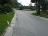
From the highway Ljubljana - Jesenice, we take the Lipce exit, where we turn right towards Jesenice. In the settlement Slovenski Javornik, at the intersection with the traffic lights, we turn left towards the town center. In the second traffic-light intersection (near the high school), we turn right, back onto Tomšičeva cesta, past the primary school on the left. We drive another 2.5 km to the end of Tomšičeva ulica, or to the spot where, by the railway tracks, there is the last bus stop below the slope. Here is a large parking lot, our starting point.
Route description:
From the parking lot, we head up the asphalt road, where just below the top on the left we notice a path, which we step onto and turn left along it past the gardens on our left. We immediately come near residential buildings on the left, where we cross a short cart track (leading to the nearby water reservoir on the right). The path now ascends slightly towards the power line, which we quickly reach. Here we turn right uphill to the east along a gravel path.
We soon reach the second power line, where the path turns left into a short woodland (depending on the season we encounter a wire fence), after which we step onto a (hunter's) path running east-west. We turn left (westwards) across the pasture; towards its end, on the left we notice a small bench, but at this junction we continue right, more steeply uphill. Soon the gradient eases and the path turns left towards the exposed rocky "baba", where we can enjoy the view.
We continue into the deciduous forest (direction west), where the path crossing the south slope of Kozjek first descends slightly, then brings us to a forest clearing. Here we turn sharply right onto the ridge, where we soon encounter a path. Along it, in an easterly direction and in a few minutes, we ascend to the summit of the vegetated ridge, where the view opens up onto Slovenski Javornik, Lipce, Blejska Dobrava, Mežaklo, Jelovica with Ratitovec and the Ljubljana Basin.

The trip can be extended to the following destinations: Jelenkamen
Photos:
 1
1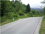 2
2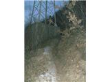 3
3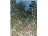 4
4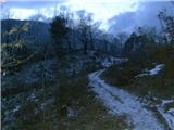 5
5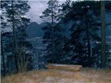 6
6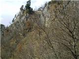 7
7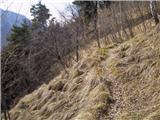 8
8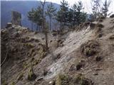 9
9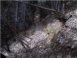 10
10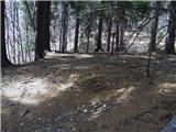 11
11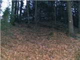 12
12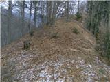 13
13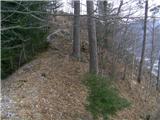 14
14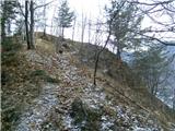 15
15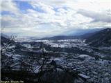 16
16
Discussion about the trip Jesenice (Straža) - Kozjek
|
| heinz16. 06. 2014 |
The bench on photo 6 is no longer there, the path is quite overgrown in the lower part.
|
|
|
|
| heinz22. 02. 2023 15:00:35 |
I recommend viewing the map located on Španov vrh, as proof that locals have always called the peak KozjEk and not incorrectly -KozjAk.
(unfortunately I cannot attach photos)
Have a nice day, safe and joyful on all paths!
H.Blagne
|
|
|
|
| gamsek122. 02. 2023 16:40:37 |
Perhaps it would also be advisable for locals to coordinate a bit with TIC and other societies, so there isn't such confusion, when on many (most?) maps it says KozjAk, as well as in the "newly minted" booklet of Jesenice hiking trails and even on the stamp itself. 
|
|
|
|
| heinz22. 02. 2023 23:29:05 |
Those you mention were misled by my original name that I posted here (Kozjak). Later, when I realized I had messed it up, I asked the administrator to correct the name, but it was already too late. Before my publication of the path and the peak as a target, you couldn't find any mention of this hill located above Sl. Javornik anywhere on the web. Then, after I posted Kozjak, the ignorant ones like I was started posting stories about trips to "Kozjak" on various websites (blogs, social networks, etc.). As said, when the correction came, it was too late. For the correct name, you can always ask the Javornik residents, or you can check that large map located on Španov vrh. All the best!
(something similar happened with the name Mali Jelenkamen, which now has a logbook with that name in completely the wrong place. I only posted the opinion of one single local, which of course wasn't final yet, but apparently too much for some who took it "as gospel")
|
|
|
To post a comment you must log in:
If you do not yet have a username, you must first
register.