Jermanca - Turska gora (via Kamniško sedlo)
Starting point: Jermanca (900 m)
| Latitude/Longitude: | 46,3349°N 14,5848°E |
| |
Route name: via Kamniško sedlo
Walking time: 4 h 45 min
Difficulty: very difficult marked way
Elevation gain: 1351 m
Elevation difference along the route: 1450 m
Map: Kamniške in Savinjske Alpe 1:50.000
Recommended equipment (summer): helmet, self belay set
Recommended equipment (winter): helmet, self belay set, ice axe, crampons
Views: 60.356
 | 3 people like this post |
Access to starting point:
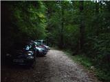
We drive to Kamnik and follow the road ahead towards the valley of Kamniška Bistrica. From the hut in Kamniška Bistrica we continue driving on the forest road which higher up brings us to a crossroads, where we continue right towards Jermanca (straight starting point for Kokrsko sedlo). We follow this occasionally somewhat steeper road to a parking lot, which is located a little before the end of the road.
Driving from the mountain hut in Kamniška Bistrica to Jermanca is now forbidden (traffic sign), this extends the path by a good hour.
Route description:
From the parking lot, we continue on the road by which we have parked. After a few minutes, the road ends, and we continue on a footpath without large ascents or descents. The path, which crosses a large number of gullies, then joins the path from Kamniška Bistrica (lower starting point). Here we need to pay attention during the descent, so that we take the path by which we came. Well-marked and relatively steep path, which for some time still ascends through the forest, higher brings us to a pleasant spring (in dry periods it dries up). From the spring, a short ascent follows and the path brings us to the known resting place Pri Pastirjih, where there stands an emergency bivouac.
We continue straight on the marked path, which then quickly passes from the forest onto an expansive panoramic meadow. Behind the meadow, the path goes into a belt of dwarf pines, where it starts to ascend more steeply again. The path, which continues on the increasingly panoramic sunny slope, brings us after a good hour of walking from Pastirji to the mountain hut on Kamniško sedlo.
From the mountain hut on Kamniško sedlo we continue left in the direction of Brana on the path which across panoramic meadows brings us to a junction, where we continue slightly left (right downwards Okrešelj). The path, which further ascends on the increasingly rocky slope, quickly brings us to a scree field, which is dangerous for slipping in snow. We cross the scree field in a gentle traversing ascent, then the path brings us to the next junction.
Left upwards leads the path to Brana, we continue slightly right and further in ascent cross the slopes towards the west. From the scree, the path for a short time brings us to a grassy slope, then the path becomes more demanding. Here we descend left downwards along a well-secured indistinct gully, which brings us into a somewhat cluttered ravine. Follows crossing of steep slopes towards the west, which brings us to the notch Kotliči (1949m).
From the notch, with the help of steel cables we descend to the south side of the ridge. Follows a shorter somewhat steeper descent, then the path begins to ascend again on a somewhat crumbly slope above Kotliški graben. With the help of a few fixed protections, we then again reach the ridge where we continue left. The path ahead briefly runs along the ridge, then turns right and past the memorial plaque crosses the exposed slope secured with pegs. The path then becomes a shade less steep and ascends on the slope from which a nice view opens towards Mrzla gora. Later the path again turns left and crosses a very steep slope. The path then turns right and follows ascent on a somewhat crumbly gully, which brings us under the chimney named Sod brez dna.
Follows a somewhat more demanding ascent through the chimney where we ascend a few meters almost vertically with the help of steel cables. Above the chimney then for some time we walk on a relatively wide and panoramic ridge, then we begin to descend somewhat more steeply with the help of a few protections. Follows a very short vertical descent on brackets, which brings us into a narrow notch. From the notch we continue left downwards, then the path turns right and with the help of a few pegs ascends the gully, which brings us above the already mentioned narrow notch. Above the notch we continue left and the path further leads on a somewhat less demanding slope, which is partly overgrown with grass. Further on the slope becomes rocky again and to the summit of Turska gora follows yet an ascent on the panoramic eastern slope of the mountain. When we reach the summit, a wonderful view opens towards the west where Grintovec, Skuta and Rinke are nicely visible.
Jermanca - Pri Pastirjih 1:15, Pri Pastirjih - Kamniška koča 1:15, Kamniška koča - Turska gora 2:15.

The trip can be extended to the following destinations: Brana
Photos:
 1
1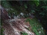 2
2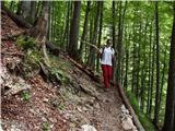 3
3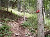 4
4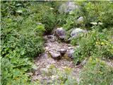 5
5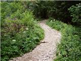 6
6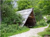 7
7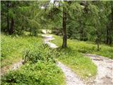 8
8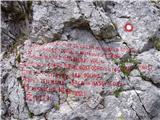 9
9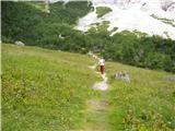 10
10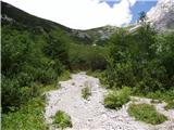 11
11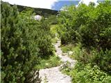 12
12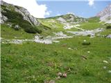 13
13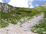 14
14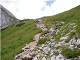 15
15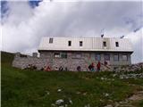 16
16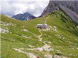 17
17 18
18 19
19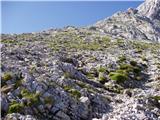 20
20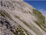 21
21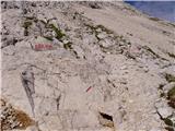 22
22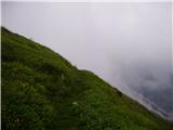 23
23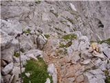 24
24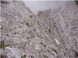 25
25 26
26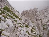 27
27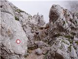 28
28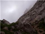 29
29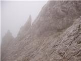 30
30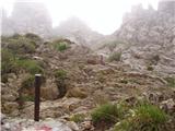 31
31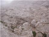 32
32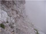 33
33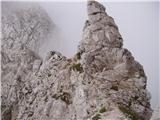 34
34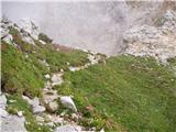 35
35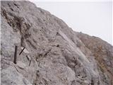 36
36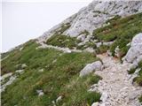 37
37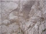 38
38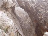 39
39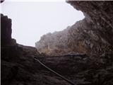 40
40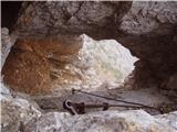 41
41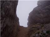 42
42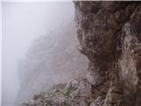 43
43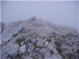 44
44
Discussion about the trip Jermanca - Turska gora (via Kamniško sedlo)
|
| Gost25. 06. 2007 |
Brane V. Demanding tour, for lovers of wire ropes. Caution, really very crumbly. Unfortunately an unpleasant wind was blowing.
|
|
|
|
| SuperNejc20. 08. 2007 |
What is the ascent to Turska gora from the Logarska side like? So past Okrešelj and through Turski žleb? I'd appreciate a reply and best regards.
|
|
|
|
| Gost7. 10. 2007 |
The path through Turski žleb is quite nice
|
|
|
|
| Gost5. 02. 2008 |
Personally I'm for the route from K. Sedlo. Through Turski žleb the descent is unpleasant - you're hanging on loosened steel cables. Highly recommend self-belaying.
Best regards, Franci
|
|
|
|
| jlogar17. 06. 2010 |
I'm curious about the conditions on the path to Turska gora via Kamniško sedlo. Is there still a lot of snow?
|
|
|
|
| rajerfss18. 06. 2010 |
on Saturday I went to Turska gora but had to turn back because there was still a lot of snow field in the gully called Kotliči which I couldn't cross without crampons and ice axe, so I only went to Brana where I couldn't stamp because the pad was completely dry. maybe the situation has improved in these days, judge yourself. lp.
|
|
|
|
| starakapa18. 06. 2010 |
But I ALWAYS carry a stamp pad with me and it's light too.
|
|
|
|
| jlogar18. 06. 2010 |
Thanks for the concrete answer! I'll wait a bit longer or take winter gear. Happy hiking to everyone 2010.....
|
|
|
|
| jlogar6. 07. 2010 |
Well, I waited a bit, at the end of the week I would go to Turska gora. How much snow is left, can one get up there without winter gear?
|
|
|
|
| Marky29. 07. 2011 |
What are the conditions like for Turska gora? I'm thinking of going up tomorrow to check.. oh, and I heard the fixed ropes were torn. Have new ones been installed or what's the situation? Thanks..
|
|
|
|
| mala planina17. 10. 2011 |
Conditions are good, the path is well marked and secured. The cables are also fine! VERY NICE HIKE
|
|
|
|
| pohodnik381. 08. 2012 |
We hiked this path with my friend on Saturday 28.7. very demanding but beautiful, path is in good condition, nice views, lots of people, weather served well too 
and some more PICTURES
|
|
|
|
| stropci27. 08. 2012 |
Hey, I'm wondering if it's possible to reach Turska gora also without a via ferrata set? Any advice? Is it necessary?
thanks 
|
|
|
|
| dprapr27. 08. 2012 |
Turska gora was quite visited in summer and winter, when there was still no "sign or sound" of SVK!
It can be done!
|
|
|
|
| pohodnik3827. 08. 2012 |
@stropci if you go from Kam.Bistrica up through Žmavcarje you definitely won't need it
|
|
|
|
| smatjaz17. 08. 2013 |
I went yesterday through Kotliče dol (much harder than going up), very crumbly, in case of larger group big risk of falling rocks (helmet mandatory), safety gear highly recommended, especially on descent (I'm of middle-aged generation).
|
|
|
|
| klavdipo7. 08. 2014 |
Is there still any snowfield over Kotliče?
|
|
|
|
| BananaBronson1. 10. 2018 |
The path via Kamniško sedlo and Kotliče is without special features. The most problematic is the road, which is hardly drivable anymore. Here is a short report.
|
|
|
|
| trdi10. 10. 2018 |
Great route, nicely secured, up and down seem similarly difficult to me, since you descend through gullies to Kotličeva in any case. Smatjaz scared me, so I took SVK, but there was no need to use it. Not overly exposed, the most critical is a couple of pegs before the bottomless cauldron. I recommend it. For me one of the nicer routes in KSA.
|
|
|
|
| Turbolazec24. 05. 2020 |
Is there still any snow on this path? Thanks
|
|
|
|
| redbull24. 05. 2020 |
Of course there's still snow!
|
|
|
|
| arko easy19. 06. 2020 |
Is there still any snow on the path? Are the cables dry?
|
|
|
|
| green23. 06. 2021 18:26:48 |
What are the conditions on this trail (snow, fixed protection)?
|
|
|
|
| Tsr4919. 09. 2025 17:20:36 |
I read comments a bit and based on them alone it's hard to figure out how demanding the path to Turska gora via Kotliče from Kamniško sedlo really is, easiest for me would be if you could compare it to some path I've already hiked. I've hiked quite a few paths in KSA, one of the more demanding was crossing Dolgi hrbet, which caused me no problems, could someone give their subjective opinion between the Dolgi hrbet tour and Turska gora from Kamniško sedlo (eventually also from Turska to Skuta) thanks in advance for comments. To everyone I wish many safe steps in our beautiful mountains.
Ps. SVK kit and helmet are always ready and used whenever necessary.
|
|
|
|
| jturk19. 09. 2025 19:30:46 |
The path via Kotliče is easier compared to crossing Dolgi hrbet, at least in my opinion. Helmet is definitely mandatory. I didn't use SVK on the ascent, haven't returned the same way (went to the valley via Žmavčarje), so can't comment on the descent. I think there's also a video on the Youtube channel V naravo.
|
|
|
|
| Tsr4919. 09. 2025 21:32:28 |
jturk, thanks for your opinion and quick reply. I'll look it up on Youtube too
|
|
|
|
| garmont20. 09. 2025 04:01:33 |
The path to Turska gora is quite exposed under the slopes of Brane. Follow the descent to Kotliče, which is secured with cables throughout. On the ascent towards Sod brez dna, you need to be careful not to stray. Markings in this section are sparse. Above Sod brez dna, there are no more issues with route-finding to the summit.
I think it's equally difficult in both directions.
|
|
|
|
| franca21. 09. 2025 11:55:47 |
I agree with garmont regarding the difficulty, it's approximately equally demanding in both directions.
The markings below Turska gora have apparently just been renewed
|
|
|
|
| zokipoki21. 09. 2025 16:15:01 |
Markings renewed, quite a few new pegs, staples, and cables too. Was there today.
Regards
|
|
|
|
| Tsr4924. 09. 2025 09:31:05 |
Thanks to everyone for the information, I walked this path a couple of days ago. Personally, I liked it, but it's true that it's crumbly, especially in Kotliči. Otherwise, the path is renovated. Markings super visible, some new pegs and cables. Thanks to everyone who contributed in any way.
Safe steps!
Regards
|
|
|
To post a comment you must log in:
If you do not yet have a username, you must first
register.