Jermanca - Planjava (via Repov kot)
Starting point: Jermanca (900 m)
| Latitude/Longitude: | 46,3349°N 14,5848°E |
| |
Route name: via Repov kot
Walking time: 4 h 30 min
Difficulty: difficult pathless terrain
Elevation gain: 1492 m
Elevation difference along the route: 1492 m
Map: Kamniške in Savinjske Alpe 1:50.000
Recommended equipment (summer): helmet
Recommended equipment (winter): helmet, ice axe, crampons
Views: 40.328
 | 3 people like this post |
Access to starting point:
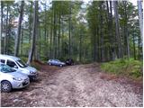
We drive to Kamnik and follow the road ahead towards the valley of Kamniška Bistrica. From the hut in Kamniška Bistrica we continue driving on the forest road, which brings us higher to a crossroad, where we continue right towards Jermanca (straight starting point for Kokrsko sedlo). We follow this occasionally somewhat steeper road to a parking lot, which is located a little before the end of the road.
Driving from the mountain hut in Kamniška Bistrica to Jermanca is now forbidden (traffic sign); this extends the path by a good hour.
Route description:
From the parking lot, we continue on a narrower road which soon changes into a footpath. Further, through the forest we cross the slope on the left side of the valley and then soon join the marked path from Kamniška Bistrica (lower starting point). Still in a gentle ascent we cross the slope towards the northeast and the path brings us to the fork V Klinu. The marked path towards Kamniško sedlo here turns left upwards (there are also signposts by the path), while we continue slightly right on an unmarked path. At the beginning of this path there is a large sign »Pot ne vodi na K. sedlo«.
Further, the path starts to ascend somewhat more steeply and runs through the forest on the left side of the valley. A few times a narrow trail branches off to the right downwards from the path, but we always walk on the better-trodden trail, which constantly runs on the left side of the valley. Later, when the path brings us out of the forest, we will notice a waterfall whenever there is enough water in the stream on the right. The path then crosses a somewhat exposed slope to the right, aided by some pitons. Here we will notice some small pools on the right side in the stream bed. We continue left and start ascending again through the forest and dwarf pines. When we come out of the forest the path brings us to a fork, where we continue right on a narrow trail through dwarf pines. Near the fork there is a storm shelter on the left side; if we continued left the path brings us to a panoramic ridge after a few meters.
From the dwarf pines the path leads us over a short scree and then crosses rocky slabs. The path still runs on the left side of the valley and in the last part turns slightly to the right. Here the path becomes somewhat steeper and some easy climbing is needed (1st degree). The path on this part is also somewhat less visible, aided by some cairns. At the last ascent towards Srebrno sedlo the path retreats from the steepness to the right side.
At Srebrno sedlo where we join the marked path we continue left. This is followed by crossing slopes towards the west, which we do in a moderate ascent. Further we come to the next fork, where we continue right towards the summit of Planjava (left Kamniško sedlo). From the increasingly panoramic path the green meadows finally depart, replaced by gray rock. A little below the summit paths from Klemenča jama and Kamniško sedlo also join us. Only a shorter ascent on the summit slope of the mountain follows.

Along the route: Srebrno sedlo (2115m)
Photos:
 1
1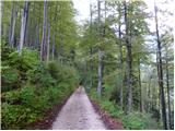 2
2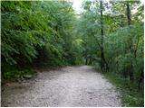 3
3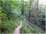 4
4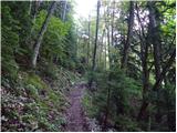 5
5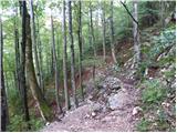 6
6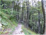 7
7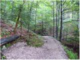 8
8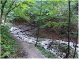 9
9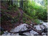 10
10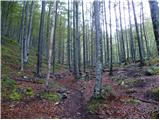 11
11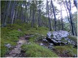 12
12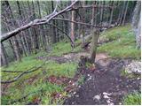 13
13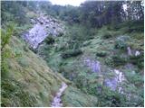 14
14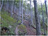 15
15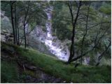 16
16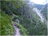 17
17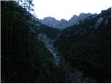 18
18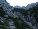 19
19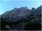 20
20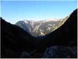 21
21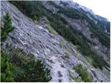 22
22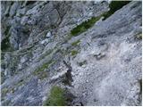 23
23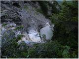 24
24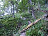 25
25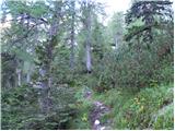 26
26 27
27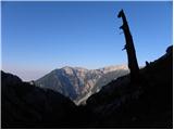 28
28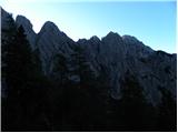 29
29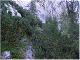 30
30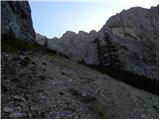 31
31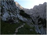 32
32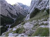 33
33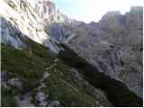 34
34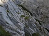 35
35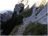 36
36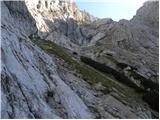 37
37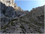 38
38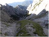 39
39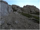 40
40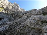 41
41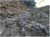 42
42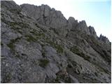 43
43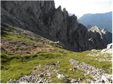 44
44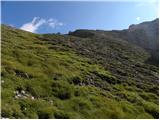 45
45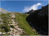 46
46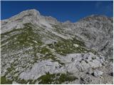 47
47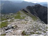 48
48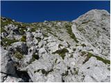 49
49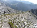 50
50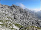 51
51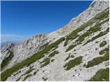 52
52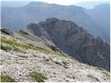 53
53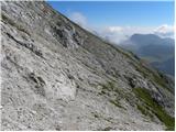 54
54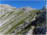 55
55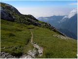 56
56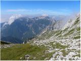 57
57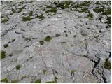 58
58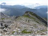 59
59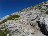 60
60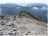 61
61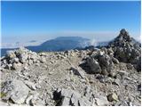 62
62
Discussion about the trip Jermanca - Planjava (via Repov kot)
|
| lepenatka1. 09. 2010 |
Super, now we have a description of this route on the portal too.
Thanks to the author
|
|
|
|
| Flora11. 09. 2010 |
Ha ha, lepenatka, I remembered you. as if ordered 
|
|
|
|
| Flora11. 09. 2010 |
Now I've looked at the photos and the memory returns. About 8 years ago we were there and not since. Yes, you need to be careful over those slabs. I also remember a short chimney or gully (there was even trash at the entrance), my friend climbed it directly, but there's an easier bypass on the left. At that time I didn't have a helmet, and now looking at the pictures, I think I was naive 
|
|
|
|
| garmont29. 08. 2011 |
The entry into the wall (the chimney mentioned above) is the key point of the tour. Once you climb it, a much easier section follows to the top of Srebrno sedlo, of course without using hands for progression it won't do.
LP
|
|
|
|
| Janc13. 10. 2011 |
Hello, is driving by car to Jermanca allowed?
|
|
|
|
| _sandra_13. 10. 2011 |
At Dom v Kamniški Bistrici there is a sign, no traffic allowed, so you go there at your own risk.. I always go, and I haven't gotten a fine yet, but it has happened that there were notes on the car..
|
|
|
|
| bostjanp13. 10. 2011 |
The path is interesting, especially the part with the pools. On the path to the top of Srebrnega sedla, for better orientation you need to pay a bit more attention to where the cairns are. Nice circular tour to Planjava-Kamniško sedlo-Kamniško bistrico. In one sentence: it's worth hiking it.
|
|
|
|
| MR26. 08. 2012 |
Yesterday we hiked this path. The sign "Path does not lead to K. sedlo" is no longer there. There weren't many cairns along the path. I especially missed hints for climbing the wall below the summit of Srebrno sedlo. We went pretty direct though.
|
|
|
|
| katty26. 08. 2012 |
Probably that storm cloud which is in one of the upper pictures  . .
|
|
|
|
| franca30. 08. 2012 |
The upper part is properly "cairned", yesterday it came in very handy on the descent. Going up you quickly see where it's easier and where more demanding, but for the descent the trail to the climbing part is quite tricky and the cairns help
|
|
|
|
| DD25. 10. 2012 |
hi.
yesterday I headed to Planjava through Repov kot, in between I decided to also visit the ridge of Zeleniške špice (one of the most beautiful ridges around here, from a climbing perspective maybe a bit uninteresting since you climb twos but the views are fantastic and the exposure is quite significant) then I continued the path from Srebrno sedlo to the top of Planjava and then to Kamniško sedlo and back to the foggy valley, where the circle was closed .
|
|
|
|
| frko15. 10. 2013 |
Nice regards. I'm tempted to visit this path this Sunday, just wondering if there's still any snow there.
|
|
|
|
| ljubitelj gora15. 12. 2016 |
pic40: in the left gully there is a snow patch. Across Planjava meadows it's fine, no snow (pics 30-31) somewhere here the pathless route branches left under the overhanging walls.
|
|
|
|
| seinfeld11. 10. 2018 |
Yesterday on this route. It is very easy to follow, extremely varied. Climbing towards Srebrno sedlo is not difficult, the section on photo 32 caused me more trouble, where in case of slip you fall several floors lower.
Back I went via Kamniško sedlo; all together 11km, in five hours and three quarters.
|
|
|
|
| trdi8. 08. 2020 |
I would put 5 hours here, because you have to consider that it's pathless terrain and some time is spent finding passages in the upper part. Also, I would categorize it as very difficult pathless route only because of those two extremely dangerous sections, namely the first rock jump towards the cirque and the smooth slabs. There is no room for error there and an error means certain death. Both dangerous sections are unsecured, although lower at the pools there are even some pegs and a rope, which are actually not necessary.
|
|
|
|
| M E S A23. 10. 2022 12:41:37 |
I agree with the tough. 'Demanding pathless terrain' doesn't say enough about the difficulty of this path. It offers some easy climbing, at two or three places (especially due to lack of protection) you really need some caution and a sure step (the problem increases when the rock is wet). So carefully...
However, the path is marked in several places amateurishly with some kind of spray. The marks are helpful of course, but this kind of marking doesn't belong in the mountains. Better to mark with cairns.
|
|
|
|
| dprapr23. 10. 2022 17:33:25 |
If the "path" is treated as pathless terrain, there is no need for any markings. Even cairns are unnecessary, although they are the most natural.
I still understand if someone builds a cairn because they fear not finding the way back... But lately a multitude of cairns are being built everywhere, which says a lot about the character of mountain visitors.
|
|
|
|
| 4318. 06. 2024 12:50:30 |
I suggest reclassifying the trail as an unmarked trail; below it's a highway-like path, but when you reach the rocky section it's marked with red blazes, just below the saddle with yellow ones, both uphill and downhill.
Regarding difficulty, only the first jump is problematic, with 2 moves say grade II in considerable exposure. However, there are plenty of holds and they are very large. Then there are a few similar moves in the gully below the saddle, but there it's not exposed.
|
|
|
|
| jprim19. 06. 2024 18:26:03 |
@43
If it says off-trail, it means the path is unmarked.
Or am I missing something?
Best regards!
|
|
|
|
| Janez Seliškar20. 06. 2024 08:12:29 |
How can it be an unmarked trail and off-trail at the same time
|
|
|
|
| Trobec20. 06. 2024 12:30:30 |
@jprim, yep, textbook case of misunderstanding
But I agree with @43, it used to be off-trail, but not for a long time now. Especially with all the apps and GPX tracks. When you look down from Dec or Zeleniški, at times it almost looks like a mulattiera...
|
|
|
To post a comment you must log in:
If you do not yet have a username, you must first
register.