Jamnik - Sveti Primož in Felicijan (Jamnik)
Starting point: Jamnik (834 m)
| Latitude/Longitude: | 46,274°N 14,208°E |
| |
Walking time: 8 min
Difficulty: easy marked way
Elevation gain: -3 m
Elevation difference along the route: 15 m
Map: Škofjeloško in Cerkljansko hribovje 1:50.000
Recommended equipment (summer):
Recommended equipment (winter):
Views: 17.465
 | 2 people like this post |
Access to starting point:
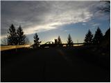
First, we drive to Kropa (to here from Gorenjska highway exit Naklo, Podnart, Brezje or Radovljica), and then we continue driving on a serpentine road towards Dražgoše, Železniki and Jamnik. When the road flattens a little, it quickly brings us to Jamnik, and we follow it a little further to the information board, by which we park. If there isn't space here, we can park a few 10 meters lower by the road.
To the starting point, we can also come from the direction of Železniki through Dražgoše or from Kranj through Besnica and Podblica.
Route description:
At the starting point, more precisely on the information board for Jamnik, we notice signs for the church of St. Primož and Felicijan, which point us to a wide path which starts descending towards the east. After a short descent, the path flattens and only a few meters ahead joins a poorer road, on which a marked path from Kropa leads. We continue on the mentioned road, which on a very scenic ridge in a few minutes brings us to the already previously mentioned church of St. Primož and Felicijan.
Photos:
 1
1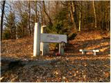 2
2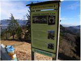 3
3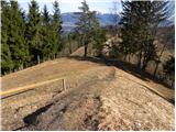 4
4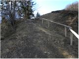 5
5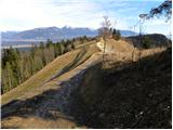 6
6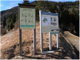 7
7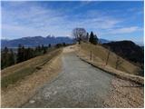 8
8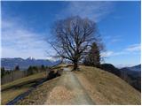 9
9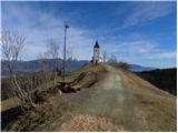 10
10 11
11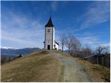 12
12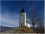 13
13 14
14 15
15
Discussion about the trip Jamnik - Sveti Primož in Felicijan (Jamnik)
To post a comment you must log in:
If you do not yet have a username, you must first
register.