Jakob pri Šentjurju - Rifnik
Starting point: Jakob pri Šentjurju (300 m)
| Latitude/Longitude: | 46,1931°N 15,3964°E |
| |
Walking time: 45 min
Difficulty: easy marked way
Elevation gain: 268 m
Elevation difference along the route: 268 m
Map:
Recommended equipment (summer):
Recommended equipment (winter):
Views: 7.140
 | 1 person like this post |
Access to starting point:
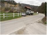
From the highway Ljubljana - Maribor, we take the Dramlje exit and follow the road ahead in the direction of Šentjur. In Šentjur, at the traffic light, we continue straight through the underpass under the railway track and follow the road ahead in the direction of Šentrupert. We park on the parking lot by the road, approximately 1 km after the sign "end of Šentjur" (nearby, a road branches off left upwards towards Rifnik - archaeological site).
Route description:
From the parking lot, we continue left upwards along the road in the direction of Rifnik. After a few minutes of walking, a macadam road branches off to the left upwards (nearby there are some disused playgrounds), which we follow for only a few steps. From this road, a marked path branches off right upwards, which after a short ascent brings us to a worse road, which we follow to the left, but only a few meters. The blazes then direct us right upwards onto a footpath, which ascends through the forest and higher leads past a farm, where we can notice some domestic animals. After the farm, we step onto a worse road, which quickly brings us to an asphalt road, which we follow left upwards. The path then leads past a few houses and higher brings us to the signs for the Rifnik archaeological site. Here the road ends, but we continue the path past the house, across a meadow into the forest. Further on, we join the path from Šentjur and follow it to the top.
Photos:
 1
1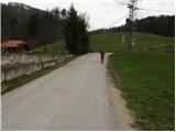 2
2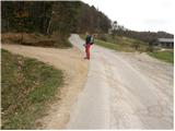 3
3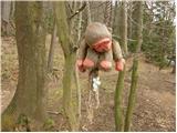 4
4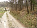 5
5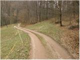 6
6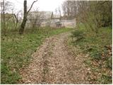 7
7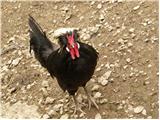 8
8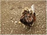 9
9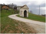 10
10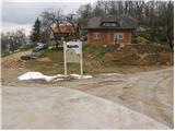 11
11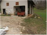 12
12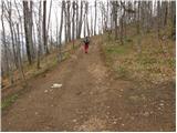 13
13 14
14
Discussion about the trip Jakob pri Šentjurju - Rifnik
|
| Tadej31. 03. 2008 |
Maybe someone knows how the hen and rooster on pictures 8 and 9 are properly named? Thanks
|
|
|
|
| ejca1. 04. 2008 |
Sorry, I'm not an expert on chickens, but I have interesting information. If anyone wants to enrich their knowledge about the excavations, the TIC Šentjur will provide you with the phone number of Mr. Toneta, who participated in the excavations and lives nearby. He will meet you at the top and give a whole lecture - for free.
Also, the description could include the option to visit the ruins of Reicheneck Castle, which is located on the northern side of the hill.
Best regards, Špela
|
|
|
|
| bruny30. 03. 2019 |
Descent and ascent today on the described path...
|
|
|
To post a comment you must log in:
If you do not yet have a username, you must first
register.