Jakob pri Šentjurju - Resevna
Starting point: Jakob pri Šentjurju (300 m)
| Latitude/Longitude: | 46,1931°N 15,3964°E |
| |
Walking time: 1 h 30 min
Difficulty: easy marked way
Elevation gain: 350 m
Elevation difference along the route: 382 m
Map:
Recommended equipment (summer):
Recommended equipment (winter):
Views: 18.212
 | 3 people like this post |
Access to starting point:
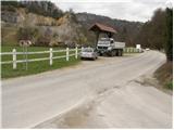
From the highway Ljubljana - Maribor we take the Dramlje exit and follow the road ahead in the direction of Šentjur. In Šentjur, at the traffic light we continue straight through the underpass under the railway track and we follow the road ahead in the direction of Šentrupert. We park on a parking lot by the road, approximately 1 km after the sign "end of Šentjur" (nearby a road branches off left upwards towards Rifnik - archaeological site).
Route description:
From the parking lot, we continue a few tens of meters on the main road ahead, and then signs for Resevna and Šibenik point us to the right over a bridge. We further follow the road which is at first ascending gently through a meadow and part of the village, and then starts moderately ascending and higher brings us to the spot, where from the right side, the path from Šentjur joins. We continue straight, on the road which higher changes into a cart track, and it brings us to a crossing, where we continue right, on a footpath steeply upwards. After a shorter steep ascent, we again step on the road which we follow in the direction of Resevna. After a few tens of strides of walking on the road, a marked footpath goes right upwards. This ascent also doesn't last long, we are again on the road. Further, we continue past a cross, on the road closed to traffic which moderately ascends and after a few minutes of walking, it brings us to the mountain hut.
From the hut, we continue on a gently sloping path, which after a few steps brings us to the summit, in the middle of which there is a 20-m-high lookout tower.

Photos:
 1
1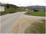 2
2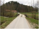 3
3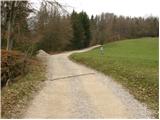 4
4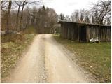 5
5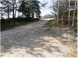 6
6 7
7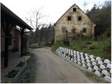 8
8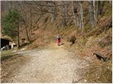 9
9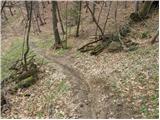 10
10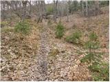 11
11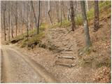 12
12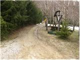 13
13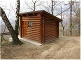 14
14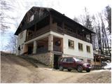 15
15 16
16
Discussion about the trip Jakob pri Šentjurju - Resevna
|
| bruny14. 04. 2013 |
Today also a part of the path at the end along the described route, while the main ascent as part of a longer path was done from the direction of Štor or Prožinska vas, Kompol and Krajnčice. The path partly runs along a babbling stream and from what I saw it is not much visited...
|
|
|
|
| Lisica16. 05. 2017 |
I went across the wooden bridge and past the first houses and parked by the road above them. The path from there seemed very short and nice to me, no hikers (except the section from the parking lot up). Beautiful places. 
|
|
|
|
| modrook1222. 04. 2018 |
Today we went up this trail. Nice and pleasant path. Nice view from the tower. Lots of people at the hut. We'll come back.
|
|
|
To post a comment you must log in:
If you do not yet have a username, you must first
register.