Jablanica - Koča na Kozleku
Starting point: Jablanica (428 m)
| Latitude/Longitude: | 45,5429°N 14,2921°E |
| |
Walking time: 1 h 45 min
Difficulty: easy marked way
Elevation gain: 569 m
Elevation difference along the route: 600 m
Map: Snežnik 1:50.000
Recommended equipment (summer):
Recommended equipment (winter):
Views: 19.222
 | 1 person like this post |
Access to starting point:
From the highway Ljubljana–Koper, take the Postojna exit and continue along the road towards Reka and Ilirska Bistrica. At the end of Ilirska Bistrica, turn left towards the villages Vrbovo, Jablanica and Trpčane. Continue past the villages Jasen, Vrbovo and Vrbica. Immediately after the village Vrbica, turn left onto a macadam road, which after 30 meters brings us to the village road, where we continue right. Drive only a few dozen meters to the parking lot by the road, which is located before a smaller bridge.
Route description:
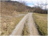
From the parking lot, we cross a small bridge and by the road notice signposts for the castle and Kozlek. The blazes lead us left onto a cart track, which soon has an unmarked junction, where we continue right into the forest. The path along which we soon notice blazes leads us past the ruins of the former church, where we again notice signs for the castle and Kozlek. Further, we continue on a fainter footpath, which a little higher brings us to a cart track, which we follow to the ruins of the former castle. Further, the cart track soon turns into a footpath that ascends more steeply over partly panoramic slopes. A little higher, we join the path from Vrbiški dol. Here we continue right on the path, which moderately ascends along a forest-covered ridge. Soon we come to panoramic slopes, from which a beautiful view opens up towards the south, and towards the east we already see the panoramic Srednji vrh, which is the forepeak of Kozjek. Here the path descends for a short time, then in a moderate ascent through the forest brings us to Srednji vrh.
From Srednji vrh, the path slowly descends to the saddle between both peaks and then starts ascending again, first over an unvegetated slope and higher through the forest. When we reach the mountain hut Koča na Kozleku, a view opens up towards the south and east. From the hut to the summit is only a few steps of easy walking.

Photos:
 1
1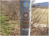 2
2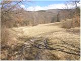 3
3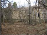 4
4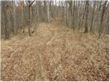 5
5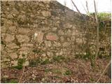 6
6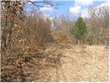 7
7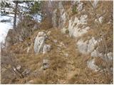 8
8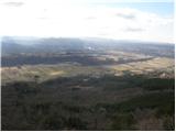 9
9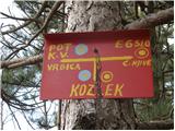 10
10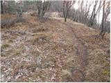 11
11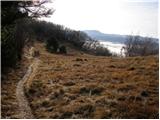 12
12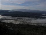 13
13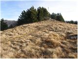 14
14 15
15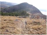 16
16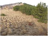 17
17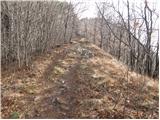 18
18 19
19
Discussion about the trip Jablanica - Koča na Kozleku
|
| odri30. 10. 2010 |
Does anyone know if bears ever roam around here too?
|
|
|
|
| marco11. 11. 2010 |
On www.medvedi.si you can sometimes check it out, as they track some bears with telemetry (GPS transmitter) collars.
|
|
|
|
| bizgo9326. 03. 2021 |
Most hikers head to Kozlek via the path from Vrbiški dol (along the road towards Svišćaki), which is entirely suitable even for the youngest.
The path starting in Jablanica is longer and quite steep in places, but very interesting. Already at the beginning of the path we pass a beautiful stream bed of conglomerate and the ruins of a church and castle. Then the path steepens considerably and doesn't let up until the ridge below Srednji vrh (on the slope we have nice views at some points towards Ilirska Bistrica, surrounding villages and Ahac).
From Srednji vrh to Kozlek it's then only about 10-15 minutes. Along the path, especially from the top, we have unique views of the Reka river valley with Kočanija and surrounding hills, Čičarija and Učka, unique on nice weather is the view of the northern part of Velebit and Kvarner Bay with Krk and Cres. At the hut there is also a logbook and stamp in the stamp box.
|
|
|
|
| Hribolazec8122. 02. 2026 22:39:59 |
The path is not marked at all, where there are markings, they are extremely faded.
As for the hut, it is insanely beautiful, the caretaker is very friendly
|
|
|
To post a comment you must log in:
If you do not yet have a username, you must first
register.