Jablance - Veliki Javornik (Bohor) (via Koprivnik)
Starting point: Jablance (500 m)
| Latitude/Longitude: | 46,0467°N 15,4454°E |
| |
Route name: via Koprivnik
Walking time: 2 h
Difficulty: easy marked way
Elevation gain: 523 m
Elevation difference along the route: 600 m
Map: Posavsko hribovje Boc - Bohor 1:50.000
Recommended equipment (summer):
Recommended equipment (winter):
Views: 38.322
 | 3 people like this post |
Access to starting point:
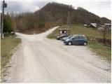
From Krško we drive towards Sevnica or vice versa. Soon after Krško, the road branches off to the right towards Brestanica (from Sevnica a little before Krško to the left). We follow this road further towards Senovo, where we notice the first signs for Bohor (in Senovo we turn left). The road, which then takes us uphill along the stream, brings us higher to a poorly marked intersection, where we continue slightly left uphill (the road which goes straight, still along the stream, brings us to the mountain hut Koča na Bohorju. Our left road then makes two sharp turns and soon brings us out of the forest, where after additional 100 m of driving, we park on the parking lot by the information board.
Route description:
From the parking lot, we continue on the right road in the direction of the mountain hut Koča na Bohorju. After a few minutes of walking, the blazes direct us to the right onto a wide footpath that moderately ascends through the forest. When we come out of the forest, the path turns left and then crosses a grassy slope (poorly marked). We follow this path, which ascends alongside the fields, towards the houses in the village that we see in front of us. In the village we step on the road along which we then walk a few dozen steps to the chapel that we see on the left side of the road. Behind the chapel, we continue the ascent on the marked footpath that ascends parallel with the road. The path, which is very well marked ahead, brings us through the forest and a few smaller meadows in a moderate ascent to an asphalt road, which we follow to the left. The road along which we walk then brings us to the mountain hut Koča na Bohorju in three minutes.
From the mountain hut we continue on the road in the direction of Lisca, Javornik and Koprivnik. After a few minutes of walking from the hut, the path brings us to a path junction, where the path to the natural window and Petrova skala branches off to the left. Here we continue straight on the road, which after a few dozen steps of further walking brings us to the place where the path to Koprivnik branches off to the right uphill (straight on the road, Veliki Javornik, direct path). We head onto this path, which moderately ascends along a cart track. After a short ascent the cart track slightly descends and changes into a wide footpath, which we then follow in a gentle ascent to the summit of Koprivnik.
From the summit of Koprivnik we continue in the direction of Javornik on the path that moderately descends through the forest. After a few minutes of descent, we return to the road that we left when we climbed to Koprivnik. Here at the path junction we continue on the poorer road in the direction of Veliki Javornik and Lisca. The increasingly poor road gradually changes into a cart track that brings us to the next path junction. We continue slightly right in the direction of Javornik (the path to the left leads to Lisca and bypasses the summit) on the cart track that still ascends through the forest. The well-marked cart track has a few smaller junctions ahead but there are no orientation problems. Further on the cart track changes into a wide footpath that brings us out of the forest in a moderate ascent, where ahead we spot the summit only a few steps away.

Photos:
 1
1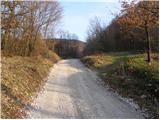 2
2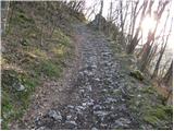 3
3 4
4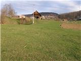 5
5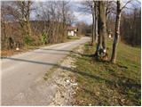 6
6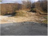 7
7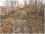 8
8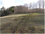 9
9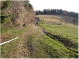 10
10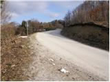 11
11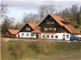 12
12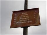 13
13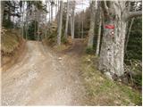 14
14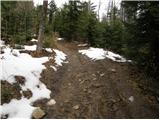 15
15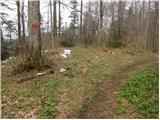 16
16 17
17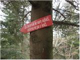 18
18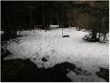 19
19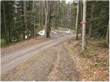 20
20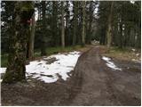 21
21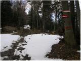 22
22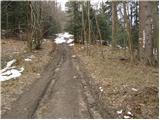 23
23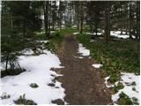 24
24 25
25
Discussion about the trip Jablance - Veliki Javornik (Bohor) (via Koprivnik)
|
| dora15. 07. 2008 |
Saturday was perfect for wandering in the Posavje hills. I did a circular tour: Jablance - koča na Bohorju - past the hospital to Veliki Javornik - over Koprivnik back to koča na Bohorju - past "Kače slince" back to Jablance.
The path is not demanding, sufficiently interesting and well marked.
|
|
|
|
| lubi15. 07. 2008 |
And how does the path past Ubijalnik look??
|
|
|
|
| andrejjerina27. 09. 2009 |
Nice afternoon excursion, which we concluded at the hut where they also have some play equipment for our youngest. I recommend it to families, the path is easy and there are no issues on the path. Best regards Andrej
|
|
|
|
| marinka678. 04. 2012 |
Is it possible to reach Bohor from somewhere else, e.g. from Kozje or Podlog pod Bohorjem? In summer we'll be in Podčetrtek, and it seems pointless to drive around Bohor to the south side, wasting time and (expensive) petrol, if there's some shortcut possibility. Is there any other path to Bohor marked??? I love the Hribi website, I've planned many trips here, but more than once at the destination I realized it could be started from some other side, closer to my home - Koroška.
Thanks for the comments and best regards M
|
|
|
|
| bruny8. 04. 2012 |
Yes, definitely near Bohor, so you won't waste time and of course expensive petrol, and since you'll already be in Podčetrtek you have practically  right nearby an interesting spot I've already written about..... right nearby an interesting spot I've already written about.....
Rudnica
|
|
|
|
| marinka679. 04. 2012 |
BRUNY, thanks for your suggestion, Rudnica looks interesting and cool, but from where (exactly) can I still start on foot to Bohor? And is it marked??? You know, women are more cautious, we ask 3 times  Best regards M Best regards M
|
|
|
|
| bruny9. 04. 2012 |
The closest and probably most sensible starting point for Bohor from Podčetrtek is presumably the Lesično settlement from where, according to available data, the 14th Division hiking trail should lead, but it is reportedly poorly marked. Probably some expert on the forum knows the paths and terrain better and will respond.
Source: Geopedia
Best regards
|
|
|
|
| marinka6710. 04. 2012 |
Thanks Bruny, I hope by July some local will advise me. If not, we'll waste time and petrol anyway, but to the summit we go for sure!!! Best M
|
|
|
|
| kozlevčarca11. 04. 2012 |
marinka67 I recommend you on the web pages www.pdbohor.si open the activities program; there you find the annual program of hikes and other activities; there are quite a few tel.nos. of PD BOHOR members including hike leaders and I believe they will advise you. I am also a member of the association but I don't have so much experience with paths on Bohor yet although I've already walked some. I know that from Podčetrtka the closest is from Kozje where the traditional Valentine hike also takes place. The path is somewhat marked too. But I think the path also goes from Podsreda. Definitely recommend PD Bohor to you
|
|
|
|
| bruny15. 04. 2012 |
@ marinka67, so that you have a peaceful and of course due to Bohor stress-free vacation, as a member of PD Poljčane and the Running Forum, I "walked" the route Lesično - Veliki Javornik (Bohor) via Koprivnik. The trail follows the alpine path of the 14th Division and is excellently marked. More will follow in the Forum - conditions topic...photos and also GPS track.
Regards bruny
|
|
|
|
| marinka6720. 04. 2012 |
Bruny!!
I only discovered today what you did for me!! Thank you, thank you, and you too, Kozlevčarca. I'll definitely check in during the summer and report. Best regards M
|
|
|
|
| bruny23. 04. 2012 |
I had Bohor on my plan anyway for some time and the report just sped things up. Otherwise, on Sunday 22.04.2012, my colleague and I also took the circular eastern variant from the starting point Kozje to Bohor with descent to Planina pri Sevnici and from there via Šentvid pri Planini and Zagorje back up from Lesično to Bohor to the height that allowed descent to Kozje...Report will follow in the Bohor-conditions thread.
Best regards
|
|
|
|
| marinka6729. 07. 2012 |
Well, the child got sick and we didn't go on vacation. Next year or sometime just like that. Thanks for the effort. Best regards
|
|
|
|
| darh2. 05. 2013 |
We explored the beauties of Bohor last Sunday. Although we initially had different plans, in the end we returned to the valley exactly along this described path. More about our trip, including pictures, can be found here.
|
|
|
|
| Tomasso26. 06. 2019 |
With my wife we went to Bohor yesterday specifically via circular path Jablance - Ubijavnik - Bolnica - Javornik - hut. Up to here all good and correct.
From hut downhill after about 300m no sign or markers to turn right into forest, also quite muddy so we said with wife better take road. Halfway asphalt and path ended. No signs anywhere. Looking around whom to ask, a Beagle dog ran past us. Earlier heard owner instructing it but not paying attention, so first didn't know dog's intentions, then surprised as it waited before each bend, ran to next when we arrived and led us successfully around several pasture fences to settlement where hayrack and metal shed below visible. Hope to find owner to repay dog and him, anyway thanks already.
|
|
|
|
| Jani3331. 03. 2021 |
Hello,
I'm interested if the stamp for the "extended Slovenian trail" is in the box on Bohor?
thanks
|
|
|
|
| zdejan3. 03. 2021 |
It is concreted into a concrete pillar.
|
|
|
|
| glorija27. 01. 2022 11:30:02 |
We walked from Koča na Bohorju and the path to the top - Javornik is very well marked..
|
|
|
|
| glorija27. 01. 2022 11:30:13 |
We walked from Koča na Bohorju and the path to the top - Javornik is very well marked..Nice view 100m further on the meadow where you see Snežnik and all the way to Kum and Lisca...Safe steps!
|
|
|
To post a comment you must log in:
If you do not yet have a username, you must first
register.