Jablance - Koprivnik (Bohor)
Starting point: Jablance (500 m)
| Latitude/Longitude: | 46,0467°N 15,4454°E |
| |
Walking time: 1 h 20 min
Difficulty: easy marked way
Elevation gain: 484 m
Elevation difference along the route: 484 m
Map: Posavsko hribovje Boc - Bohor 1:50.000
Recommended equipment (summer):
Recommended equipment (winter):
Views: 8.698
 | 2 people like this post |
Access to starting point:
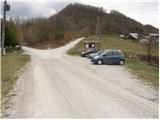
From Krško we drive towards Sevnica or vice versa. Soon after Krško, the road branches off to the right towards Brestanica (from Sevnica a little before Krško to the left). We follow this road ahead towards Senovo, where we notice the first signs for Bohor (in Senovo we turn left). The road, which then runs along the stream upwards, brings us higher to a poorly marked crossroads, where we continue slightly left upwards (the road which goes straight, still along the stream, brings us to the mountain hut Koča na Bohorju. Our left road then makes two sharp turns and soon brings us out of the forest, where after an additional 100 m of driving, we park on the parking lot by the information board.
Route description:
From the parking lot, we continue on the right road in the direction of the mountain hut Koča na Bohorju. After a few minutes of walking, the blazes direct us to the right on a wide footpath which moderately ascends through the forest. When we come out of the forest, the path turns left and then crosses a grassy slope (poorly marked). We follow this path which ascends along the fields towards the houses in the village, which we see in front of us. In the village we step on the road along which we then walk a few dozen steps, to the chapel which we see on the left side of the road. Behind the chapel, we continue the ascent on a marked footpath which ascends parallel with the road. The path which is ahead very well marked brings us through the forest and some smaller meadows in a moderate ascent on an asphalt road, which we follow to the left. The road on which we walk then brings us to the mountain hut Koča na Bohorju in three minutes.
From the mountain hut, we continue on the road in the direction of Lisca, Javornik and Koprivnik. After a few minutes of walking from the mountain hut, the path brings us to a crossing of paths, where to the left branches off the path to the natural window and Petrova skala. Here we continue straight on the road, which after a few dozen steps of further walking brings us to the spot where to the right upwards branches off the path to Koprivnik. We head onto this path, which moderately ascends on a cart track. After a short ascent, the cart track slightly descends and changes into a wide footpath, which we then follow in a gentle ascent to the summit of Koprivnik.

Photos:
 1
1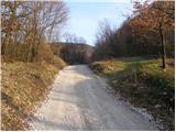 2
2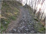 3
3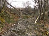 4
4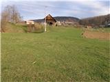 5
5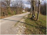 6
6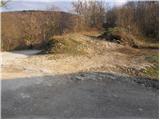 7
7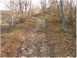 8
8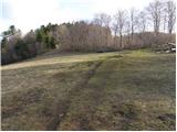 9
9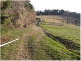 10
10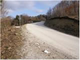 11
11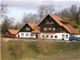 12
12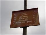 13
13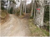 14
14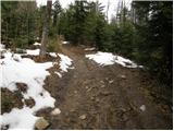 15
15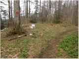 16
16 17
17
Discussion about the trip Jablance - Koprivnik (Bohor)
|
| Dayna10. 05. 2016 |
Very poorly marked trail, especially from Koča na Bohorju onwards 
|
|
|
|
| _d_10. 05. 2016 |
Marked from the hut onwards, except for Koprivnik which is marked, then just follow the only wide (then slightly narrower) trodden path that leads nowhere else but to Koprivnik  Or from the hut along the road to the junction for Veliki Javornik, turn right (also marked) to Koprivnik. Or from the hut along the road to the junction for Veliki Javornik, turn right (also marked) to Koprivnik.  Otherwise, the description and photos explain the path well. Otherwise, the description and photos explain the path well.
|
|
|
|
| Hribolazec8121. 03. 2021 |
Previously it was, now it's super marked
|
|
|
To post a comment you must log in:
If you do not yet have a username, you must first
register.