Iverje - Dom v Kamniški Bistrici (Koželjeva pot)
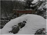
Starting point: Iverje (458 m)
| Latitude/Longitude: | 46,2797°N 14,614°E |
| |
Route name: Koželjeva pot
Walking time: 2 h 45 min
Difficulty: partly demanding marked way
Elevation gain: 142 m
Elevation difference along the route: 200 m
Map: Kamniške in Savinjske Alpe 1:50.000
Recommended equipment (summer):
Recommended equipment (winter): ice axe, crampons
Views: 42.536
 | 1 person like this post |
Access to starting point:
First, we drive to Kamnik, then we continue driving in the direction of Kamniška Bistrica. In Stahovica (we can also get here via the mountain pass Črnivec or Volovjek), we continue left or right if coming from Črnivec or Volovjek, and follow the road ahead through the valley of Kamniška Bistrica. Soon after the large quarry, which we notice on the left side, we will notice by the road signs for Koželjeva pot, which direct us left over a small wooden bridge. Immediately behind the bridge or a few 10 meters ahead, we park on one of the smaller parking areas by the road.
Route description:
From the starting point, we continue on a macadam road which continues on the left side or right bank of the river Kamniška Bistrica. The road soon narrows a little and starts moderately ascending. After a few minutes it turns sharply to the left, and we follow it only to the beginning of the mentioned turn, where signs for Kamniška Bistrica via Koželjeva pot direct us onto a narrower and occasionally somewhat steeper path. The path ahead soon leads onto steep slopes that are mainly dangerous for slipping when wet. After a longer crossing of the slopes, the path slightly descends and brings us to a cart track, along which we continue for some time. The cart track soon turns into a footpath, which then crosses a few more quite steep slopes. The path ahead approaches the riverbed of the river Kamniška Bistrica completely, then turns left and ascends steep stairs. A short descent follows, and the path brings us to a macadam road that leads into the valley of Korošica. We only cross the mentioned road, as the blazes direct us into the forest, where already after a few meters over a small wooden bridge we cross the stream Korošica. The path ahead continues along the riverbed of the clear Kamniška Bistrica and ascends barely noticeably for quite some time. The path, which leads us past a large boulder, brings us after some time to the end of the gorges Predaselj. Here the marked path turns left and starts steeply ascending along the right bank of the aforementioned gorges. The path, which further on is exposed in some places, quickly brings us to a wooden bridge, from which there is a nice view of the gorges. Over the bridge we step for the first time onto the right side (left bank) of Kamniška Bistrica, then we ascend an exposed but fenced path. After a few 10 steps the steepness eases, and the path brings us to the next macadam road.
Here we can from the bridge also view the upper part of the gorges; otherwise, we continue along the marked path, which proceeds on the right side of Kamniška Bistrica (parallel to "our" path, another path continues on the left side, via which we can reach the Dom v Kamniški Bistrici). The path ahead continues through the forest and a little higher approaches the asphalt road completely. We continue on the marked footpath, which again turns somewhat left and after a few minutes of further walking brings us to the Mali izvirek. The path ahead approaches a larger meadow on the left, then slowly turns towards the right, where after a few minutes of moderate ascent it joins the road leading to the Dom v Kamniški Bistrici. When we step onto the road, we soon cross the river Kamniška Bistrica over the bridge, and then ahead of us we already see the Dom v Kamniški Bistrici.

Along the route: Predaselj (560m)
Photos:
 1
1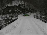 2
2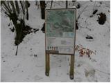 3
3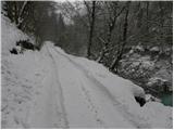 4
4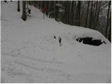 5
5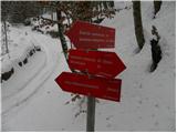 6
6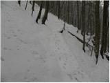 7
7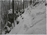 8
8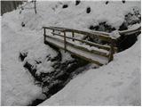 9
9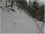 10
10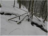 11
11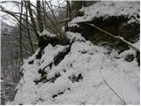 12
12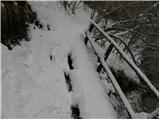 13
13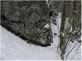 14
14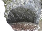 15
15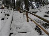 16
16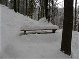 17
17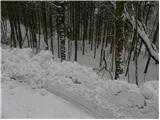 18
18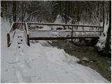 19
19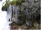 20
20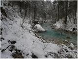 21
21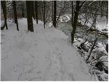 22
22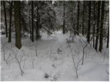 23
23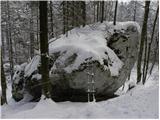 24
24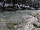 25
25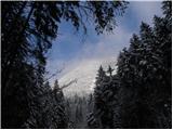 26
26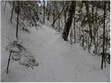 27
27 28
28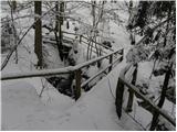 29
29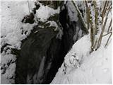 30
30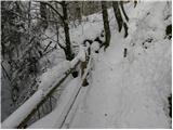 31
31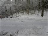 32
32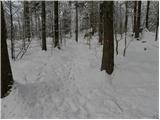 33
33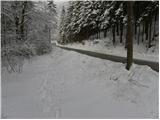 34
34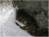 35
35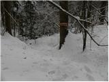 36
36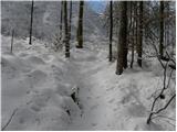 37
37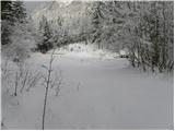 38
38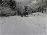 39
39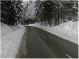 40
40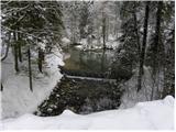 41
41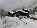 42
42
Discussion about the trip Iverje - Dom v Kamniški Bistrici (Koželjeva pot)
|
| EUGEN14. 05. 2010 |
With my wife and little dog, we walked this interesting path on Sunday, excellent štruklji in the hut and continued to the memorial park, where we lit a candle for Tomaž.
Return via the upper Koželjeva path.
Despite occasional rain, it was a nice trip.
|
|
|
|
| pohodnik387. 06. 2012 |
Yesterday Wednesday 6.6.2012 walked this path: interesting, peaceful, somewhat in need of renovation, at least the footbridges are quite "rickety", plenty of photo motifs....and flat when weather isn't for summits.
More here - photos and GPS track on this LINK
|
|
|
|
| katty7. 06. 2012 |
Well, clearly this lonely path needs walking too. But that's how it is, such paths are really welcome when weather is overcast and conditions don't allow higher ascents. Otherwise super photos.
|
|
|
|
| pohodnik388. 06. 2012 |
Short video from this hike along Kamniška Bistrica VIDEO
|
|
|
|
| LidijaJesih8. 07. 2012 |
Pleasant, it adds up to 15 km both ways, very bearable even in these temperatures. Full of hidden corners, nice retreat for a hot day. It hides many things hidden from eyes from the car. After countless visits to these areas (by car at least to Dom v K. Bistrici), today discovered completely new dimensions of these places. Then I think I know something. Phhhh...
|
|
|
|
| garmont28. 03. 2015 |
The lower part of the trail from the starting point in the village Iverje to the road in the Korošica valley, which we cross, is impassable due to fallen trees (and in one section the trail washed away for 10m) and is closed for the foreseeable future.
|
|
|
|
| Žan11. 10. 2015 |
The first part of the path is still only passable via the alternative route, which is arranged and marked, but quite time-consuming as it mostly runs on forest roads far from the river. Anyone who wants to taste the essence of this interesting path can tackle it halfway without a guilty conscience. At the lower station of the cable car to Velika planina there is a concrete bridge and immediately after the bridge, on the right, the path branches off. From here on, there is really some curiosity around every bend, such as the remains of the construction site of the ill-fated hydroelectric power plant, the inn at Juri, not to mention Predaslije itself.
|
|
|
|
| ljubitelj gora23. 04. 2016 |
On 17.4 I partially returned along this path and it is still all collapsed. But about 200 vertical meters go on a cart track.
|
|
|
|
| rmitja18. 06. 2017 |
On 17.6. we walked the path from the end of the quarry to Bistric. As Žan wrote, you can still safely skip the lower part. The path is very poorly marked, overgrown and in some sections very nasty (dangerous). On this part of the path you can only pick up some nasty infected critter (tick  ). Otherwise a pleasant trip for hot summer days. ). Otherwise a pleasant trip for hot summer days.
|
|
|
|
| sirt118. 06. 2017 |
Koželjeva pot ob Kamniški Bistrici Show section course
Maintainer: PLANINSKO DRUŠTVO KAMNIK
Area: Kamniško Bistriški
Section: E0002, Easy path, D = 2328 m
Junction by Bistrici Bridge under cableway
21. 02. 2014
The path is partially and indefinitely closed.
|
|
|
|
| ločanka4. 08. 2019 |
The trail is open, but the benches and some small bridges are already quite poor, they beg for a little renovation.
It's very nice to find short cuts to the water, where stops are quite necessary.
The most beautiful is the Predaselj gorge, and it's nice to extend the trail to the memorial park. Otherwise, there's usually no time for something like that.
I recommend it on a nice sunny day, so the water shines in its glow, otherwise the trail is all through the forest, suitable therefore for hot days when other ideas run out.
|
|
|
|
| orchigu8. 08. 2024 23:17:07 |
The trail was badly damaged in last year's floods. It was supposed to be fully restored by mid-August this year, and the municipality and PD Kamnik have posted that the trail is open again. Well... unless something new was washed away just yesterday, the trail is definitely not okay. After about 15-20 minutes of walking from this starting point, the trail simply disappears - you can see where the torrent water took it or where it slid. I went a little to explore full of hope with very careful steps, but I didn't persist long - the ground is sliding a lot and the risk of slipping/falling is really high. At the starting point, I met a group that tried to pass the trail from the other side, from the swing bridge, where there's still an old notice about the trail being closed (there was nothing at this starting point), and they said it's not really passable either. Too bad, there were quite a few of us today who wanted this trip, but left disappointed. 
|
|
|
|
| Tadej9. 08. 2024 12:11:38 |
Forwarding part of the notice I received. The described trail is still closed.
"At PD Kamnik itself, as well as at TIC Kamnik, it's exclusively stated that Koželjeva pot is officially closed. Even on today's call to PD Kamnik, they only confirmed the closure. So that there are no unnecessary incidents in these hot days that are coming again, as many people-hikers also seek cooling by the rivers. Although the entire Koželjeva is officially closed, it is possible to walk the trail from the Cable Car to Kam. Bistrica. Perhaps there was a misunderstanding, as Koželjeva pot was selected as the best hiking trail 2024, but that doesn't mean it's open."
|
|
|
|
| orchigu13. 08. 2024 07:49:54 |
Thanks for the comment. I didn't call myself because I took the notice seriously - I see that they are no longer on the PD website now given that I wasn't the only one with this experience, I would still say that unfortunately it is not communicated clearly and loudly enough that the path is closed. Notices at the starting points wouldn't hurt either. Well, sometimes we mess up and have to turn back.
|
|
|
|
| meta5016. 08. 2024 10:39:24 |
Hello!
orchigu- I'm writing on behalf of PD Kamnik.
The notice you read is from 2017, which was also evident.
So that such unpleasant incidents don't happen in the future, it has been removed from the website.
Thank you for understanding.
|
|
|
To post a comment you must log in:
If you do not yet have a username, you must first
register.