Ivarčko jezero - Uršlja gora (Plešivec) (Železarska pot)
Starting point: Ivarčko jezero (633 m)
| Latitude/Longitude: | 46,5066°N 14,9689°E |
| |
Route name: Železarska pot
Walking time: 2 h 45 min
Difficulty: easy marked way
Elevation gain: 1066 m
Elevation difference along the route: 1066 m
Map: Koroška ali Kamniške in Savinjske Alpe 1:50.000
Recommended equipment (summer):
Recommended equipment (winter): ice axe, crampons
Views: 72.624
 | 1 person like this post |
Access to starting point:
We drive to Ivarčko Lake from the village Kotlje past Rimski vrelec or Šrotnek.
Route description:
We park the car on one of the three parking lots below Ivarčko Lake and we go to a roundabout, where the path takes us past the signpost Uršlja gora on the road into the forest.
We continue the path for a few moments below the newly built chairlift all the way to the bridge, which we cross and immediately turn right into the bank. After fifteen minutes of walking we can also decide for Grofovska pot, which branches off to the left – Železarska pot continues straight ahead.
When we come out of the forest we continue the path below the farm Jurček on the road to the partisan monument, where we turn right onto the road below the forest. At the place where the road continues into the forest the direction sign directs us to the left upwards into the forest. Here we can rest for a moment and direct our gaze towards the town Ravne na Koroškem, Strojna and Košenjak in the background.
We continue the path all the way through mixed forest and on a nicely arranged and well-marked path upwards, where we cross forest roads several times.
On the path after a good hour of walking we can rest on a nicely arranged bench and 15 minutes higher refresh ourselves at the spring of Uršljica.
A little before the spring of Uršljica, Železarska and Grofovska pot join again.
The renewed ascent towards the summit brings us to the junction of the Slovenian transverse path, which runs from Poštarski dom. At this junction of paths there is a nicely arranged wayside shrine - cross.
We continue the path on the transverse path partly also on the road to Uršlja gora. Just below the summit the path from Andrejev dom na Slemenu also joins.

Photos:
 1
1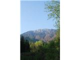 2
2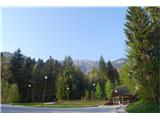 3
3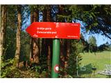 4
4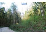 5
5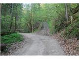 6
6 7
7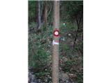 8
8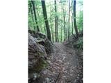 9
9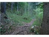 10
1011
 12
12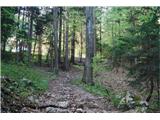 13
13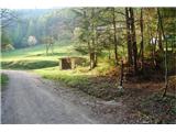 14
14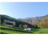 15
15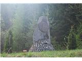 16
16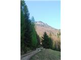 17
17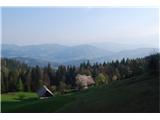 18
18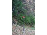 19
19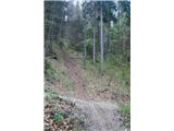 20
20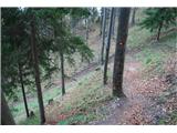 21
21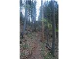 22
22 23
23 24
24 25
25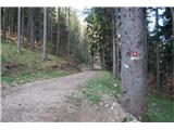 26
26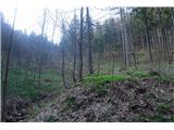 27
27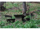 28
28 29
29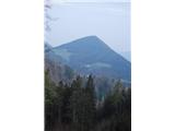 30
30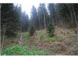 31
31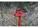 32
32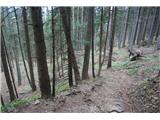 33
33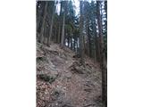 34
34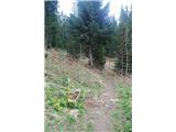 35
35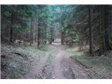 36
36 37
37 38
38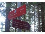 39
39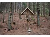 40
40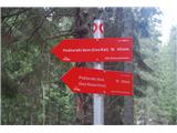 41
41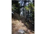 42
42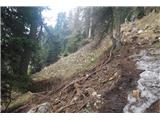 43
43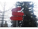 44
44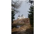 45
45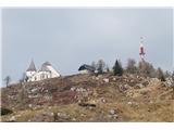 46
46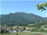 47
47
Discussion about the trip Ivarčko jezero - Uršlja gora (Plešivec) (Železarska pot)
|
| dolenjska23. 05. 2011 |
This weekend my husband and I went on this path. Very nice tour, well marked and not demanding, although it does require some fitness. Highly recommended. Highly recommended.
|
|
|
|
| dolenjska23. 05. 2011 |
This weekend my husband and I went on this path. Very nice tour, well marked and not demanding, although it does require some fitness. Highly recommended.
|
|
|
|
| Hribovc8823. 05. 2011 |
Yeah, for Dolenjci it's pretty steep, I believe it's no easy bite  
|
|
|
|
| jprim16. 01. 2012 |
Saturday ascent to Urška, windy and cold,
this path is quite icy - in the hut such a crowd that there was no desire to visit, as they had some party (as we later learned in the valley).
LP!
|
|
|
|
| resar21. 09. 2012 |
Saturday's ascent to Uršlja gora we started from the Ošven farm. At Vrh 4 chairlifts above the hunting hut we turned left then continued on the gravel road. This path is not well marked, because Carinthians mostly walk other paths (Železarska or from the west side). Luckily two friendly Carinthians joined us, just at the moment when you have to turn right from the gravel road into the forest on the trail. A sign would be needed there! At the top wonderful view, back we went via Kozji hrbet, also a little visited path. In the upper part pleasant for walking, in the lower part a bit steeper, but for us the closest to our starting point.
|
|
|
|
| neph5. 09. 2012 |
Resar2, so you climbed Uršlja gora via the unmarked Grofovska pot, which branches off and then rejoins the Železarska pot. Since it's an unmarked path, no sign is needed of course. And by the way, the Grofovska is also very well visited...
|
|
|
|
| katja8716. 02. 2014 |
Yesterday, 15.2.2014, we set off along this path to the top of Uršlja gora
The day was nice, only at the top it was blowing quite strongly. The sun also appeared in between
The path is nicely trodden, we met quite a few hikers. The lower part of the path is more frozen and small crampons came in handy. In the upper part, the snow is softer, so walking was quite difficult and we used up quite a bit of energy. But at the top with the wonderful views all the effort was already forgotten
Pictures from the hike can be viewed on the website of Planinsko društvo Matica Murska Sobota: http://www.mojalbum.com/pdmaticams/20140215-urslja-gora/razgled-na-ursljo-goro-nad-ivarckim-jezerom/21486787
|
|
|
|
| DomenPiko13. 12. 2015 |
13.12.2015....Super path and super marked..
|
|
|
|
| sasgittariusvz12. 10. 2016 |
Which path is passable in winter when there's snow? If starting at Ivarčko jezero?
|
|
|
|
| Janezs12. 10. 2016 |
Every day a few people go up, most on weekends, then the hut is also open. Path always well trodden. lp.
|
|
|
|
| jprim13. 10. 2016 |
But he also sends greetings to you, yet it's still for a Slovene.☺
Just so he has happy moments.
I'm ashamed to be Slovenian, as for the vast majority national affiliation with GB means nothing.
|
|
|
|
| garmont17. 10. 2016 |
@jprim....I'm reading, but I don't understand anything at all...
And probably I'm not the only one.
|
|
|
|
| turbo17. 10. 2016 |
You're not the only one 
|
|
|
|
| jprim19. 10. 2016 |
Well, my comment is really wrapped in fog and there's a bit of irony in it.
To simplify. When we vacation with our neighbors,... Do they speak Slovenian to us? But we bow deeply and speak the guests' language, proud that we know one more foreign language. When I listen to our caretakers and their talk, how they forget they are Slovenes.
I don't want to open any debate with this comment.
Best
|
|
|
|
| Ksandarela13. 06. 2017 |
A nice mountain greeting
On Saturday, June 10th, our team of imps set off along this path to the summit. The path is truly wonderful, green, forested and varied, but I would note that it is also quite steep! Since we forgot to stretch our leg muscles a bit, it's still noticeable today (true, on Sunday we also went up the climbing route to Peca)
In the morning, a little rain wet the path and it was very damp on a large part of the path - mud and slippery rocks, so the descent was very careful and took only half an hour less than the ascent. Therefore, I recommend caution and safe steps in case of prior rain!
Good luck and best regards!
|
|
|
|
| Gripen20. 12. 2017 |
Nice regards, I'm interested in what the road conditions are like and how much snow there is at the top
|
|
|
To post a comment you must log in:
If you do not yet have a username, you must first
register.