Ivarčko jezero - Uršlja gora (Plešivec) (Grofovska pot)
Starting point: Ivarčko jezero (633 m)
| Latitude/Longitude: | 46,5066°N 14,9689°E |
| |
Route name: Grofovska pot
Walking time: 2 h 50 min
Difficulty: easy unmarked way
Elevation gain: 1066 m
Elevation difference along the route: 1066 m
Map: Koroška 1:50.000
Recommended equipment (summer):
Recommended equipment (winter): ice axe, crampons
Views: 23.013
 | 2 people like this post |
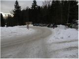
Access to starting point:
A) From the highway Ljubljana - Maribor we take the exit Žalec, and then we continue driving in the direction of Velenje, Mislinja and Slovenj Gradec. In Slovenj Gradec at the traffic light (traffic light at the Lidl store) we turn left, and then at the crossroads we follow the road in the direction of Ravne na Koroškem and Kotlje. From Slovenj Gradec the road ascends for a few kilometers, and then descends to Kotlje, where at the crossroad we continue left towards Ivarčko Lake (right Ravne na Koroškem). Further, we follow a somewhat narrower road in the direction of Ivarčko Lake (also ski slope Ivarčko-Ošven), near which we also park on one of the several arranged parking spots.
B) From Koroška we first drive to Ravne na Koroškem, and then we continue driving towards Kotlje. From Kotlje onwards we follow the signs for Ivarčko Lake and ski slope Ivarčko-Ošven. We park on the parking lot by the lake, or on the parking lot by the ski slope.
Route description:
From the parking lot, we first walk to the nearby roundabout, and from there we continue on the forest road, by which we notice signs for Uršlja gora - Železarska pot. For a short time, we walk on the road, and after a small bridge we turn right on a marked footpath which ascends by the stream Uršeljca. Higher, the path for a short time steeply ascends, and then it flattens and brings us to a nearby road which we follow to the left. The road then below the farm Jurček brings us to a crossroad by the NOB monument.
At the monument, we leave the marked path and continue on the left road which we follow for approximately 500 m. After approximately 500 m we get to a smaller junction, where we step onto Grofovska pot, which from the road continues sharply to the right.
We continue the ascent on the so-called Grofovska pot, which further ascends in zig-zags over a relatively steep slope. Higher, we cross a smaller cart track, and we follow the forest path to the spot where we step onto a wider cart track and follow it to the right. The cart track then quickly brings us to the "bife pod jelko" and we follow it in a moderate ascent mostly to the right. Higher, the cart track ends, and we continue on a path that is steeper for a short time, which quickly flattens and shortly after joins the Železarska pot.
We continue past a spring and ahead the relatively gentle path quickly brings us to the spot where from the left the path from Poštarski dom joins. We continue to the right and a little higher we step onto a macadam road which we follow to the right. We walk along the road to the first left bend, where by the bench we notice the continuation of the mountain path. The path ahead first steeply ascends, then in a moderate ascent crosses increasingly panoramic slopes. Higher, the path turns somewhat more to the right and flattens even further. Another 10 m or so higher we step out of the forest, and we follow the increasingly panoramic path to Dom na Uršlji gori.
From the hut we continue on the wide path, along which in approximately 5 minutes of further walking we reach the summit, from which a nice view opens up on all sides.

Photos:
 1
1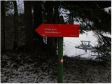 2
2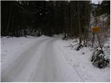 3
3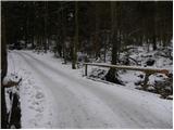 4
4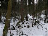 5
5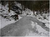 6
6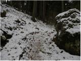 7
7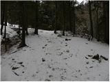 8
8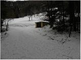 9
9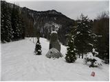 10
10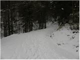 11
11 12
12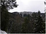 13
13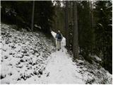 14
14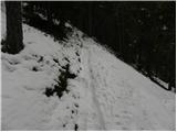 15
15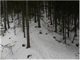 16
16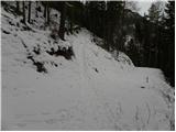 17
17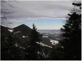 18
18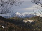 19
19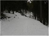 20
20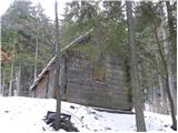 21
21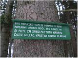 22
22 23
23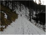 24
24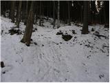 25
25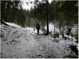 26
26 27
27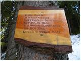 28
28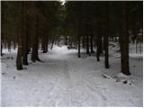 29
29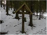 30
30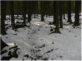 31
31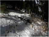 32
32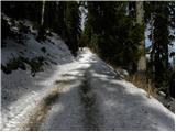 33
33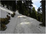 34
34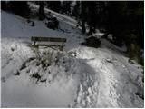 35
35 36
36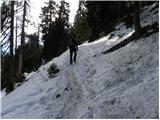 37
37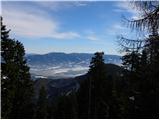 38
38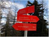 39
39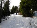 40
40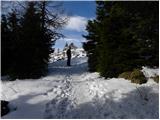 41
41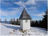 42
42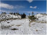 43
43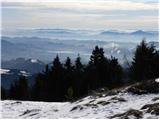 44
44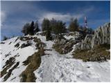 45
45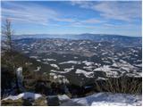 46
46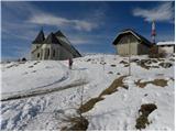 47
47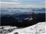 48
48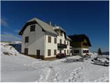 49
49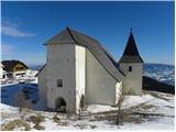 50
50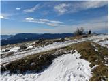 51
51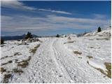 52
52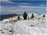 53
53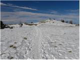 54
54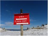 55
55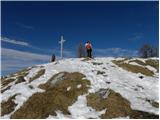 56
56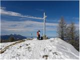 57
57 58
58
Discussion about the trip Ivarčko jezero - Uršlja gora (Plešivec) (Grofovska pot)
|
| NINICA27. 10. 2011 |
Has anyone been to Uršlja recently...how much snow is there, what are the conditions?
Thanks for all answers!!
|
|
|
|
| vespuci27. 10. 2011 |
On Peca at 1900m (ski slope), which is near Uršlja, there is almost no more of it.
|
|
|
|
| NINICA28. 10. 2011 |
Vespuci, thanks for the answer!!!
|
|
|
|
| brankob28. 10. 2011 |
Uršlja gora is snow-free, today it was very warm, plus 12 degrees.
|
|
|
|
| timi_9523. 12. 2012 |
Does anyone know if the hut is open on 25.12.2012?
|
|
|
|
| neph24. 12. 2012 |
First of all, let me note that there was no need to list all topics about Uršlja gora with the same question. As far as I know, the hut will be open.
|
|
|
|
| podgorc15. 01. 2013 |
Yesterday, 14.1.2013, trampled the path from farmer Janez's near Ivarčko jezero along Grofovska to the top. On Uršlja gora approx. 40 cm snow. Recommend gaiters and crampons.
|
|
|
|
| penuša15. 02. 2013 |
Podgorc, thanks for the info, I plan to go to the top via this path tomorrow.
|
|
|
|
| čara15. 10. 2018 |
We were there yesterday. Nice trail, just two fallen trees under which you duck a bit and it's fine. At first we went too far along the gravel road from the NOB monument and turned onto the wrong path, then down and back along the road. The right path is the first one, where there's also the no-motorcycles sign.
|
|
|
|
| Lipovnik14. 09. 2021 21:57:34 |
From the NOB monument along the road to the junction it's not 500m, but 170m and it's easy to miss the first time.
Otherwise, this path is very elegant. Mostly along forest switchbacks and avoids most of the rocks, wet slabs and swampy part of the ironworks path.
Contrary to the description, the path branches off from the ironworks path shortly after you enter the forest behind the bridge above Ivarčko and after the first somewhat longer steep ascent turn left. On the tree on the left, the G.P. marker is poorly visible, next to it is an arrow to the left. The path leads directly to the NOB monument.
|
|
|
To post a comment you must log in:
If you do not yet have a username, you must first
register.