Lovski dom pod Glavico - Slavnik (by road)
Starting point: Lovski dom pod Glavico (610 m)
| Latitude/Longitude: | 45,5815°N 13,9404°E |
| |
Route name: by road
Walking time: 2 h 30 min
Difficulty: easy unmarked way, easy marked way
Elevation gain: 418 m
Elevation difference along the route: 500 m
Map: Slovenska Istra - Čičarija, Brkini in Kras 1:50.000
Recommended equipment (summer):
Recommended equipment (winter):
Views: 13.971
 | 2 people like this post |
Access to starting point:
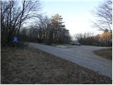
From the Ljubljana - Koper highway we go to the Kozina exit and follow the road ahead in the direction of Reka. In Hrpelje we notice a signpost for Slavnik, which points us to the right. The road which at first runs past the industrial area soon becomes a macadam and a little higher brings us into the forest. We then follow this occasionally a little worse road to a marked parking lot near the hunting lodge below Glavica.
Route description:
From the parking lot, we continue on the left "main" road which after approximately 15 minutes of walking brings us to an unmarked crossroad. We continue slightly right (slightly left Hrpeljska gora, Koča pri Lipi cottage and Jegno mountain pasture) on the road which is still slightly ascending through the forest. Ahead the road flattens a little and continues with some short descents and ascents. After a time the road passes out of the forest on panoramic grassy slopes, where from the right joins the marked path from Prešnica.
We still continue on the road which a little higher brings us to the next crossroad. We again continue straight (left road from which marked footpath branches off) on the road which then in a moderate ascent in a semicircle circles panoramic Grmada (998m) on which there is situated observatory for fire control.
The road then crosses a short lane of forest and then brings us to the spot, where unmarked cart track branches off to the left, which leads towards the summit of Grmada. We continue on the road to which only few steps later from the left joins a marked footpath. The road that soon starts ascending steeper we then follow all the way to the top of Slavnik.

Photos:
 1
1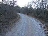 2
2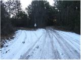 3
3 4
4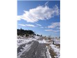 5
5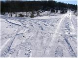 6
6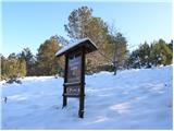 7
7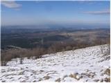 8
8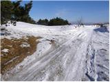 9
9 10
10 11
11 12
12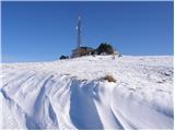 13
13 14
14 15
15
Discussion about the trip Lovski dom pod Glavico - Slavnik (by road)
To post a comment you must log in:
If you do not yet have a username, you must first
register.