Hrastnik (Podkraj) - Kum (via Matca)
Starting point: Hrastnik (Podkraj) (210 m)
| Latitude/Longitude: | 46,121°N 15,0916°E |
| |
Route name: via Matca
Walking time: 2 h 55 min
Difficulty: easy marked way
Elevation gain: 1010 m
Elevation difference along the route: 1015 m
Map:
Recommended equipment (summer):
Recommended equipment (winter): ice axe, crampons
Views: 23.990
 | 2 people like this post |
Access to starting point:
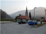
A) First, we drive to Litija, and then we continue driving in the direction of Trbovlje and further towards Hrastnik. When we arrive in Hrastnik, we do not continue left on the main road across the bridge over the Sava River, but continue straight ahead; some 10 meters further, we turn right towards the Podkraj industrial zone. Between the industrial zone and the settlement of a few smaller blocks, the described path to Kum begins. We park in a suitable spot nearby; if there is enough space, we can use one of the parking lots near the blocks.
B) From the Ljubljana–Maribor motorway, we take the Trojane exit, then continue driving towards Zagorje ob Savi. Through Zagorje, we follow the signs for Litija, then after the bridge over the Sava River, we continue left towards Trbovlje (Litija right). We continue on the main road all the way to Hrastnik, where we do not continue left on the main road across the bridge over the Sava River, but continue straight ahead; some 10 meters further, we turn right towards the Podkraj industrial zone. Between the industrial zone and the settlement of a few smaller blocks, the described path to Kum begins. We park in a suitable spot nearby; if there is enough space, we can use one of the parking lots near the blocks.
C) First, we drive to Celje, then continue driving towards Laško, Rimske Toplice, and Hrastnik. Through Hrastnik, we follow the main road, and when we cross the bridge over the Sava River, we continue left towards the Podkraj industrial zone. A few meters further, the road turns right and takes us between the industrial zone on the left and the settlement of a few smaller blocks on the right, where the described path to Kum begins. We park in a suitable spot nearby; if there is enough space, we can use one of the parking lots near the blocks.
D) We drive to Radeče, from where we continue towards Zidani Most, and there we turn left towards Hrastnik. We continue on a narrower road that runs along the Sava River, and when we arrive in Hrastnik, we first continue left (right is the center of Hrastnik); then, when we cross the bridge over the Sava River, we turn left again towards the Podkraj industrial zone. A few meters further, the road turns right and takes us between the industrial zone on the left and the settlement of a few smaller blocks on the right, where the described path to Kum begins. We park in a suitable spot nearby; if there is enough space, we can use one of the parking lots near the blocks.
Route description:
From the starting point, we continue in the direction of Kum and quickly leave the dead-end road, as the signs for the path via Matco direct us onto a footpath that, after a short ascent, brings us to gardens; a few steps higher, we also cross an asphalt road leading to the nearby water reservoir. We bypass the water reservoir on the left side, then follow the frequent signs for Kum through the forest. When we step out of the forest, the path leads us in a traverse ascent across a panoramic hay meadow, from which a beautiful view opens towards part of Hrastnik and the surrounding hills. Higher up, the path returns to the forest and gradually transitions to more scenic and steeper slopes. A wide path leads us across the steep slopes, so that in snow-free conditions the ascent poses no major danger, but in snow there is a risk of slipping in several places. When the steepness eases higher up, we gradually emerge from the forest at the edge of the hamlet of Matica, where the path takes us past a few houses. We quickly leave the road, then briefly continue along the edge of a meadow. A little further on, we cross a poor macadam road, then ascend through a strip of forest to another asphalt road, which we follow left towards Kum. After a short ascent along the road, at a small junction we continue on the right-hand road towards Kum, which is for pedestrians only. When the road enters the forest after a few meters, we leave it, as the signs for Kum direct us right onto a footpath that continues through the forest and a little higher crosses an asphalt road. After the crossing, we step out of the forest and ascend beside a pasture to the next hamlet, where we follow the road left; at the marked junction by the houses, we turn sharply right onto the road running past the farm building. Beyond the house on the left, we continue left onto the path that ascends across an increasingly panoramic hay meadow, then higher enters the forest through which we continue climbing. At junctions, we follow the signs for Kum, meanwhile crossing another macadam road (left leads to the chapel of St. Mary on Ključevica, right to Tratovškova valley).
Further on, the forest thins somewhat and partly across meadows we reach the road leading to Kum. We follow the road left, onto which two paths from Trbovlje also join (the path via Dobovec and the path via Čebulova valley). When the forest thins again, the signs for Kum direct us right, then along a somewhat steeper path with ever finer views we reach a junction just below the summit of Kum, where the path from Zidani Most joins from the left (also the path from Radeče and Podkum).
Here we continue right and past the mountain hut ascend to the summit of Kum, where the church of St. Neža stands.
The description and photos refer to the conditions in 2016 (March).

Along the route: Matica (662m)
Photos:
 1
1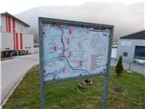 2
2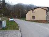 3
3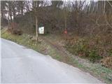 4
4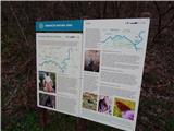 5
5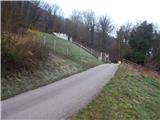 6
6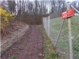 7
7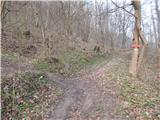 8
8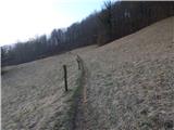 9
9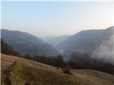 10
10 11
11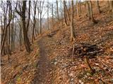 12
12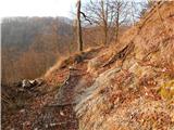 13
13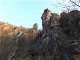 14
14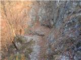 15
15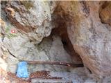 16
16 17
17 18
18 19
19 20
20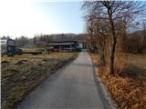 21
21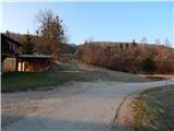 22
22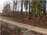 23
23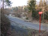 24
24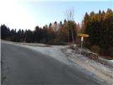 25
25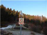 26
26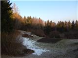 27
27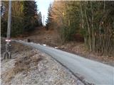 28
28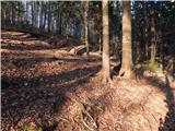 29
29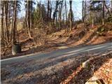 30
30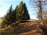 31
31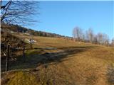 32
32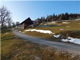 33
33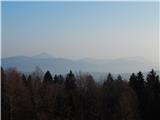 34
34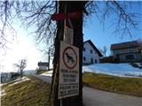 35
35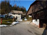 36
36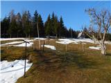 37
37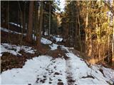 38
38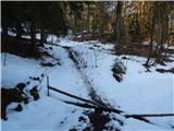 39
39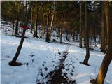 40
40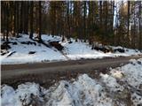 41
41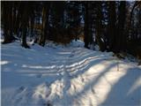 42
42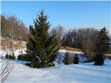 43
43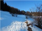 44
44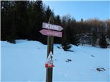 45
45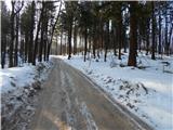 46
46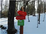 47
47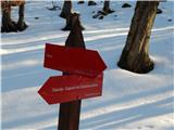 48
48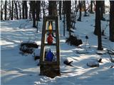 49
49 50
50 51
51 52
52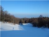 53
53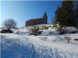 54
54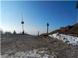 55
55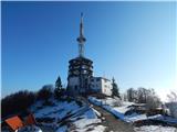 56
56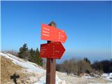 57
57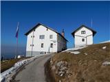 58
58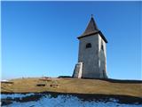 59
59 60
60
Discussion about the trip Hrastnik (Podkraj) - Kum (via Matca)
|
| andrej7824. 03. 2016 |
The walking time is completely exaggerated... an averagely fit hiker reaches the summit in under 2 hours without any problems...
|
|
|
|
| garmont24. 03. 2016 |
And covers on average more than 500 elevation meters per hour...
|
|
|
|
| Hribolazec8117. 04. 2016 |
I was up there in 1:45 hours of normal walking and photographed along the way, the path is nice
|
|
|
|
| bruny17. 04. 2016 |
These times are relative...From the train station on the other side of Sava it took 1 hour and 45 minutes and took a lot of photos. But, if you want to see everything somewhere a bit more in detail and chat with someone along the path, the time in the description is quite realistic for a complete impression.  Some reach the top in an hour and maybe some need five. Some reach the top in an hour and maybe some need five.  That's not important, the meaning is in the path and the goal is just the reward of the path... That's not important, the meaning is in the path and the goal is just the reward of the path...
|
|
|
|
| Stamp7. 07. 2019 |
Up described path (2h10min), down some scrambling - to Trbovlje but east shortcut (had time/will)..
If interested Pics/maps there (click TO)
|
|
|
|
| gumpy23. 02. 2021 |
Nice path!
After a quite nice winter January and beginning of February, this end of February is already very spring-like. Temperatures from 8 to 17C! Warm-almost hot on the steep part through Matco. Super marked path, so no chance to get lost!
The whole path is already dry. First time up on Kum.
Fun!
|
|
|
To post a comment you must log in:
If you do not yet have a username, you must first
register.