Hotovlja - Bukov vrh (footpath)
Starting point: Hotovlja (400 m)
| Latitude/Longitude: | 46,1184°N 14,1944°E |
| |
Route name: footpath
Walking time: 1 h
Difficulty: easy marked way
Elevation gain: 432 m
Elevation difference along the route: 432 m
Map: Škofjeloško in Cerkljansko hribovje 1:50.000
Recommended equipment (summer):
Recommended equipment (winter):
Views: 20.586
 | 1 person like this post |
Access to starting point:
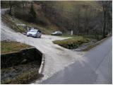
From Škofja Loka we drive towards Gorenji vasi. The road then brings us to the traffic-light intersection in the village Poljane nad Škofjo Loko. Here we turn left towards the village Hotovlja. The road immediately after the intersection crosses Poljanščica over a bridge and then brings us to the next intersection, where we continue left. Further, the road brings us among houses in the village, where we also notice the beginning of the footpath to Bukov vrh. Here we drive a few dozen meters further to the parking lot, which we notice on the other side of the stream along which we are driving.
Route description:
From the parking lot, we return a few meters on the road back to the marked beginning of the mountain path to Bukov vrh. The path then over a small bridge crosses the stream and on the other side steeply ascends. The path ahead ascends for a good 20 minutes through the forest, then brings us to a sparsely vegetated slope, where the steepness eases. Here by the path we notice two crosses, which are only a few meters apart. A little further the path brings us to a smaller hamlet, where we continue on a poor road which we follow only for a short time. When we come to the fence we continue through the gate and then gently ascend between the fences. We follow this path along which the blazes are very rare for a few minutes to the spot where we step onto a poor road. Here we notice the sign for Bukov vrh, which directs us across the grassy slope towards the church, which we already see in front of us. A little below the summit, the path ascends a little more steeply for a short time and with increasingly beautiful views quickly brings us to the summit.

Photos:
 1
1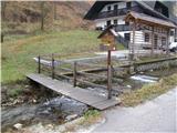 2
2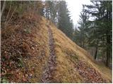 3
3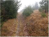 4
4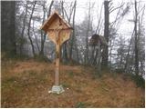 5
5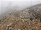 6
6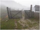 7
7 8
8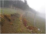 9
9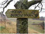 10
10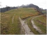 11
11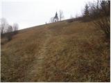 12
12 13
13
Discussion about the trip Hotovlja - Bukov vrh (footpath)
|
| KARAMELICA1. 04. 2013 |
Was on Bukov Vrh today, but we started in the village of Visoko pri Poljanah. The path initially follows asphalt, then past isolated farms along the ridge. Given that the snow is not trodden, I recommend good footwear. Shame about the poor visibility, as on a nice day there are superb views of the Škofjeloško pogorje. On Bukov Vrh there is also a beautiful church of St. Sobota. Recommended
|
|
|
To post a comment you must log in:
If you do not yet have a username, you must first
register.