Hotel Plesnik - Logarska peč (via Rkljeva peč)
Starting point: Hotel Plesnik (760 m)
| Latitude/Longitude: | 46,3946°N 14,63°E |
| |
Route name: via Rkljeva peč
Walking time: 2 h 20 min
Difficulty: partly demanding marked way
Elevation gain: 776 m
Elevation difference along the route: 780 m
Map: Kamniške in Savinjske Alpe 1:50.000
Recommended equipment (summer): helmet
Recommended equipment (winter): helmet, ice axe, crampons
Views: 9.327
 | 1 person like this post |
Access to starting point:
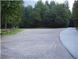
We drive to Luče (from Mozirje or over Kranjski rak) and continue towards Logarska dolina. Soon after the village of Solčava we come to the junction, where the road to Logarska dolina branches off to the left. We turn left towards Logarska dolina (toll payment) and drive to a junction, where we continue on the left road (slightly right waterfall Rinka), which we then follow to a large parking lot near the hotel Plesnik (parking in front of the hotel is only for guests).
Route description:
From the parking lot, we go on a walking path, which past the hotel Plesnik in a few minutes brings us to the waterfall Palenk. At the waterfall we notice a mountain signpost with a caption Strelovec and Icmankov stan, which points us to the left. The path then immediately steeply ascends on a steep and in wet for slipping dangerous slope, which is at the same time also exposed to falling stones. Steep path quickly brings us to a stream (above the waterfall), where there is a smaller orientation loop. We continue here sharply left on a poorly beaten, but marked path (path right leads towards waterfalls of the stream Palenk), which is still steeply ascending. Higher, the steepness for a short time decreases, but only because we cross slightly exposed steep slope below Rkljeva peč (steel cable). The path then goes again in the forest and higher joins the path from Plesnikova planina.
We continue left on a noticeably less steep path, which with some smaller views brings us to a wooden cottage. From the cottage, which is situated on a smaller non-panoramic clearing, the path returns into the forest, where it ascends to the edge of the mountain pasture Icmanikova planina, where there is a junction.
We continue left in the direction of Logarska peč, on the path which at first gently ascends through quite overgrown mountain pasture and then it goes into the forest. After a few dozen steps of ascent through the forest, the path brings us on a ridge, from which we then descend to the vantage point.

Photos:
 1
1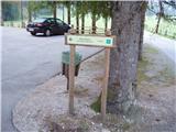 2
2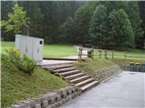 3
3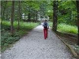 4
4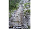 5
5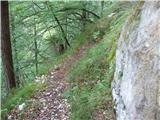 6
6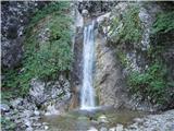 7
7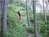 8
8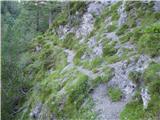 9
9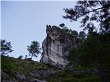 10
10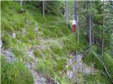 11
11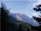 12
12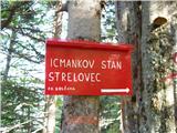 13
13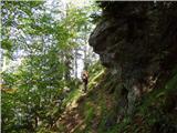 14
14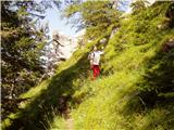 15
15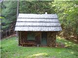 16
16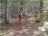 17
17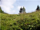 18
18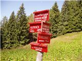 19
19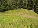 20
20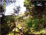 21
21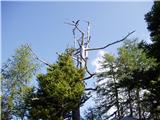 22
22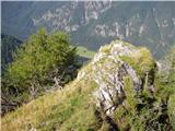 23
23
Discussion about the trip Hotel Plesnik - Logarska peč (via Rkljeva peč)
|
| bubi24. 06. 2010 |
Two years ago I descended this path from Logarska peč with friends. Still worth warning again that this ascent is much less innocent than it seems at first glance. A narrow path on a very exposed slope without any protection is something I prefer to avoid.
|
|
|
|
| tejkolino27. 06. 2021 20:21:22 |
Today (27.6.) we ascended to Logarska peč from Hotel Plesnik via Rkljeva peč. It's an orientationally and also technically demanding tour. The path description could be corrected, as the path is not marked. We can find only rare faded markers and an unbeaten trail that quickly disappears due to a large amount of fallen trees (even below Rkljeva peč). Not to mention that in wet weather there are many slipping hazards.
|
|
|
To post a comment you must log in:
If you do not yet have a username, you must first
register.