Hotel Plesnik - Icmanikova planina (via Rkljeva peč)
Starting point: Hotel Plesnik (760 m)
| Latitude/Longitude: | 46,3946°N 14,63°E |
| |
Route name: via Rkljeva peč
Walking time: 2 h 15 min
Difficulty: partly demanding marked way
Elevation gain: 760 m
Elevation difference along the route: 760 m
Map: Kamniške in Savinjske Alpe 1:50.000
Recommended equipment (summer): helmet
Recommended equipment (winter): helmet, ice axe, crampons
Views: 5.818
 | 1 person like this post |
Access to starting point:
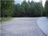
We drive to Luče (from Mozirje or over Kranjski rak) and continue towards Logarska dolina. Soon after the village Solčava we come to the crossroads, where the road to Logarska dolina branches off to the left. We turn left towards Logarska dolina (toll payment) and drive to the crossroads, where we continue on the left road (slightly right to the Rinka waterfall), which we then follow to the large parking lot near the hotel Plesnik (parking in front of the hotel is permitted only for guests).
Route description:
From the parking lot, we head to the walking path, which past the hotel Plesnik in a few minutes brings us to the Palenk waterfall. At the waterfall we notice a mountain signpost with the inscription Strelovec and Icmankov stan, which directs us to the left. The path then immediately steeply ascends a steep and, when wet, slippery slope, which is also exposed to falling stones. The steep path quickly brings us to the stream (above the waterfall), where there is a small orientation loop. Here we continue sharply left on a poorly beaten but marked path (the path to the right leads to the waterfalls of the Palenk stream), which continues steeply ascending. Higher up the steepness eases briefly, but only because we cross a slightly exposed steep slope below Rkljeva peč (steel cable). The path then enters the forest again and higher joins the path from Plesnikova planina.
We continue left on a noticeably less steep path, which with a few smaller views brings us to a wooden hut. From the hut, which is located on a small clearing without views, the path returns to the forest, where it then ascends to the edge of Icmanikova planina, where there is a junction. From the junction we can descend a few dozen meters to the shepherd hut or ascend to the vantage point Logarska peč, which is 5 minutes away.

Photos:
 1
1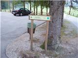 2
2 3
3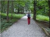 4
4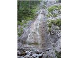 5
5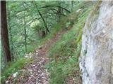 6
6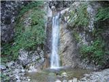 7
7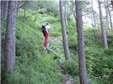 8
8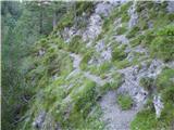 9
9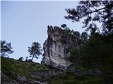 10
10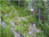 11
11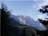 12
12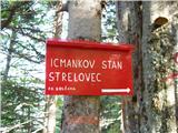 13
13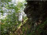 14
14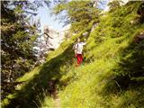 15
15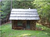 16
16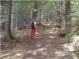 17
17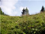 18
18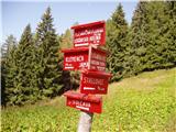 19
19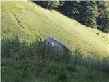 20
20
Discussion about the trip Hotel Plesnik - Icmanikova planina (via Rkljeva peč)
|
| lararal7. 09. 2020 |
Last week (Sep 2020) we set off on this path. The path is extremely steep, very poorly marked, if at all (No direction signs and the markings are completely faded) and partly difficult to pass due to fallen trees and storm damage.
Later we talked about the path with locals who advise against the ascent on the mentioned path and said that the path is no longer intentionally maintained. I suggest to the author to change the description to unmarked trail.
|
|
|
To post a comment you must log in:
If you do not yet have a username, you must first
register.