Heidi Alm - Falkert (climbing way)
Starting point: Heidi Alm (1872 m)
| Latitude/Longitude: | 46,8634°N 13,8313°E |
| |
Route name: climbing way
Walking time: 2 h
Difficulty: extremely difficult marked way
Via ferrata: D
Elevation gain: 436 m
Elevation difference along the route: 436 m
Map:
Recommended equipment (summer): helmet, self belay set
Recommended equipment (winter): helmet, self belay set, ice axe, crampons
Views: 6.734
 | 4 people like this post |
Access to starting point:
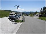
A) Through the Karawanks Tunnel, we drive to Austria, and then continue driving on the Tauern highway, which we leave already on the Villach bypass and continue driving towards the settlement Feldkirchen. Further, we drive by Osojsko jezero / Ossiacher See to the already mentioned settlement. In Feldkirchen we continue left in the direction of the mountain pass Turacher Höhe and drive ahead past settlements Himmelberg, Gnesau, Mitterdorf to the settlement Wiedweg, where from the left also the road from Bad Kleinkirchheim joins. From the mentioned crossroad, we continue towards the mountain pass Turacher Höhe only a few 100 m, then signs for mountain pasture Heidialm and village and lake Falkertsee direct us left onto an ascending road. We follow the mentioned road to its end, where we park on one of the many parking lots.
B) From Štajerska or Koroška, we first drive to Dravograd and then over the border crossing Vič into Austria, where we then follow signs for Celovec / Klagenfurt. Further, we drive on the so-called South highway, which we leave at Celovec (direction Feldkirchen). Further, we drive on a regional road, by which we arrive at the already mentioned settlement. In Feldkirchen we continue right in the direction of the mountain pass Turacher Höhe and drive ahead past settlements Himmelberg, Gnesau, Mitterdorf to the settlement Wiedweg, where from the left also the road from Bad Kleinkirchheim joins. From the mentioned crossroad, we continue towards the mountain pass Turacher Höhe only a few 100 m, then signs for mountain pasture Heidialm and village and lake Falkertsee direct us left onto an ascending road. We follow the mentioned road to its end, where we park on one of the many parking lots.
Route description:
From the parking lot, we head in the direction of the park Heidi-Alm to which we have 130 m. After 130 m a path branches off to the left to the mentioned park (entrance fee is charged to view the park), and we continue straight and continue the path along the road, which quickly brings us to the high mountain lake Falkertsee.
From the lake, which we bypass on the left side, the path starts to ascend more moderately and continues on an increasingly worse road. A little higher we arrive at a marked junction, where we continue right towards the saddle Falkertscharte (left ridge path to Rodresnock). We continue the ascent for some time on the worse road, then we arrive at a smaller wooden hut, where it changes into a pleasant path. We continue through the high mountain valley, which on the left side is surrounded by steep slopes of Rodresnock, on the right by the south face of the peak Falkert, where the climbing path soon branches off.
Straight through the valley the path leads towards the notch Falkertscharte, and we continue right on a narrow path that leads towards the climbing path on Falkert. At the junction there is also a bench and a sign with a description of the climbing path.
From the junction we start to ascend more steeply on a narrow path marked with red dots and soon we are at the entrance to the climbing section of the path.
At the entrance to the climbing section of the path we equip ourselves with a via ferrata set and helmet, and the use of climbing gloves is also highly recommended.
At the beginning of the climbing section we ascend up the gully rightwards A/B. This is followed by a demanding traverse leftwards upwards on quite smooth slabs C/D. We continue along the ledge, which is partly overgrown with grass, then the path ascends somewhat more steeply again and brings us to a small bench where there is also a summit logbox.
Continuing, we first cross steep grass-covered slopes, then a more demanding traverse follows and later an ascent on a steep rocky slope C/D. In the final section the climbing path turns right and an ascent to the bridge follows. The bridge is made of two steel cables: we walk on one and use the other for holding and self-belaying. After crossing the bridge there follows a very short but demanding descent over an overhang (difficulty D). The climbing path then ends and brings us to the grassy slopes below the summit.
We continue left and in approximately 10 minutes of ascent on the grassy slope we reach the summit.

Along the route: Falkertsee (1872m)
Photos:
 1
1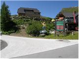 2
2 3
3 4
4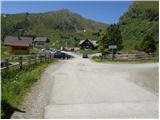 5
5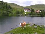 6
6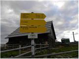 7
7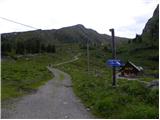 8
8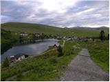 9
9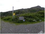 10
10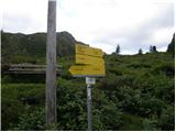 11
11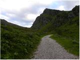 12
12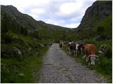 13
13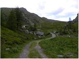 14
14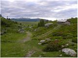 15
15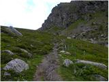 16
16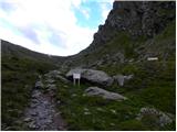 17
17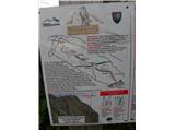 18
18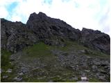 19
19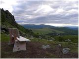 20
20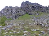 21
21 22
22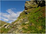 23
23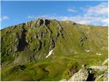 24
24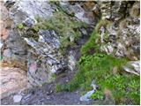 25
25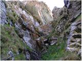 26
26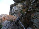 27
27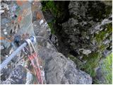 28
28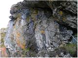 29
29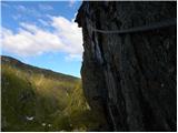 30
30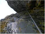 31
31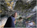 32
32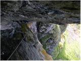 33
33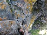 34
34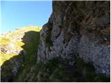 35
35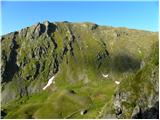 36
36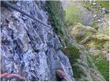 37
37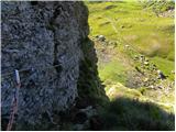 38
38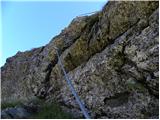 39
39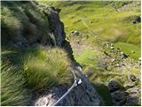 40
40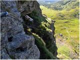 41
41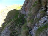 42
42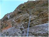 43
43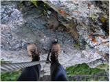 44
44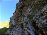 45
45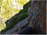 46
46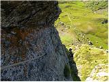 47
47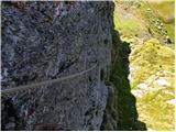 48
48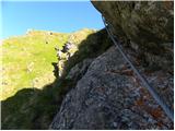 49
49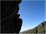 50
50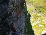 51
51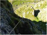 52
52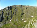 53
53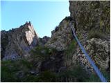 54
54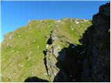 55
55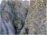 56
56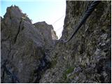 57
57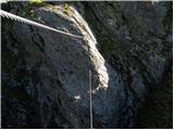 58
58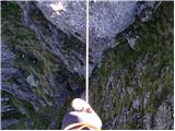 59
59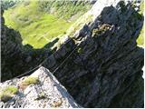 60
60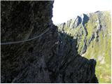 61
61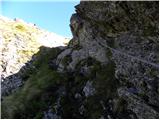 62
62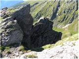 63
63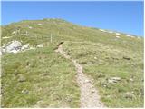 64
64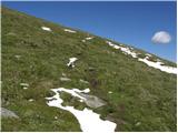 65
65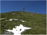 66
66 67
67 68
68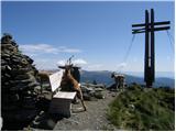 69
69
Discussion about the trip Heidi Alm - Falkert (climbing way)
|
| Želva ekspres17. 06. 2019 |
Due to a rockfall, the approach and initial part of the via ferrata have changed. The entire rock where there used to be a gully with difficulty A/B has collapsed. The intermediate sections are also partially changed. The consequences of the fall are visible already at the approach, where the narrow path between rocks and grass has been replaced by a path over scree. The approach and path are otherwise the same as before and well marked, just turn right just before the old entrance.
But on this hill a new via ferrata "Murmel-steig" with difficulty B/C has been created. The approach is the same as for Falkert, just turn left at the new junction.
|
|
|
To post a comment you must log in:
If you do not yet have a username, you must first
register.