Gradiško jezero - Limbarska gora
Starting point: Gradiško jezero (355 m)
| Latitude/Longitude: | 46,1621°N 14,708°E |
| |
Walking time: 1 h 55 min
Difficulty: easy marked way
Elevation gain: 418 m
Elevation difference along the route: 460 m
Map:
Recommended equipment (summer):
Recommended equipment (winter):
Views: 19.170
 | 2 people like this post |
Access to starting point:
From the Ljubljana - Maribor highway, we take the Lukovica exit, then continue driving towards Moravče. After crossing Radomlje, we arrive at the beginning of the settlement Spodnje Prapreče, where at the intersection we continue left in the direction of Lake Gradiško. After a short ascent, we arrive at an intersection with the priority road, where we continue right towards Lake Gradiško (left Gradišče), then just a little further, from the priority road left towards Lake Gradiško (right Preserje pri Lukovici), in front of which we then park on a large parking lot.
Route description:
From the starting point, we continue on a marked path in the direction of Limbarska gora, which continues by the northern shore of Lake Gradiško. The path which continues on a macadam road and which is closed for public traffic, soon turns right and passes on the eastern side of the lake, where the marked path towards Limbarska gora turns left in the forest.
We continue towards Limbarska gora, where we at first ascend steeper, and then the path which continues on a cart track, quickly flattens. Higher, we come out of the forest and on the right side a nice view opens up towards the church of St. Mohor on Mohorjev hrib, and the path in additional few minutes descends to the settlement Vinje pri Moravčah, where there is a marked junction.
We continue left in the direction of Limbarska gora (right St. Mohor), where we go past few houses, chapel and inscription box of the Rokovnjaška planinska pot. A little further, at the smaller crossroad, by which there is a wooden religious symbol, we continue right in the direction of Limbarska gora and we ascend to the settlement Negastrn, where at the crossroads we follow the blazes. When we leave the asphalt road, we also quickly leave the village, and at the junction, we choose the bottom right cart track which descends to a marked junction, where also a marked path from Krašnja joins.
We continue in the direction of Limbarska gora, and the path little ahead crosses the asphalt road Krašnja - Moravče. The path ahead leads us on a macadam road, from which we soon go left on a marked path, which gradually passes into the forest. After few minutes, we reach a wide cart track, from there blazes point us to the left. Next follows a moderate ascent through the forest, when the forest ends we get to a larger meadow, where the path turns left. Next follows some quite gentle walking, and then we reach an asphalt road, on which in few minutes and with increasingly beautiful views, we ascend to the summit of Limbarska gora, where there is the church of St. Valentine.
Starting point - Vinje pri Moravčah 0:45, Vinje pri Moravčah - Limbarska gora 1:10.
Description and pictures refer to the condition in the year 2018 (November).

Along the route: Vinje pri Moravčah (394m), Negastrn (464m)
Photos:
 1
1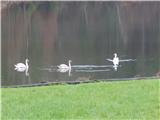 2
2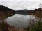 3
3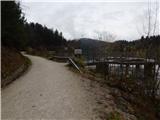 4
4 5
5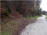 6
6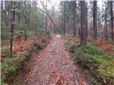 7
7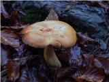 8
8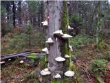 9
9 10
10 11
11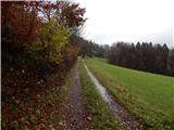 12
12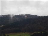 13
13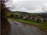 14
14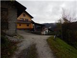 15
15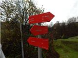 16
16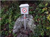 17
17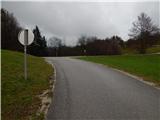 18
18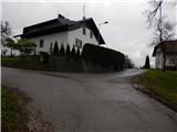 19
19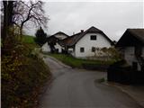 20
20 21
21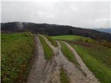 22
22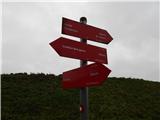 23
23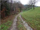 24
24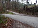 25
25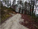 26
26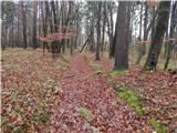 27
27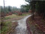 28
28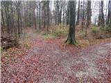 29
29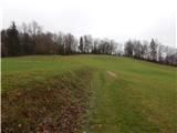 30
30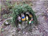 31
31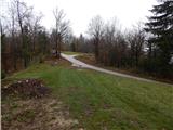 32
32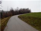 33
33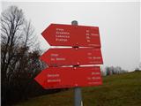 34
34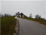 35
35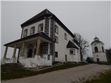 36
36 37
37
Discussion about the trip Gradiško jezero - Limbarska gora
|
| zlatica18. 02. 2019 |
Diverse and interesting trail, only for me it took quite longer than the time stated above. The trail is 15km long in both directions and apparently I no longer meet the norms of fast hikers. But no problem, the important thing is to be in nature and take time to see the sights offered along the trail.
|
|
|
|
| roženkravt17. 02. 2020 |
Exceptionally beautiful, almost fairy-tale trail. Surely it's like that in all seasons. In summer, it seems, it provides nice shady shelter.
The trail description with all photos is outstanding.
And full praise to the Blagovica mountaineering association for more than exemplary markings. Rarely do you find such an excellently marked trail. No chance of getting lost.
Visit Limbarska gora via this trail. You won't regret it.
|
|
|
|
| TamaraTP5. 03. 2020 |
It's really a nice trail, as both predecessors wrote. Palčkov klanec is quite interesting. Plenty of habitat. Suitable trail with a four-legger.
|
|
|
|
| J.P.1. 01. 2021 |
Definitely recommend starting from the lake. A nice trip full of beautiful views, beautiful nature... regardless of the season and weather. Lp
|
|
|
|
| smatjaz2. 01. 2021 |
Even nicer is from the lake to Gradišče and the summit of Gradišče above the church of St. Margaret, from where there is a nice view over a large part of the Ljubljana Basin, Vodiške Plains, KSA and Julijci, and descent through the forest to the dam and further to Limbarska, this additional loop takes me about 1 hour.
|
|
|
To post a comment you must log in:
If you do not yet have a username, you must first
register.