Gozd - Storžič (via Psica)
Starting point: Gozd (891 m)
| Latitude/Longitude: | 46,3408°N 14,3286°E |
| |
Route name: via Psica
Walking time: 4 h 45 min
Difficulty: very difficult marked way
Elevation gain: 1241 m
Elevation difference along the route: 1400 m
Map: Karavanke - osrednji del 1:50.000
Recommended equipment (summer): helmet
Recommended equipment (winter): helmet, ice axe, crampons
Views: 10.460
 | 2 people like this post |
Access to starting point:
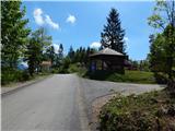
A) From the Ljubljana–Jesenice highway, take the Kranj–West exit and continue along the road towards Golnik. Just a little after Golnik (more precisely, after the settlement of Senično), a steep road branches off to the right uphill, leading towards Zgornje Vetrno and Gozd. After the village of Zgornje Vetrno, the road mostly continues through the forest, and we follow it to the marked parking lot located right next to the shelter Zavetišče v Gozdu.
B) From the Jesenice–Ljubljana highway, take the Podbrezje exit, then continue driving towards Ljubelj and Tržič. Before the Petrol gas station in Bistrica pri Tržiču, turn right and then drive into Tržič. When the road descends into the valley, continue sharply right towards Pristava and Križe, then drive along the main road leading towards Zgornje and Spodnje Duplje; leave this main road at the settlement of Retnje, continuing left towards the settlements of Križe and Golnik. Continue towards Golnik; after the settlement of Križe, soon reach a smaller intersection where a steep road branches off to the left, leading towards Zgornje Vetrno and Gozd. After the village of Zgornje Vetrno, the road mostly continues through the forest, and we follow it to the marked parking lot located right next to the shelter Zavetišče v Gozdu.
Route description:
From the shelter, we walk to the nearby church, then arrive at a marked junction where the path from Golnik joins from the right. We continue left uphill along an increasingly poor road that brings us to a junction in a few minutes.
We continue along the right track in the direction of Storžič, Tolsti vrh, and Mala and Velika Poljana (left Koča na Kriški gori). The track, which ascends diagonally towards the east, has a few junctions in the lower section, but they are well marked, so there are no major orientation problems. Higher up, the track turns into a gradually steeper footpath that leads us out of the forest onto panoramic grassy slopes. After a while, the path levels out and takes us to a pleasant viewpoint with a bench, beside which we notice a memorial plaque.
Ahead, the path crosses a steep grassy slope (danger of slipping and in winter also avalanches) and then enters dense forest, where we reach a marked junction. We continue straight towards Velika Poljana (left Tolsti vrh), crossing forested slopes for a short time, then the forest gradually thins and transitions to the steeper slopes of Štajnarica, continuing with some shorter ascents and descents; on the more difficult sections, a few steel cables assist us. In the final section over Štajnarica, we cross another steep grassy slope, from which the first close-up view of Storžič opens up. After the bench, the path enters the forest and then begins descending diagonally towards Mala Poljana, which we reach after a few minutes. When we step out of the forest, we also step onto the track, along which we descend to the hunting hut on Mala Poljana.
From Mala Poljana, where paths join from Tolsti vrh, Dom pod Storžičem, and Zalog, we continue along the left side of the hunting hut on the path towards Velika Poljana. The path, which continues along the track, quickly enters the forest, where it then ascends diagonally. After a few minutes of walking, we reach a panoramic slope from which a nice view opens up onto the surrounding mountains. A little further on, the track turns right and, after a short ascent, brings us to the upper edge of Velika Poljana, where there is a marked junction.
We continue straight into the forest along the path towards Storžič via Psica (right Koča na Veliki Poljani 1 minute). The path ahead begins to ascend quite steeply, then turns slightly right and the gradient eases somewhat. This path soon leads us out of the forest to a path junction. We turn left onto the path via Psica; right leads the easier path to Storžič.
From the junction, the path initially runs across grassy terrain amid dwarf pines and sparse trees, then re-enters the forest and begins to ascend steeply. In a few places, the path is somewhat exposed. This is followed by an ascent across a grassy slope amid sparse dwarf pines to a panoramic ridge. We continue ascending the increasingly exposed ridge for a while, then reach the indistinct summit of Psica. From the top, we descend slightly, then continue along the exposed ridge. Further on, the path along the ridge rises and falls several more times, with some fixed protections to assist us. Later, the path through Žrelo joins from the left, but we continue along the ridge path. In the final section, we ascend steeply a few more times, assisted by some fixed protections. A little below the summit, the easiest path to Storžič joins from the right, leading over the mountain pasture Javornik. Only a short ascent remains along the summit slope of Storžič, reaching the top in a few minutes.
Zavetišče v Gozdu - Mala Poljana 2:00, Mala Poljana - Velika Poljana 0:15, Velika Poljana - Storžič 2:30.

Photos:
 1
1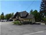 2
2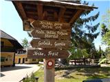 3
3 4
4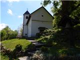 5
5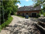 6
6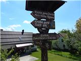 7
7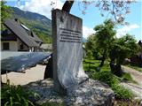 8
8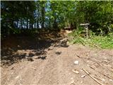 9
9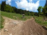 10
10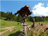 11
11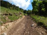 12
12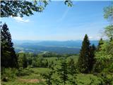 13
13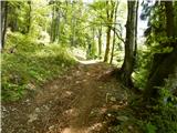 14
14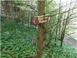 15
15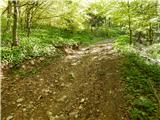 16
16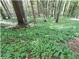 17
17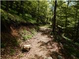 18
18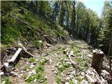 19
19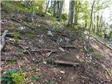 20
20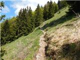 21
21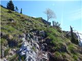 22
22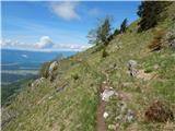 23
23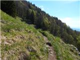 24
24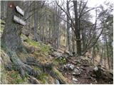 25
25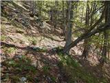 26
26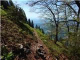 27
27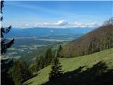 28
28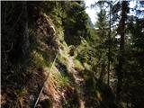 29
29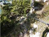 30
30 31
31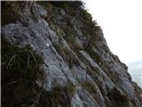 32
32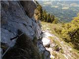 33
33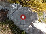 34
34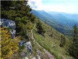 35
35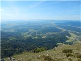 36
36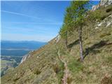 37
37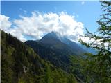 38
38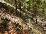 39
39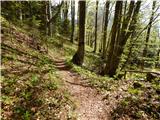 40
40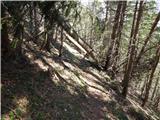 41
41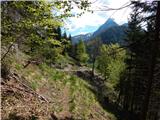 42
42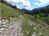 43
43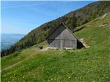 44
44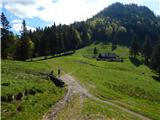 45
45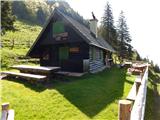 46
46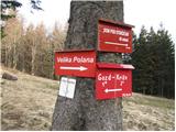 47
47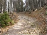 48
48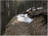 49
49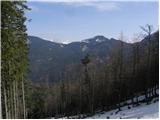 50
50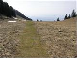 51
51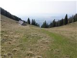 52
52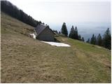 53
53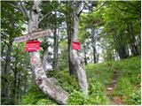 54
54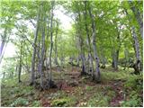 55
55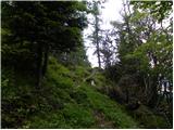 56
56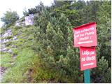 57
57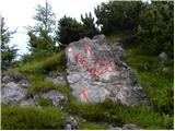 58
58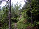 59
59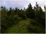 60
60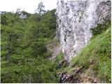 61
61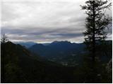 62
62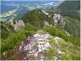 63
63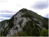 64
64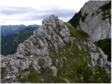 65
65 66
66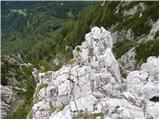 67
67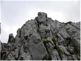 68
68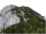 69
69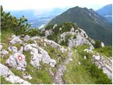 70
70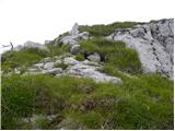 71
71 72
72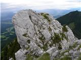 73
73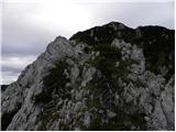 74
74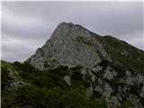 75
75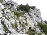 76
76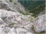 77
77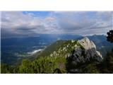 78
78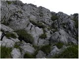 79
79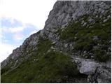 80
80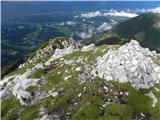 81
81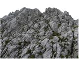 82
82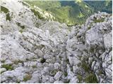 83
83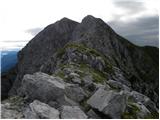 84
84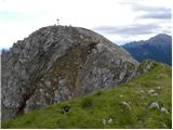 85
85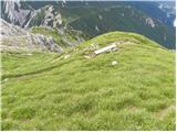 86
86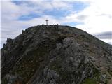 87
87 88
88
Discussion about the trip Gozd - Storžič (via Psica)
|
| ljubitelj gora2. 06. 2014 |
Above it says "demanding marked path" on picture 57 (that sign isn't there) but it says "very demanding marked path". I did this path yesterday from the Laški direction, thought I'd go towards Kališča, but then descended back to Krničarjeva hut.
|
|
|
|
| Tadej2. 06. 2014 |
Thanks for the heads-up, the difficulty was mistakenly written incorrectly. I've corrected it to very demanding.
Best, Tadej
|
|
|
|
| KrEnPlaninc7. 09. 2024 23:59:51 |
Hello! Today I completed this trail. One of the most beautiful and interesting trails I've done so far. The ridge to Psica is quite technical. In places it descends with the help of a fixed cable where your legs might shake a bit as there are quite steep drops on both sides. The whole trail moves along the ridge up and down and there's a steep drop on both sides all the time. Especially be careful not to do this trail in strong wind as there are some sections on the top of the ridge with very little support. The trail itself winds through live rock in places and is only visible from the markers on the ground, watch out for that.
|
|
|
To post a comment you must log in:
If you do not yet have a username, you must first
register.