Gozd Martuljek - Pri treh macesnih
Starting point: Gozd Martuljek (750 m)
| Latitude/Longitude: | 46,4821°N 13,8378°E |
| |
Walking time: 3 h 40 min
Difficulty: very difficult unmarked way
Elevation gain: 1060 m
Elevation difference along the route: 1080 m
Map: Kranjska Gora 1:30.000
Recommended equipment (summer): helmet
Recommended equipment (winter): helmet, ice axe, crampons
Views: 13.387
 | 5 people like this post |
Access to starting point:
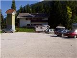
From Mojstrana we drive towards Kranjska Gora or vice versa, but only to the village Gozd Martuljek, where we park on a parking lot near the bridge over the river Sava Dolinka (parking lot is located after the bridge, or before, if we come from Kranjska Gora).
Route description:
From the parking lot, we continue by the main road towards Kranjska Gora, but only to a spot, where cycling road branches off to the left (by the beginning of the cycling path there are also signposts, which point us on the mentioned road). We follow the cycling road to the first crossroad, where we continue straight on a macadam road (cycling road turns right), which quickly brings us to the next crossroad.
We continue right and we follow the for traffic closed road to TNP signpost. Further, the path splits into two parts. We continue straight upwards on a steep cart track which is ascending on the right side of Martuljška soteska. Cart track, which is mostly ascending through the forest after 15 minutes brings us on a nice vantage point, where a view opens up towards a valley. The path then goes again in the forest and continues to ascend. A little further from the left joins the path from the waterfall, and a little further, the path towards the bivouac pod Špikom branches off to the right. We continue in the direction of the cottage Ingotova koča. The path ahead brings us to a crossing, where we continue straight, the path left runs to the cottage Ingotova koča to which is two minutes of walking.
The path ahead is at first ascending gently but only for some time. After that, the path crosses a small spring and on the other side steeply ascends. Steepness starts decreasing and the path brings us to a crossing, where we continue slightly right in the direction of bivouac Za Akom (left Zgornji slap 10 minutes). The path ahead is for some time still steeply ascending, and then the path brings us to a more demanding part. First, with the help of steel cables we cross steep grassy slope, and then still with the help of fixed safety gear we walk over an exposed ledge (watch your head, slightly overhanging rock above us). Still secured path (fixed safety gear are here mainly because of wet terrain), then starts ascending steeper and after few minutes of additional walking brings us to the most difficult part. With the help of made footholds and steel cables, we cross a smooth and wet rocky plate, and then we also cross a shorter very steep wall, which is also well-secured (because of wet slopes a great caution is needed). The steepness of the slopes then decreases and still wet path after a shorter ascent brings us by the edge of mighty gravel beds. Soon trail blaze on rock points us on the mentioned gravel beds, and right upward leads the path towards the bivouac Za Akom, to which is otherwise only few minutes of a steep ascent.
When we come on gravel beds we continue right where also numerous cairns point us to. Further when we walk on a wide torrential riverbed, we stick to the right side of the torrent. Here also nice views open up on the northern walls of Martuljek mountains where Široka Peč stands out. Below Široka Peč we can already see the landmark Pri treh macesnih. From gravel beds, we then continue slightly left and for a short time ascend on a footpath through dwarf pines. The footpath brings us by a little steeper riverbed of a torrent by which we are then ascending. The path here leads by the right side of the riverbed on an indistinct small ridge past rare larches upwards. Next follows crossing of a smaller stream and then ascent on the scree, which brings us on steeper rocky slopes. From here we continue slightly to the right and on smooth rocky plates on which there is quite a lot of sand we again cross the mentioned stream. The slope is here quite steep and because of sand on rocky plates quite some caution is needed. A short ascent follows on a very crumbly steep slope, which is also dangerous for slipping, and then the path brings us to the vantage point Pri treh macesnih.

Photos:
 1
1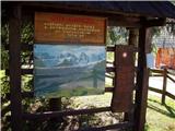 2
2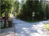 3
3 4
4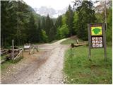 5
5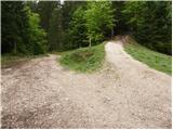 6
6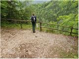 7
7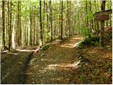 8
8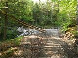 9
9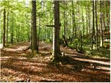 10
10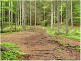 11
11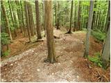 12
12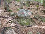 13
13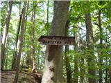 14
14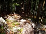 15
15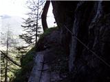 16
16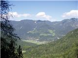 17
17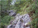 18
18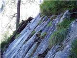 19
19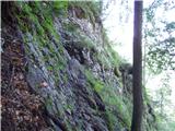 20
20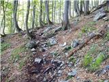 21
21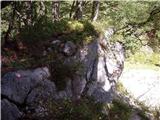 22
22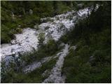 23
23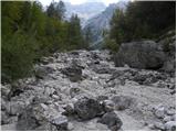 24
24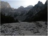 25
25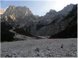 26
26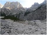 27
27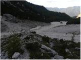 28
28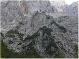 29
29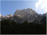 30
30 31
31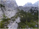 32
32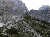 33
33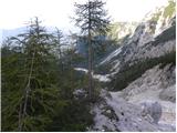 34
34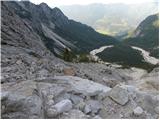 35
35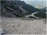 36
36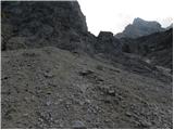 37
37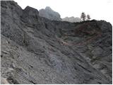 38
38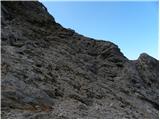 39
39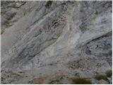 40
40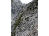 41
41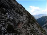 42
42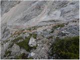 43
43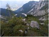 44
44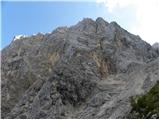 45
45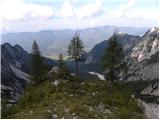 46
46
Discussion about the trip Gozd Martuljek - Pri treh macesnih
|
| andrejp6. 10. 2014 |
Under the larches a path goes right. Does anyone know where to?
|
|
|
|
| ločanka6. 10. 2014 |
I think into the basin. Someone correct me!
|
|
|
|
| di23. 08. 2020 |
I too wondered about the path in picture 33 and attached:
|
|
|
To post a comment you must log in:
If you do not yet have a username, you must first
register.