Starting point: Gotenica (550 m)
| Latitude/Longitude: | 45,6148°N 14,7459°E |
| |
Walking time: 1 h 30 min
Difficulty: easy marked way
Elevation gain: 531 m
Elevation difference along the route: 531 m
Map:
Recommended equipment (summer): helmet
Recommended equipment (winter): helmet, ice axe, crampons
Views: 6.534
 | 2 people like this post |
Access to starting point:
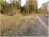
From Ljubljana, we drive towards Kočevje. Soon after Ribnica, near Dolenja vas, we will notice signs for the villages Grčarice, Gotenica and Kočevska Reka, which direct us to the right from the main road. We follow the mentioned road to the beginning of the village Gotenica, where only 50 meters before the old gas station we notice a parking lot and next to it signposts for Goteniški Snežnik (the starting point is situated on the right side of the road, only a few meters before the sign for the beginning of Gotenica).
To the starting point, we can also come from the direction of Kočevska Reka.
Route description:
From the parking lot, signs for Goteniški Snežnik direct us onto a wide footpath, which at first slightly descends to a torrent stream and then starts ascending. After a short ascent, we step onto a wide cart track, which we follow to the right. The cart track, which partly runs through the forest and partly over smaller clearings, brings us higher to a crossing, where we continue sharply left.
We continue the ascent on the cart track, which passes into a dense forest and only a little further changes into a relatively steep footpath. The mentioned path higher slightly flattens and starts turning a little towards the left, where we step onto the very steep slopes of Kameni zid. Here, because of the relatively narrow footpath, which is often covered with leaves, there is a danger of slipping. The path, from which beautiful views of the surroundings begin to open up, is also exposed to falling stones on this steep section.
Higher, the path turns right and brings us, along a relatively steep ascent which again runs through the forest, to a smaller saddle, where we notice signs for the viewpoint Kameni zid. Here we turn right onto a poorly beaten footpath, along which with two minutes of additional ascent we climb to the summit of Kameni zid.

Photos:
 1
1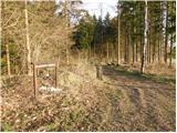 2
2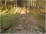 3
3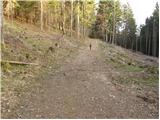 4
4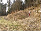 5
5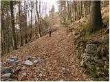 6
6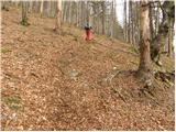 7
7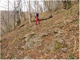 8
8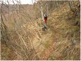 9
9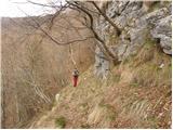 10
10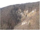 11
11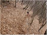 12
12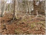 13
13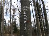 14
14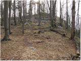 15
15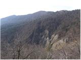 16
16 17
17
Discussion about the trip Gotenica - Kameni zid
To post a comment you must log in:
If you do not yet have a username, you must first
register.