Gorjane (Železno) - Podsreda castle
Starting point: Gorjane (Železno) (368 m)
| Latitude/Longitude: | 46,0378°N 15,5749°E |
| |
Walking time: 45 min
Difficulty: easy marked way
Elevation gain: 107 m
Elevation difference along the route: 130 m
Map:
Recommended equipment (summer):
Recommended equipment (winter):
Views: 106
 | 1 person like this post |
Access to starting point:
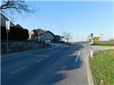
a) From the Sevnica - Krško road, head towards Brestanica, then follow the signs for Podsreda. Before descending towards Podsreda, in the settlement of Gorjane reach the Železno pass, where the described trail begins at the Gorjane bus stop. There are no suitable parking spots at the starting point.
b) Drive to Podsreda, then follow the signs for Krško, Sevnica and Brestanica. Before descending towards Brestanica, in the settlement of Gorjane reach the Železno pass, where the described trail begins at the Gorjane bus stop. There are no suitable parking spots at the starting point.
Route description:
From the bus stop, head onto the side road, alongside which there are signs for Grad Podsreda and Ekološko kmetijo Krivec, where the path leads past a few more houses, at the next intersection go straight in the direction of Grad Podsreda. The road then moderately ascends, later leading past a cross and one house, then continues through the forest for some time. Higher up, the road levels out and takes us to a marked intersection, from which we continue straight in the direction of Grad Podsreda (right Krško and Brestanica).
This is followed by a slight traverse descent through the forest and we arrive at a well-arranged rest area near the chapel of sv. Florjan, from where a nice view of Grad Podsreda opens up.
Continue along the road and in a few minutes of further walking we reach the castle, where on the outer side of the wall there is a logbook box and above it a stamp.
Starting point - Turnič 0:30, Turnič - Grad Podsreda 0:15.
Description and photos refer to the condition in March 2026.

Along the route: Turnič (496m)
Photos:
 1
1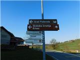 2
2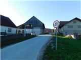 3
3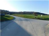 4
4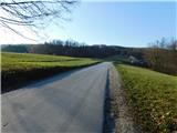 5
5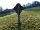 6
6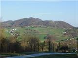 7
7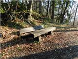 8
8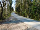 9
9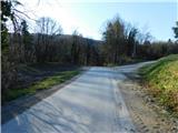 10
10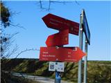 11
11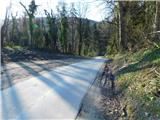 12
12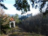 13
13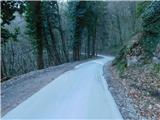 14
14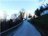 15
15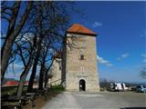 16
16
Discussion about the trip Gorjane (Železno) - Podsreda castle
To post a comment you must log in:
If you do not yet have a username, you must first
register.