Gorenji Novaki (Mrovlje) - Škofje
Starting point: Gorenji Novaki (Mrovlje) (740 m)
| Latitude/Longitude: | 46,1395°N 14,0431°E |
| |
Walking time: 1 h
Difficulty: easy unmarked way
Elevation gain: 233 m
Elevation difference along the route: 275 m
Map: Škofjeloško in Cerkljansko hribovje 1:50.000
Recommended equipment (summer):
Recommended equipment (winter): ice axe, crampons
Views: 755
 | 1 person like this post |
Access to starting point:
A) From Poljanska Valley we drive to Hotavlje, then we follow the signs for Cerkno ski resort. We follow the signs for Cerkno ski resort only to Kopačnica, where from the intersection, where the road continues to the right towards the ski resort and Leskovica, we continue straight on the road which continues along the Podplečica stream. At the Joškovec homestead, where there is the next confluence, we continue right, then on a partly macadam road we start to ascend more steeply. Higher up we leave the valley and the road brings us in two hairpin turns and after a shorter crossing to a double hayrack in front of the Mrovlje farm, where the described path begins. At the starting point there are no arranged parking spots.
B) We drive to Cerkno, then we continue driving in the direction of Cerkno ski resort. In Dolenji Novaki, where the road makes a left hairpin turn (the hairpin turn is located a few 100 m before the parish church of St. Tomaž), we continue right on the side road in the direction of Kopačnica. There follows driving on a narrower asphalt road, at intersections we continue straight or on asphalt. Higher up there follow still a few turns, then we arrive from the forest to individual houses at the Mrovlje farm in the settlement Gorenji Novaki. Here at the first intersection we continue slightly right, before the road starts to descend visibly we notice a hayrack on the right, by which the described path begins. At the starting point there are no arranged parking spots.
Route description:
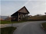
From the hayrack we head onto the macadam road which continues towards the southwest. We ascend on a panoramic grassy slope, from which a nice view opens up on the surrounding hills, after less than 10 minutes we arrive at the shrine and a few steps further to the Novine farm.
We continue between the hayrack and the house, at the junction we choose the slightly right cart track, from which we soon go left. There follows a light to moderate ascent through the belt or edge of the forest, when we reach the indistinct ridge where another cart track joins from the left, we continue right, initially along the ridge. At the nearby fork we choose the slightly left cart track and leave the ridge and continue crossing the slopes mostly towards the west. During the crossing, on a somewhat more grassy section a path branches off slightly to the left towards the nearby hamlet, we continue slightly right and continue the crossing. When the path has already brought us west of the hamlet, it turns more towards the south and continues through the forest. When we reach the side ridge of Škofje we continue right, and when higher up we reach a poorer road, we follow it to the right as well. A little further we step out of the forest and continue on the wider road or cart track. There follows crossing a panoramic grassy slope, we leave the road at the section where at the small hut (probably old haybarn) we continue slightly left onto pathless terrain. On pathless terrain we ascend in a few minutes to the panoramic northeastern ridge of Škofje, from where a nice view opens up in the direction of Porezen, and we continue left into the forest. In the forest a followable little path immediately appears, on which we continue to the nearby summit.
If from the summit we continue on the marked path, we descend in a few minutes to the viewpoint.
Description and pictures refer to the condition in 2019 (April).

Photos:
 1
1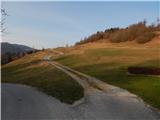 2
2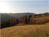 3
3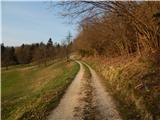 4
4 5
5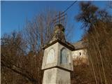 6
6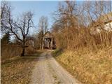 7
7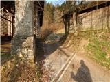 8
8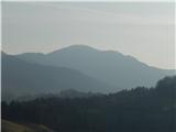 9
9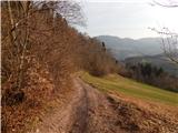 10
10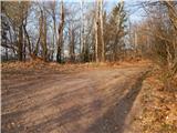 11
11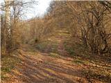 12
12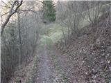 13
13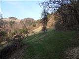 14
14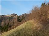 15
15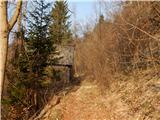 16
16 17
17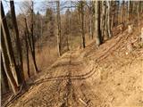 18
18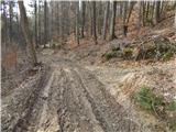 19
19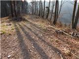 20
20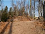 21
21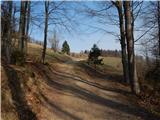 22
22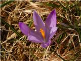 23
23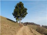 24
24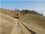 25
25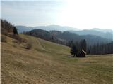 26
26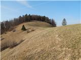 27
27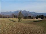 28
28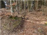 29
29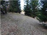 30
30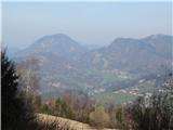 31
31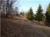 32
32 33
33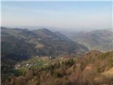 34
34
Discussion about the trip Gorenji Novaki (Mrovlje) - Škofje
To post a comment you must log in:
If you do not yet have a username, you must first
register.