Starting point: Golice (575 m)
| Latitude/Longitude: | 46,2194°N 14,7908°E |
| |
Walking time: 2 h 45 min
Difficulty: easy marked way
Elevation gain: 933 m
Elevation difference along the route: 950 m
Map: Posavsko hribovje - zahodni del 1:50.000
Recommended equipment (summer):
Recommended equipment (winter):
Views: 18.790
 | 1 person like this post |
Access to starting point:
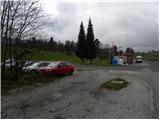
A) First, we drive to Kamnik, and then we continue driving on a regional road through Tuhinjska dolina. Only a little after the village Laze v Tuhinju, we will get to the gas station, by which a road branches off to the left towards the villages Golice, Češnjice v Tuhinju and Okrog pri Motniku. Here we turn left and then only a few meters ahead we park on an appropriate place by the bus stop.
B) From the highway Maribor - Ljubljana, we take the exit Vransko, and then we continue driving in the direction of Kamnik. Only a little after the mountain pass Kozjak (mountain pass between Gorenjska and Štajerska), we will get to the gas station, by which a road branches off to the right towards the villages Golice, Češnjice v Tuhinju and Okrog pri Motniku. Here we turn right and then only a few meters ahead we park on an appropriate place by the bus stop.
Route description:
From the crossroad next to the starting point, we head on the road in the direction of the village Golice, and the signposts for the mountain hut Dom na Menini planini also direct us there. The path first leads along an ascending asphalt road, then it brings us to the already mentioned village. Here, after the second house in the village, the blazes direct us right onto a somewhat steeper road, which ends after just a few meters behind the mentioned house. We continue on a marked cart track, which ascends alongside the yard, then we continue on a well-marked path that ascends over numerous pastures. Higher up, the path enters a belt of forest, and we follow it at all junctions by the signs for Menina planina (mostly they are just signposts without inscription). The path occasionally crosses a forest road, otherwise it mostly runs on cart tracks or tractor paths. After a while, the path brings us to the NOB monument, by which there is a trough with water, and here we continue sharply left on the still relatively well-marked path. Higher up, the path brings us to a somewhat wider forest road, which we just cross, and continue the ascent in the direction toward the Dom na Menini planini mountain hut (left Tuhinj, right Biba planina). Ahead, the path becomes somewhat harder to follow, but if we carefully follow the blazes, there are no major orientation problems. Higher, we reach the pasture areas of Menina planina, and we continue on a noticeably worse-marked path in the already familiar direction. A little further on, the path steeply ascends for a short time, then it almost completely levels out and leads us further over pleasant, partly grassy slopes. After a few minutes of further walking, we reach a marked junction, where the signs for Vivodnik direct us right onto a steep path, by which in two minutes we arrive at the summit, in the middle of which stands a smaller lookout tower.

Photos:
 1
1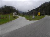 2
2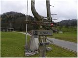 3
3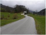 4
4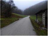 5
5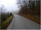 6
6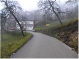 7
7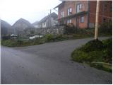 8
8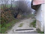 9
9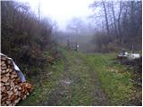 10
10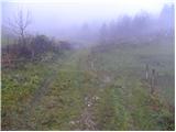 11
11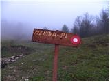 12
12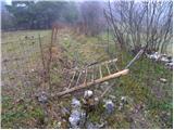 13
13 14
14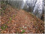 15
15 16
16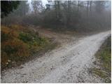 17
17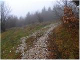 18
18 19
19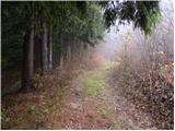 20
20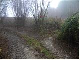 21
21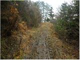 22
22 23
23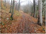 24
24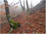 25
25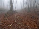 26
26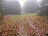 27
27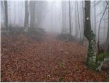 28
28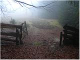 29
29 30
30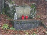 31
31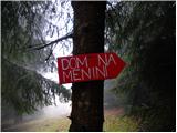 32
32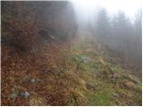 33
33 34
34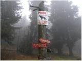 35
35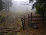 36
36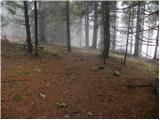 37
37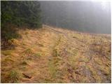 38
38 39
39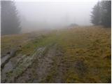 40
40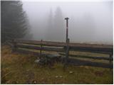 41
41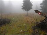 42
42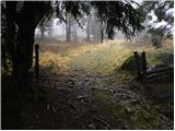 43
43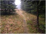 44
44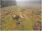 45
45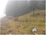 46
46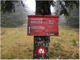 47
47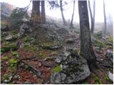 48
48 49
49
Discussion about the trip Golice - Vivodnik
|
| CarpeDiem2477. 09. 2011 |
I've gone this path 4 times already to Menina or Vivodnik, always drove quite a few km higher up (past the village, later forest road) along the path, saving at least an hour of walking. I recommend to others too, if the path hasn't deteriorated too much in the last two years since I haven't been there!
|
|
|
|
| pohodnik3830. 04. 2012 |
On Friday, April 27th, I did this trail and can say it's very nice, well marked, and beautiful views from the tower at the top. Spring is in full swing on the plateau as it's covered with carpets of crocuses.
Some photos at this link
|
|
|
|
| borutpovse4. 05. 2014 |
Hi. I'm interested, since there's probably no more snow, is the alpine pasture in blooming state? Thanks for info. Best regards
|
|
|
|
| otiv4. 05. 2014 |
You probably meant crocus, it has probably already wilted. 
|
|
|
|
| monika899512. 10. 2020 |
Trail hiked on 10.10.2020 on a clear sunny day without wind. It was wonderful. The trail is very steep in the first three quarters and mostly runs through the forest. Caution is advisable especially on the descent, as injuries can happen quickly on steep paths.
|
|
|
|
| roksraka17. 10. 2020 |
In my opinion, the trail is by no means "very steep" (it fully deserves the status of 'easy marked trail'), but it can still be quite slippery and muddy. It could be better marked at certain points. Today there was quite firm and walkable snow on top (ca. 20cm, without crampons), lower down it was already melting considerably, so it was really muddy in places.
|
|
|
|
| Jankolav25. 05. 2023 19:29:19 |
Today my partner and I went on the mentioned path. Disaster, how poorly marked the path is. The marks are either old and barely visible or not there at all. At junctions where you'd expect a mark, you have to go at least 200m on each path to find the way. There are signs, but you don't know where they point because they are not marked at all, only towards the top from the NOB monument it gets a bit better. I suggest that the path be tidied up a bit, as it is otherwise nice and worth visiting.
|
|
|
|
| jprim25. 05. 2023 21:14:53 |
I'm glad that someone else criticizes our hiking trails too.
LP!
|
|
|
|
| Trobec25. 05. 2023 21:20:52 |
Great that someone is happy about negativity...
Otherwise yes, disaster, what are these volunteers doing that they can't fix the trails. It's known that their free time is dedicated to maintaining trails, not enjoying them...right...
|
|
|
|
| frover26. 05. 2023 06:47:58 |
Sad Jankolav, that you jump so critically on trail maintenance. I too am sometimes disappointed, but I know that the markers try their best. I am aware that they do this in their free time. The only payment for them is our gratitude and understanding of the conditions in which they work. A good map and app on a smartphone help in finding the right trail. Otherwise, on the PZS website it says: Send an SMS with the keyword POT5 to 1919 and you will contribute 5 € for the renovation of hiking trails! Jankolav and jprim have the opportunity!!
|
|
|
|
| turbo26. 05. 2023 10:41:19 |
In one section like this:
"How some are happy when some criticism appears, they immediately join with nodding."
But here like this, the same person:
"I'm glad that someone else criticizes our hiking trails."

|
|
|
To post a comment you must log in:
If you do not yet have a username, you must first
register.