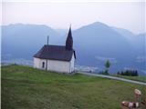
Starting point: Goldberg (1050 m)
| Latitude/Longitude: | 46,6748°N 13,0678°E |
| |
Walking time: 3 h 45 min
Difficulty: easy marked way
Elevation gain: 1184 m
Elevation difference along the route: 1184 m
Map:
Recommended equipment (summer):
Recommended equipment (winter): ice axe, crampons
Views: 3.377
 | 1 person like this post |
Access to starting point:
From Beljak/Villach we drive towards Hermagor and further towards Lienz, but only to the village of St. Daniel. In the mentioned village, we continue right (from Spittal, from Lienz left) in the direction of the smaller mountain settlement Goldberg. We follow the ascending road to a small parking lot near the church in Goldberg.
Route description:
From the church, we continue on the road in the direction of the mountain pasture Jaukenalm. The road ahead past a gate brings us into the forest, where it then continues. After a few minutes of gentle ascent by the road we notice signposts, which from the road point us onto a footpath. This path, which higher up quite a few times crosses a forest road, we follow all the way to the mountain pasture Jaukenalm. All shortcuts are well marked and with orientation to the mountain pasture there are no problems. To the mountain pasture we can also get by road, but this path is almost 1 hour longer.
From the mountain pasture, we continue left in the direction of the peak Jaukenstöckl. The path ahead leads us over an ample mountain pasture on at first poorly visible path in the direction of northwest. When we come to the other side of the mountain pasture the path is again better visible. Here the path turns a little to the left and then in a moderate diagonal ascent brings us to the western slopes, from which a wonderful view opens up on the highest peaks of the Carnic Alps, and a little later also on the Lienzer Dolomites. Further, the path slightly descends and brings us to a crossing, where we continue right upwards. The increasingly panoramic path over partly grassy slopes quickly brings us to a smaller saddle between Jaukenstöckl (left) and Jaukenhöhe (right). Here we continue right on an invisible but marked path, which over grassy slopes in 10 minutes brings us to the summit.
Orientation of the path in fog is difficult.

Photos:
 1
1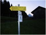 2
2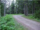 3
3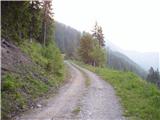 4
4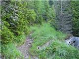 5
5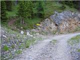 6
6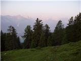 7
7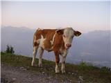 8
8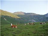 9
9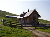 10
10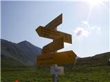 11
11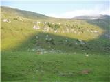 12
12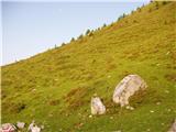 13
13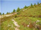 14
14 15
15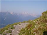 16
16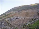 17
17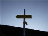 18
18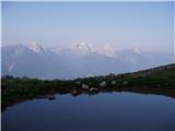 19
19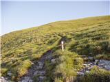 20
20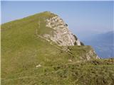 21
21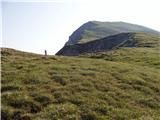 22
22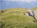 23
23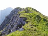 24
24 25
25
Discussion about the trip Goldberg - Jaukenhöhe
To post a comment you must log in:
If you do not yet have a username, you must first
register.