Gleichenberg Dorf - Gleichenberger Kogel
Starting point: Gleichenberg Dorf (292 m)
| Latitude/Longitude: | 46,88550°N 15,89790°E |
| |
Walking time: 50 min
Difficulty: easy marked way
Elevation gain: 306 m
Elevation difference along the route: 306 m
Map:
Recommended equipment (summer):
Recommended equipment (winter): ice axe, crampons
Views: 12
 | 1 person like this post |
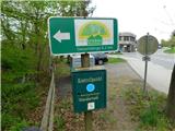
Access to starting point:
We drive to Gornja Radgono, from where we continue into Austria. Through Radgono / Bad Radkersburg we follow the signs for the motorway, then beyond the settlement of Halbenrain we turn right towards the town of Vrbna / Feldbach. When we reach the settlement of Bad Gleichenberg we continue following the signs for the town of Vrbna. In the settlement of Gleichenberg Dorf we drive past the company Kiefer technik to the Schweizerhof estate, where the described trail begins nearby. There are no designated parking spaces for hikers at the starting point, so we park elsewhere, which extends our route.
Route description:
From the main road we head east and immediately cross the Klausenbach stream. Behind it we turn right onto the hiking trail, which is initially asphalted and leads us near the stream to the nearby houses. At the junction by the houses we continue left, following the signs for Bergkreuz.
The trail leads us past a few more houses, then enters the forest, where it starts to climb more steeply. Due to storm damage and snow breakage there are some fallen trees over the path, where we make a short detour (condition April 2026), higher up the fallen trees have already been removed from the path.
Higher up the path widens into a cart track, which first leads us through a small valley. When we climb a bit higher, we reach a poor forest road, which we follow to the right to the nearby shelter, where there is also a control point.
Here is a marked junction, where we take the right path (straight ahead leads an unmarked steep shortcut, which is however well trodden). We continue on the cart track, which in a traverse climb in a semicircle ascends to the cross and ruins on the forested summit of Gleichenberger Kogel.
The description and photos refer to the condition of April 2026.

Photos:
 1
1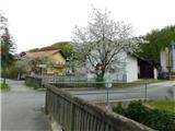 2
2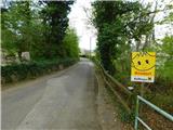 3
3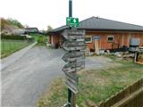 4
4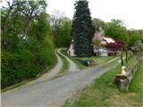 5
5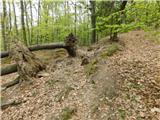 6
6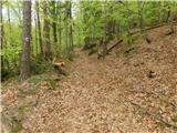 7
7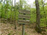 8
8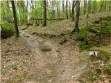 9
9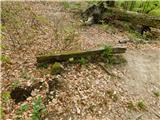 10
10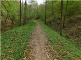 11
11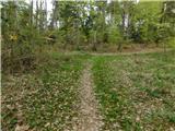 12
12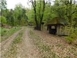 13
13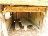 14
14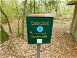 15
15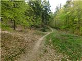 16
16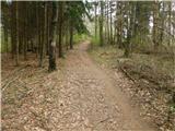 17
17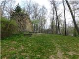 18
18 19
19
Discussion about the trip Gleichenberg Dorf - Gleichenberger Kogel
To post a comment you must log in:
If you do not yet have a username, you must first
register.