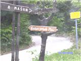
Starting point: Gašperjev hrib (1381 m)
| Latitude/Longitude: | 45,591°N 14,4749°E |
| |
Walking time: 1 h 30 min
Difficulty: easy marked way
Elevation gain: 415 m
Elevation difference along the route: 415 m
Map: Snežnik 1:50.000
Recommended equipment (summer):
Recommended equipment (winter): ice axe, crampons
Views: 18.321
 | 5 people like this post |
Access to starting point:
From Cerknica we drive towards Lož and further to the village Pudob, where we turn right in the direction of Snežnik and the village Kozarišče. At Snežnik Castle the asphalt ends, and we continue further on a macadam road and at the crossroads we stick to the direction of Mašun. After a long drive we get to Leskova Valley and a little further to a crossroad, where signs point to Gašperjev hrib and we have to turn left. Further we drive for some time, where an inscription on the rock warns us to turn right, and a few more minutes and we are at the starting point of the path over Gašperjev hrib. We park there.
Route description:
From the parking lot, we head left, where a steep ascent awaits us. After walking for some time we already spot Snežnik. The path leads us a little up a little down, when we get to a signpost and the last ascent from here less than half an hour and we are on the summit.
Photos:
 1
1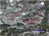 2
2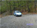 3
3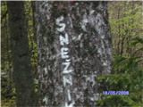 4
4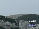 5
5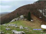 6
6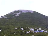 7
7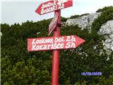 8
8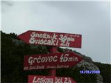 9
9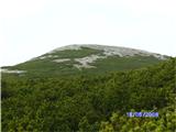 10
10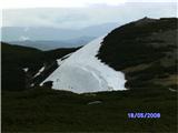 11
11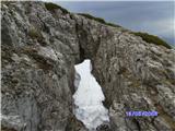 12
12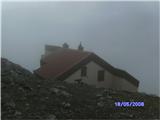 13
13 14
14 15
15 16
16 17
17
Discussion about the trip Gašperjev hrib - Snežnik
|
| LadoP25. 09. 2013 |
The three musketeers set off on foot from Kranj to Snežnik. It was unforgettable. Special thanks go to Janja and Slavko, who rightfully manage this beautiful mountain jewel. We'll return - I recommend (thanks), Lado, Sašo, Janez
|
|
|
To post a comment you must log in:
If you do not yet have a username, you must first
register.