Franz-Josefs-Hohe - Großglockner (via Pasterze Glacier and Hofmannskees)
Starting point: Franz-Josefs-Hohe (2369 m)
| Latitude/Longitude: | 47,07520°N 12,75160°E |
| |
Route name: via Pasterze Glacier and Hofmannskees
Walking time: 8 h
Difficulty: very difficult marked way
Elevation gain: 1429 m
Elevation difference along the route: 1650 m
Map:
Recommended equipment (summer): helmet, ice axe, crampons
Recommended equipment (winter): helmet, ice axe, crampons
Views: 77.828
 | 7 people like this post |
Access to starting point:
Through the Karawanks Tunnel, we drive past Spittal towards Lienz, but only to the place Molbrucke. Further, we follow the signs for the alpine road to Grossglockner. When we get to the mountain village Heiligenblut (holy blood) 1336 m high, we have only 17 more km of Grossglockner Hochalpenstrasse, the most famous alpine panoramic road. The toll for this road is 26 euros per car (except at night until 5 a.m.). The road is open from May to October or depending on snow conditions.
More information at: http://www.grossglockner.at/en/hochalpenstrasse
Route description:
We park in garages by the edge of the glacier Pastirica/Pasterze on the most beautiful vantage point Franz-Josefs-Höhe 2369 m high, from where we can see our path all the way to Kleine Grossglockner. If we come there at night or the day before, it is good to have a sleeping bag and armaflex with us, because it is possible to sleep somehow in the garages. On the glacier Pastirica/Pasterze runs the rack railway Grossglockner Gletscherbahn since 1963. From the altitude of 2356 m it runs along a 212 m long track 144 m lower to the edge of the glacier.
Our ascent starts directly from the garages through one of five tunnels towards the hut Hofmannhütte 2444 m high. The tunnels were built because the old path-road was swept away by a landslide in several places and the path was closed for several years. The path through the tunnels is really fun. It reminds one of Gardaland. When we are through the last tunnel, we soon spot the hut Hofmannhütte to the left, past which our path runs. The hut is in bad condition and therefore has been closed and occupied by marmots for many years. Past the hut, we descend approximately 200 m lower to the glacier Pastirica/Pasterze. We cross the glacier at right angles to the slope down which we descended onto it. During the crossing, it is necessary to watch for crevasses in the glacier, as they can be quite wide and of unknown depth. The glacier is up to 160 m thick. In case of fog, orientation on the glacier is very difficult. If on the other side we do not see colored markings on the rocks or marked poles, we go first a little downward, because during the crossing we usually go a little to the right. If after 100 meters there are no markings, we repeat this upward and we will certainly find the markings. The path then ascends steeply along the ridge all the way to the spot named Fruhstuchsplatz, where we turn from the ridge a few steps left downward. Here starts a long ascent across the glacier Hofmannskees all the way to the hut Erzherzog-Johann-Hütte (Adlersruhe - eagle's rest) at 3454 m. The lower part of the path goes left, the upper one upward and right to the hut. To the right we can go: 1. on the glacier below the intermediate rocky ridge. Caution is needed due to crevasses; 2. we continue on the glacier upward all the way to the edge on the upper ridge, where the path from the hut Salmhütte on the south side joins ours. We continue right on the glacier. Soon we have to cross the rocky intermediate ridge. Then the paths join and the hut is already within reach. Orientation on the glacier Hofmannskees in good weather is easy, in fog very difficult or impossible.
From the hut Erzherzog-Johann-Hütte (the hut is open from May to the end of September) we continue on the snowfield immediately behind the hut. On the steep snowfield we ascend to Sattele (saddle) 3680 m high, where the snowfield ends. Further in the summer months there is usually not much snow, so this part of the ascent is more on rock than on snow. First, we ascend on the steep exposed ridge to Kleine Grossglockner 3783 m high and descend over it a little lower to the very narrow notch Glockner-scharte. There is space for passage only for one person, so longer delays occur several times at this spot. There follows only approximately 50 m of steep ascent over Steile Platten to the summit of Grossglockner. For the conquered summit we are rewarded with a view of the French and Swiss Alps, Italian Dolomites, Julian Alps and High Tauern.
Fixed protections over Kleine Grossglockner and to the summit are steel rods and pitons with rings, so with the right equipment there are no problems with belaying. We also need equipment for walking roped up. The ascent requires considerable mountaineering knowledge and experience. If we lack these, it is wisest to conquer the summit with a guide or experienced alpinist.
We descend along the ascent route. When we descend to the glacier Pastirica/Pasterze, we can go directly down the glacier to the lower station of the rack railway, take it to the garages or climb back on foot.

Along the route: Koča Hofmannshütte (2444m), Koča Erzherzog-Johann-Hutte (3454m), Kleine Grossglockner (3783m)
Photos:
 1
1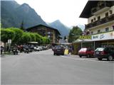 2
2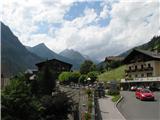 3
3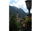 4
4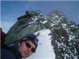 5
5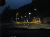 6
6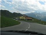 7
7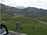 8
8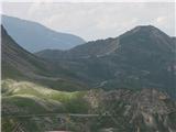 9
9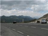 10
10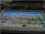 11
11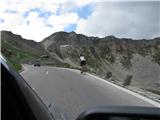 12
12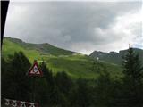 13
13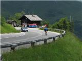 14
14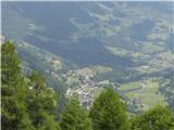 15
15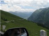 16
16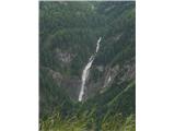 17
17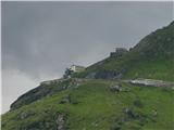 18
18 19
19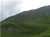 20
20 21
21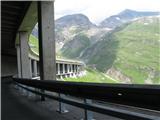 22
22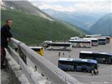 23
23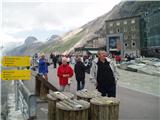 24
24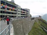 25
25 26
26 27
27 28
28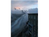 29
29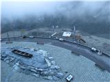 30
30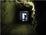 31
31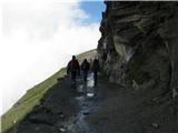 32
32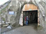 33
33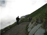 34
34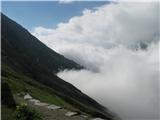 35
35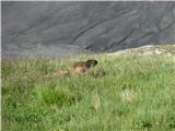 36
36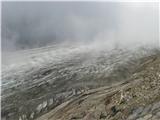 37
37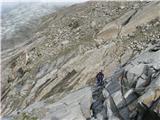 38
38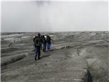 39
39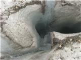 40
40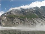 41
41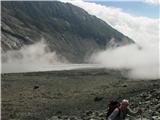 42
42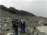 43
43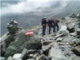 44
44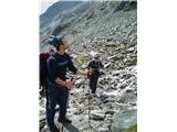 45
45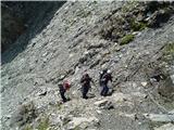 46
46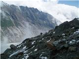 47
47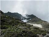 48
48 49
49 50
50 51
51 52
52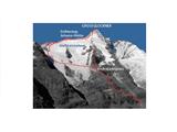 53
53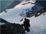 54
54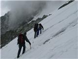 55
55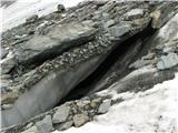 56
56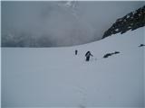 57
57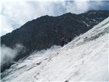 58
58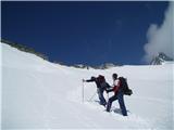 59
59 60
60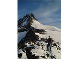 61
61 62
62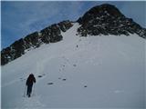 63
63 64
64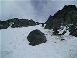 65
65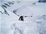 66
66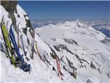 67
67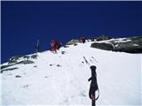 68
68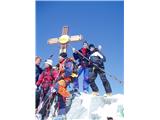 69
69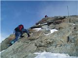 70
70 71
71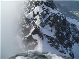 72
72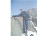 73
73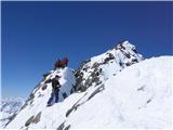 74
74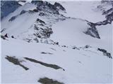 75
75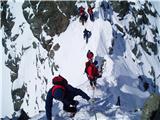 76
76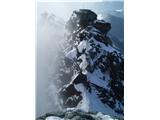 77
77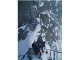 78
78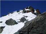 79
79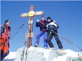 80
80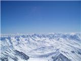 81
81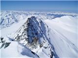 82
82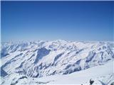 83
83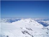 84
84 85
85 86
86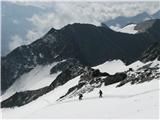 87
87 88
88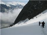 89
89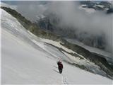 90
90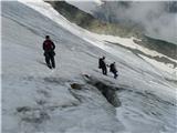 91
91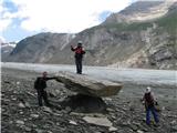 92
92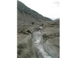 93
93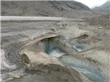 94
94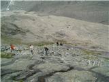 95
95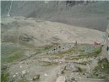 96
96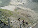 97
97
Discussion about the trip Franz-Josefs-Hohe - Großglockner (via Pasterze Glacier and Hofmannskees)
|
| Johny7726. 09. 2009 |
Hi, saw these pics, very interesting. Did you have to hire their guide?
|
|
|
|
| andrej jerina27. 09. 2009 |
Congratulations, guys! Best regards Andrej
|
|
|
|
| izigov27. 09. 2009 |
Congratulations from the Carinthian end.
|
|
|
|
| JTrogar27. 09. 2009 |
In Austria hiring a high-mountain guide is not yet mandatory, but that can change overnight. Best regards, Janez.
|
|
|
|
| Gornik110. 01. 2010 |
A few photos from the trip.
|
|
|
|
| planinc28. 06. 2010 |
I would like to ask something myself. Which month did you choose for the ascent? Thanks
|
|
|
|
| JTrogar14. 06. 2010 |
Those photos with little snow are from end of June, with lots of snow from early April.
Best regards, Janez.
|
|
|
|
| šerpa8. 07. 2010 |
In both posts about Großglockner you write Mali Klek "Kleine Großglockner". In German this small peak is Kleinglockner (3,770 m). Probably a typing error, correct it if you want. Otherwise I was at the summit for the first time yesterday - unforgettable.
|
|
|
|
| petruša12. 09. 2011 |
Hello, I know many have already been here. Since we've heard from many people that it's very nice here with beautiful views, we've decided on a day trip. We wouldn't go to Großglockner but only to that hotel or whatever it is. We're interested in approximately how long the drive is here, we're from Styria, and how much the road toll is, to see roughly how much it costs us. And whether this access is worth writing about, so we don't get lost somewhere in Austria. Thanks in advance and best regards.
|
|
|
|
| facko12. 09. 2011 |
If you like "crowds" and the view of GG from the SE direction, then the Glocknerstrasse road with the viewpoint platform is it. But if you want a trip + short hike, I recommend the route from the south - from Kals to Lucknerhaus and then (on foot) to Stüdlhütte (about 2 hours up and 1.5 hours down).
For route planning use ViaMichelin, which tells you most realistically where, how and for how much ... for the final destination enter the address: Glor-Berg 16
A-9981 Kals am Großglockner
If you need more info, ask 
|
|
|
|
| Enka12. 09. 2011 |
Petruša, in my opinion this is quite a lot of driving for one day. From Ljubljana it's about 3h drive there, from Styria surely a bit more. So 6-7h driving, not counting the drive on the alpine road itself. We combined the visit with a (whole-day) trip to Salzburg - we returned via the alpine road past GG.
Otherwise, the road and its points are something exceptionally beautiful and I warmly recommend a visit. Perhaps stay overnight in Heiligenblut (plenty of options, as it's a ski resort in winter and such capacities are plentiful) and treat yourselves to an ascent to one of the huts under GG .
|
|
|
|
| Okmodko12. 09. 2011 |
Isn't it sad that such an obviously Slovenian word is written as pesterze? Why doesn't it say under the route name, across the Pastirica glacier? Are we Slovenes so stupid that we can't pronounce Slovenian words? Aufwiedersehen teptschki!
|
|
|
|
| facko12. 09. 2011 |
@Okmodko: in German nouns are written with a capital letter 
@Enka: it's not a little driving for one day but a nice autumn day in those areas you remember for a long time On the alpine road however - if I'm not mistaken - only a light hiking walk to Hoffmans-Hütte or with a "little trick" onto the glacier 
|
|
|
|
| Okmodko12. 09. 2011 |
I apologize because I don't know German as well as you know Slovenian. I wish you a nice trip and enjoy when you drive through free Kärnten via Klagenfurt or Villach to Gross Glockner. Let us know in Laibach or Marburg how you had it.
|
|
|
|
| atoamac12. 09. 2011 |
@Okmodko, just trolling or something else?
|
|
|
|
| Okmodko12. 09. 2011 |
Well I don't know why we speak Slovenian at all, if nobody cares. Come on, let's change all Slovenian place names in Slovenia to English names, so foreigners can understand easier. Damn looks at Slovenia and Slovenian language. What is that at all? Synonym for pig grunting!
|
|
|
|
| facko13. 09. 2011 |
@Enka: distances and timetable as shown by ÖAMTC Routenplaner ...
1.
Maribor/DVORANA TABOR - Labot - Celovec - Beljak - Špital ob Dravi - Möllbrücke - Lienz - Kals pod Velikim Klekom 306.3 km 4:44 h:min
2.
Maribor/DVORANA TABOR - Labot - Celovec - Beljak - Špital ob Dravi - Möllbrücke - Heiligenblut  288.0 km 4:33 h:min 288.0 km 4:33 h:min
Nice autumn days beckon
|
|
|
|
| Enka13. 09. 2011 |
Facko, for me it's too much driving for one day, although I agree it's worth it because the road and everything along it is fantastic. Well, I also want to ski in Heligenblut sometime, but I don't feel like driving there for a one-day ski trip. But sure, to each his own, for those who don't mind the drive - highly recommend the trip.
|
|
|
|
| visokogorc26. 07. 2013 |
is the big klek really tough
|
|
|
|
| Janez Seliškar26. 07. 2013 |
Veliki Klek is as difficult as the lesser abilities of the one who wants to climb it.
Otherwise, mountain as mountain. In the middle of glaciers with all their beauties and dangers.
|
|
|
|
| mirni9. 06. 2014 |
I'm wondering if anyone knows how much snow is left on the path to Veliki Klek?
Thanks and best regards
|
|
|
|
| mirni9. 06. 2014 |
I'm also wondering if anyone plans to go to Veliki Klek within one month
|
|
|
|
| Branee9. 06. 2014 |
I think it's bare ground now!
|
|
|
|
| viharnik9. 06. 2014 |
You'll still be trudging to Študlc, from Franz-Josefs-Hohe there is eternal snow and ice anyway. Take a look at the TK map of Johannisberg, so you'll better understand what you're getting into. Crevasses are also opening and widening now. Three-thousanders aren't just like Šmarna gora after all.
|
|
|
|
| rusmi27. 06. 2014 |
has anyone been up there in the last week?
|
|
|
|
| mukica24. 07. 2014 |
Katja from PD Murska Sobota...
|
|
|
|
| Janez Seliškar24. 07. 2014 |
Quite a few in the last about 14 days, but all from Kals.
|
|
|
|
| petruša19. 08. 2014 |
Hello, I'm interested in how much the toll is....
|
|
|
|
| KANA19. 08. 2014 |
for car 34€, for motorbike 24€
|
|
|
|
| Marko8331. 08. 2014 |
I'm curious, how much walking is it to Erzherzog-Johann-Hütte? And are there safety ropes in the notch there? pictures 76,77,78
|
|
|
|
| mukica31. 08. 2014 |
If there are few hikers it's from 1h to 1.30h, but usually there's a crowd. No safety gear.
|
|
|
|
| JTrogar31. 08. 2014 |
To Adlerce is about 6h(+-1h), depending on conditions and fitness. Definitely not 1-1.5h as mukica wrote. That's the time from Adlerce to the top.
Over Malega there are quite a few ladders, from it to the notch there's a rope (pic.77), from it to Velikega again some ladders so the securing itself is fairly easy.
Best, Janez
|
|
|
|
| lovrodro20. 08. 2022 15:36:16 |
We were up there this July, glaciers already had quite large crevasses, ice melting so much that on some sections you almost need swimwear  . .
|
|
|
To post a comment you must log in:
If you do not yet have a username, you must first
register.