Forni di Sopra - Rifugio Som Picol
Starting point: Forni di Sopra (1060 m)
| Latitude/Longitude: | 46,4323°N 12,5702°E |
| |
Walking time: 1 h 15 min
Difficulty: easy marked way
Elevation gain: 406 m
Elevation difference along the route: 406 m
Map: Tabacco 02, 1:25.000
Recommended equipment (summer):
Recommended equipment (winter): ice axe, crampons
Views: 3.115
 | 1 person like this post |
Access to starting point:
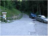
From Kranjska Gora over the border crossing Rateče to Trbiž / Tarvisio (to here also possible over the border crossing Predel) and further on the highway towards Udine. We leave the highway at the settlement Tolmezzo, from where we continue driving towards the settlement Ampezzo and further towards the Alpine pass Passo della Mauria (1298 m). Still before the mentioned pass we arrive at the settlement Forni di Sopra, where approximately 100 m before the lower station of the four-seater chairlift we turn right onto a narrow and, higher up, quite steep road. Along the mentioned road we drive above the settlement, and there at a smaller intersection we park at an appropriate place (the road continues towards the ski area Forni di Sopra and is closed to public traffic by a traffic sign). From Kranjska Gora to the starting point it is approximately 122 km.
Route description:
From the starting point we head onto a steep macadam road in the direction of the mountain hut Som Picol. The fairly steep road (gradient up to 30%) first leads us through the forest, then brings us to the chairlift that goes to the hut Som Picol. Here the road turns slightly to the right and flattens a little. Higher up beautiful views open up on the surrounding mountains, and the path brings us below the steep cliffs of the peak Clap Varmost (1751 m). Here our path, which continues along the road that then follows a ski slope, turns left and brings us to a trough with water. From here we continue for a few more minutes and the path brings us to the mountain hut Rifugio Som Picol, which is located at the upper station of the four-seater chairlift that leads from the settlement Forni di Sopra to the hut Som Picol.
Photos:
 1
1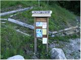 2
2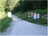 3
3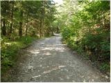 4
4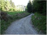 5
5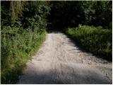 6
6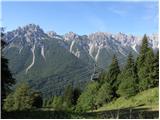 7
7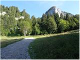 8
8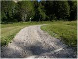 9
9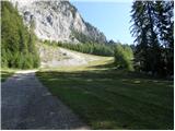 10
10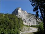 11
11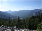 12
12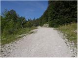 13
13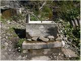 14
14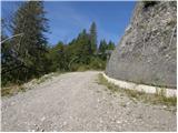 15
15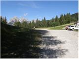 16
16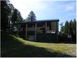 17
17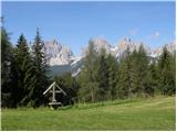 18
18
Discussion about the trip Forni di Sopra - Rifugio Som Picol
To post a comment you must log in:
If you do not yet have a username, you must first
register.