Starting point: Ernejčkov graben (485 m)
| Latitude/Longitude: | 46,0641°N 14,2513°E |
| |
Walking time: 2 h
Difficulty: easy marked way
Elevation gain: 449 m
Elevation difference along the route: 550 m
Map: Škofjeloško in Cerkljansko hribovje 1:50.000
Recommended equipment (summer):
Recommended equipment (winter):
Views: 18.796
 | 2 people like this post |
Access to starting point:
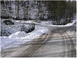
First, we drive to Polhov Gradec (to here from Dobrova or Horjul), and then we continue driving towards Črni vrh. At the hamlet Zalog (which we recognize by the large meadow) we leave the road which runs towards Črni vrh and we continue left in the direction of Setnik and Srednji vrh (we leave the mentioned road only a few meters before it crosses a smaller wooden bridge). From the mentioned road soon a road towards Setnik branches off to the left, and we continue straight on the lower road by which we soon notice mountain signposts for Srednji vrh and Pasja ravan. We park a little further on a parking lot near the smaller crossroads.
Route description:
From the parking lot, we first walk to the signposts, which direct us onto a steep road on which in a few steps we ascend to the house, which the marked path bypasses on the right side. Behind the house, we notice a cart track which ascends diagonally a little towards the left and then goes into the forest.
A partly overgrown path ahead ascends past a lonely farm and a little higher brings us to the forest road which we follow to the right, but only a few steps, because then the blazes direct us left onto a footpath. The footpath soon brings us out of the forest, where it turns a little towards the left and only a little further brings us onto a grassy cart track, which we follow to the village Srednji vrh following poorly visible blazes. When we step on the road in the village, we only cross it and continue straight past houses to the chapel behind the house (this part of the path is poorly marked). At the chapel, from where a nice view opens up towards Črni vrh and the church of Saint Lenart, the marked path turns sharply to the left and then in a gentle ascent continues on a cart track which higher brings us into the forest. In the forest the blazes from the cart track direct us to the right onto a footpath which gradually starts ascending steeper. Occasionally poorly visible, but relatively well-marked path then flattens and brings us past the ruins to a somewhat wider cart track which we then follow to a macadam road.
On the mentioned road, we ascend to the farm Rus; here the marked path turns sharply to the left and continues on a gentle cart track which higher changes into a macadam road which for a short time steeply descends. The road ahead leads past a few houses and then continues through panoramic grassy hay meadows. We follow this road for quite some time, and then signs for Sivka direct us to the right and then immediately left onto a footpath (well-marked), where we will notice the sign PPP (Polhograjska planinska pot).
We continue the gentle ascent for some time through the forest, then the path brings us out of the forest, where in front of us we notice some houses. The path behind the houses brings us to the chapel behind which there is a well-marked junction. We continue on the footpath in the direction of Sivka (right Pasja ravan, left Planina nad Horjulom), and it brings us to the panoramic summit in a few minutes with increasingly beautiful views.

Along the route: Srednji vrh (650m)
Photos:
 1
1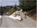 2
2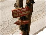 3
3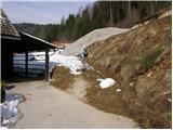 4
4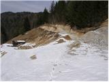 5
5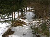 6
6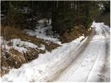 7
7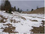 8
8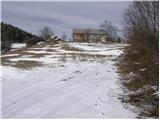 9
9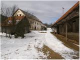 10
10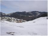 11
11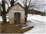 12
12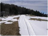 13
13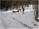 14
14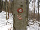 15
15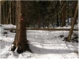 16
16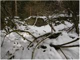 17
17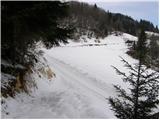 18
18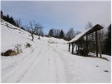 19
19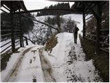 20
20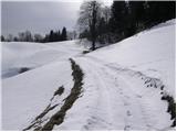 21
21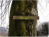 22
22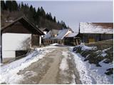 23
23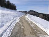 24
24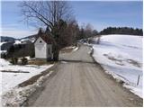 25
25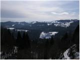 26
26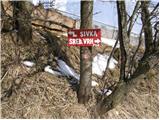 27
27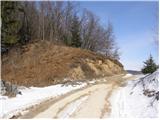 28
28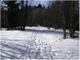 29
29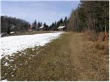 30
30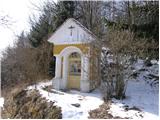 31
31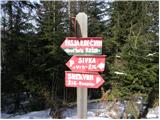 32
32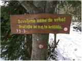 33
33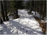 34
34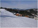 35
35 36
36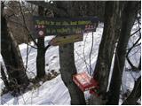 37
37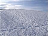 38
38 39
39
Discussion about the trip Ernejčkov graben - Sivka
|
| Tadej21. 02. 2009 |
Sivka is for me the most beautiful viewpoint in Polhograjsko hribovje. Panorama
|
|
|
|
| viharnik21. 02. 2009 |
I have cycled to Sivka, besides Pasja ravn, also with MTB. Indeed the view from the top has no major obstacles, only the summit itself is a bit remote. Very nice view also from Treh Kraljev-Butajnova-Smrečje (MTB-Ljubljana), but the peak already belongs to the Notranjska summits.
|
|
|
|
| podplat8. 03. 2009 |
Today my wife and I went to the apparently less visited Sivka from Ernejčkov graben. The path is steeper at the start, then turns into a nice walking path to the top. Very nice views along the path, the best at the summit where you can see far around. Today it was warm and windless, so we enjoyed it. Attaching some photos, regards Borut
|
|
|
|
| Lisica20. 03. 2011 |
The trail is from Jernejčkov graben and not Ernejčkov. It's a nice trip, but a considerable part is on gravel roads. It has very little traffic, the views are great. I will surely come back to these areas, they are really beautiful.
|
|
|
To post a comment you must log in:
If you do not yet have a username, you must first
register.