Starting point: Duga Resa (185 m)
| Latitude/Longitude: | 45,44853°N 15,50982°E |
| |
Walking time: 30 min
Difficulty: easy marked way
Elevation gain: 136 m
Elevation difference along the route: 136 m
Map:
Recommended equipment (summer):
Recommended equipment (winter):
Views: 297
 | 1 person like this post |
Access to starting point:
We drive to Karlovec / Karlovac and continue towards Duga Resa. When we arrive in Duga Resa, at the intersection behind the NKL store we turn left. The road leads us through an underpass under the railway to a roundabout, where we turn right. We drive to the church of St. Anthony of Padua, which we see on the right. There we turn left and drive over the bridge over the Mrežnica river. We continue straight towards Vinica, we can park here by the road or continue further along the ascending road which curves, and when the asphalt ends there is space by the road for a few cars where we park.
Route description:
From the starting point we proceed straight along the road which leads us through a sparse forest then past a small fenced field into dense forest. Along the road are stations of the way of the cross. The road becomes steeper and narrower. It makes a bend in between and then we have a short walk along a level road and soon on the left we spot the Mladen Polović mountain hut from which we get some views towards Karlovac.
From the hut we continue straight into the forest. The road turns into a cart track and in 2 minutes we reach a junction where we continue slightly right. Left Mala Švarča. In three minutes walking along a gentle path we are at Vinica.
Description and photos refer to the condition in October 2025.
Photos:
 1
1 2
2 3
3 4
4 5
5 6
6 7
7 8
8 9
9 10
10 11
11 12
12 13
13 14
14 15
15 16
16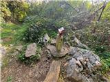 17
17
Discussion about the trip Duga Resa - Vinica
|
| bos28. 12. 2025 19:00:09 |
You describe the HPO points nicely, how many points left to the end of HPO?
|
|
|
|
| rokeg28. 12. 2025 20:18:47 |
Thanks for the praise.
Still 41 points left. Probably another two years.
Still missing all of Slavonia, quite a bit of Biokovo, southern part of Dinaric Alps, part of Međimurje, half of South Velebit, and another 7 points in other groups.
|
|
|
To post a comment you must log in:
If you do not yet have a username, you must first
register.