Starting point: Dovje (760 m)
| Latitude/Longitude: | 46,4688°N 13,9602°E |
| |
Walking time: 1 h 5 min
Difficulty: easy marked way
Elevation gain: 365 m
Elevation difference along the route: 365 m
Map: Kranjska Gora 1:30.000
Recommended equipment (summer):
Recommended equipment (winter): ice axe, crampons
Views: 1.610
 | 2 people like this post |
Access to starting point:
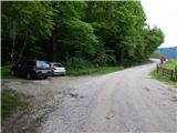
A) We leave the Gorenjska motorway at the Jesenice west exit (Hrušica), and then continue driving towards Kranjska Gora. On the main road towards Kranjska Gora we drive to the first turn-off to the road towards Dovje, through the settlement we follow the signs for Dovška Baba. After crossing the Mlinca stream, where there is a small hydropower plant (MHE), we park at a suitable place by the road, where there are also mountaineering signposts.
B) First we drive to Kranjska Gora, then continue driving towards Jesenice. We leave the main road towards Jesenice when the signs for Dovje direct us left, through the settlement we follow the signs for Dovška Baba. After crossing the Mlinca stream, where there is a small hydropower plant (MHE), we park at a suitable place by the road, where there are also mountaineering signposts.
Route description:
From the starting point we continue left in the direction of Dovška Baba, where we first cross the stream and then ascend through the forest. We quickly reach the cart track, which leads us along the edge of the hay meadow; through a strip of forest we arrive at a newer holiday cottage. Behind the holiday cottage we go left, where we ascend over a shorter grassy slope, from which a nice view of the Julian Alps opens up when looking back; after that the path steeply ascends through the forest. Higher up we cross an older fence, behind which we step onto the mountain pasture Goreljše, where the path first turns left upwards, then right and ascends with wonderful views to a newer, still unfinished cottage, which is located on the upper edge of the mentioned mountain pasture.
Description and pictures refer to the condition in May 2020.
Photos:
 1
1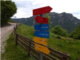 2
2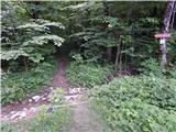 3
3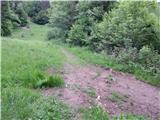 4
4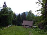 5
5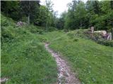 6
6 7
7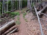 8
8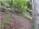 9
9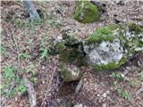 10
10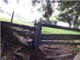 11
11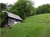 12
12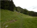 13
13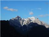 14
14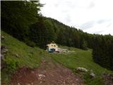 15
15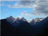 16
16
Discussion about the trip Dovje - Planina Goreljše
To post a comment you must log in:
If you do not yet have a username, you must first
register.