Dovje - Erjavčev rovt (Planina Mlinca) (footpath)
Starting point: Dovje (755 m)
| Latitude/Longitude: | 46,4682°N 13,957°E |
| |
Route name: footpath
Walking time: 1 h
Difficulty: easy marked way
Elevation gain: 350 m
Elevation difference along the route: 375 m
Map: Kranjska Gora 1:30.000
Recommended equipment (summer):
Recommended equipment (winter): crampons
Views: 3.806
 | 1 person like this post |
Access to starting point:
A) We leave the Gorenjska motorway at the Jesenice - west (Hrušica) exit, then continue driving towards Kranjska Gora. Soon we will arrive at a junction, where signs for Dovje direct us right onto the road along which we arrive in the village Dovje, where from the left also join the road from the monument to Jakob Aljaž and the nearby parish church. At the mentioned junction, we continue right and drive past a few more houses. Above the village, the road becomes macadam and brings us to a junction, where left continues the road towards Kepa, right towards Dovška Baba. We park at an appropriate place by the junction, or also lower or higher along the road. A designated parking lot is located by the monument to Jakob Aljaž in Dovje or at the church in Dovje. If we park at the monument or church, the path extends by 10 to 15 minutes.
B) First, we drive to Kranjska Gora, then continue driving towards Jesenice. Behind the settlement Belca, we arrive at the hamlet Na Belah (part of Dovje), where we leave the main road and continue driving towards the nearby church. From the church, we continue driving through the village and follow the signs for Dovška Baba. Above the village, the road becomes macadam and brings us to a junction, where left continues the road towards Kepa, right towards Dovška Baba. We park at an appropriate place by the junction, or also lower or higher along the road. A designated parking lot is located by the monument to Jakob Aljaž in Dovje or at the church in Dovje. If we park at the monument or church, the path extends by 10 to 15 minutes.
Route description:
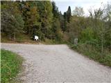
From the junction we continue on the left road in the direction of Kepa (right Dovška Baba), which continues moderately ascending. After a few minutes a walking path from Dovje joins from the left, we continue slightly right and ascend further on a panoramic road, from which a nice view opens onto Mojstrana and the peaks of the Julian Alps. We continue on the road, which mainly enters the forest, through which it ascends in a few hairpin turns. Higher a marked footpath branches off from the road; the start of the footpath is not specially marked, and the blazes appear only a bit further.
When we catch the footpath branch-off we continue on the forest path, which leads us past a pleasant bench with a nice view. A few minutes above the bench we step back onto the road and follow it to the nearby junction, beside which there is a small parking lot and signs for Dovška Baba and Kepa.
At the mentioned junction we continue right (left Planica, Borovje...) and ascend lightly for a few more minutes; then, when the road goes above the bed of the Mlinca stream, it levels out and gradually begins to descend. During the descent the path leads us past a pleasant spring, then we arrive at the confluence of Žakelj and Mlinca.
We continue along the left stream Žakelj, along which there also runs a marked path towards Dovška Baba and Kepa. The marked path soon leaves the riverbed and turns sharply right, ascending transversely across a fairly steep slope. When the marked path from the slope goes onto a sort of ridge and turns sharply left, we continue only slightly left onto a cart track, along which in one or two minutes of further walking we arrive at Erjavčev rovt, in the middle of which stands a wooden hut.
Description and pictures refer to the condition in 2014 (October).

Photos:
 1
1 2
2 3
3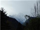 4
4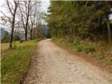 5
5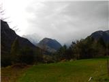 6
6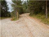 7
7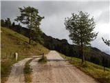 8
8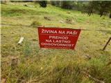 9
9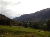 10
10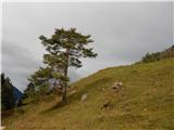 11
11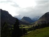 12
12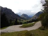 13
13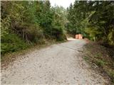 14
14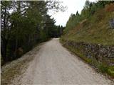 15
15 16
16 17
17 18
18 19
19 20
20 21
21 22
22 23
23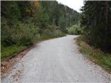 24
24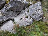 25
25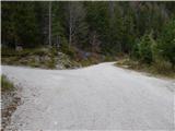 26
26 27
27 28
28 29
29 30
30 31
31 32
32 33
33 34
34 35
35 36
36 37
37 38
38 39
39 40
40 41
41 42
42 43
43
Discussion about the trip Dovje - Erjavčev rovt (Planina Mlinca) (footpath)
To post a comment you must log in:
If you do not yet have a username, you must first
register.