Dovje - Blažčeva skala (western path)
Starting point: Dovje (760 m)
| Latitude/Longitude: | 46,4688°N 13,9602°E |
| |
Route name: western path
Walking time: 1 h
Difficulty: easy unmarked way
Elevation gain: 331 m
Elevation difference along the route: 335 m
Map: Kranjska Gora 1:30.000
Recommended equipment (summer):
Recommended equipment (winter): ice axe, crampons
Views: 3.600
 | 2 people like this post |
Access to starting point:
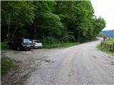
A) We leave the Gorenjska motorway at the Jesenice west exit (Hrušica), and then continue driving in the direction of Kranjska Gora. On the main road towards Kranjska Gora we drive to the first turn-off of the road towards Dovje, through the settlement we follow the signs for Dovška Baba. After crossing the Mlinca stream, where there is a small hydropower plant (MHE), we park at a suitable place by the road, where there are also hiking signposts.
B) First, we drive to Kranjska Gora, and then continue driving towards Jesenice. We leave the main road towards Jesenice when the signs for Dovje direct us to the left, through the settlement we follow the signs for Dovška Baba. After crossing the Mlinca stream, where there is a small hydropower plant (MHE), we park at a suitable place by the road, where there are also hiking signposts.
Route description:
From the starting point, we continue on the macadam road in the direction of Jesenice (left marked path to Dovška Baba). On the road, we first ascend transversely, during the ascent occasionally a nice view opens up on the Julian Alps. Higher, the road first turns sharply left and then right. At the right bend, we leave it and continue straight on a cart track which ascends transversely towards the left, before we reach a small saddle we go from it right onto a beaten footpath, which then bypasses a small, partly wooden house on the left side. The path continues through the forest, where we pass a feeding site for wild animals, after crossing a stream we go slightly left. Further on, the path temporarily flattens, then we ascend through an indistinct little valley to a small saddle, where there is a junction of unmarked footpaths.
To the left along the ridge continues a path which higher brings us to the road leading to the mountain pasture Dovška Rožca, straight down we descend along the eastern path to the road, to the right continues the path leading to Blažčeva skala.
We continue right and quickly ascend to the registration box, bench and cross on Blažčeva skala.
Description and pictures refer to the condition in May 2020.

Photos:
 1
1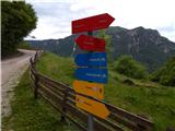 2
2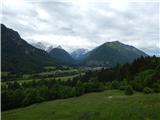 3
3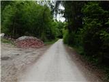 4
4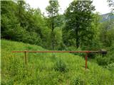 5
5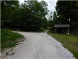 6
6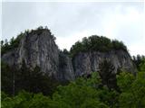 7
7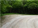 8
8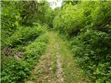 9
9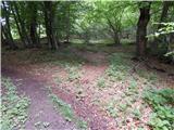 10
10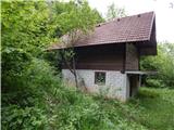 11
11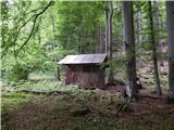 12
12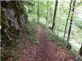 13
13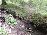 14
14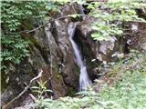 15
15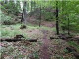 16
16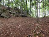 17
17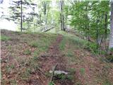 18
18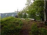 19
19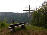 20
20 21
21
Discussion about the trip Dovje - Blažčeva skala (western path)
|
| tango4. 02. 2022 14:53:42 |
Today we jumped onto Bvažčova skala, that's how the signs on the "eastern" path are. From the road leading to the parking lot which is the starting point for Dovška baba (not the one by the small HE) but the final one, we turned left in the part where there are three weekend houses and the "way of the cross". Easy access, at the top one, two, three, views really beautiful. For a better view of the Julians you need to descend a bit from the top (NW direction), in the direction from which the western path comes.
|
|
|
|
| Majdag25. 05. 2023 15:13:43 |
Bvaščeva skala, circular path.... We started with my sister at the bend, picture 8. We descended on the other side at the way of the cross. Then along the road back to the car. Easier, at least for me, is the approach to the rock from the bend. The feeling at the top of the rock is wonderful and the views are beautiful. The path is steep on both sides. On the descent there was still a lot of leaves and a few meters of muddy trail.
https://jelenkamenmajdag.blogspot.com/2023/05/bvasceva-skala.html
|
|
|
|
| grega_p20. 03. 2025 16:38:43 |
After the junction in picture 14, the path (currently) almost disappears or tempts higher up to the next pass. That's where I went too and then down the ridge to the correct pass.
During the descent, I noticed quite a few fallen beeches and that leaves cover the "turn-off" to the right across the stream just before picture no. 16. Orientation is not that difficult, but I still moved the leaves a bit there and set up poles for the correct direction of travel.
|
|
|
To post a comment you must log in:
If you do not yet have a username, you must first
register.