Dom v Lepeni - Velika Montura
Starting point: Dom v Lepeni (700 m)
| Latitude/Longitude: | 46,3037°N 13,6814°E |
| |
Walking time: 3 h 55 min
Difficulty: easy unmarked way
Elevation gain: 1258 m
Elevation difference along the route: 1275 m
Map: Julijske Alpe - zahodni del 1:50.000
Recommended equipment (summer): helmet
Recommended equipment (winter): helmet, ice axe, crampons
Views: 5.040
 | 2 people like this post |
Access to starting point:
Between Trenta and Bovec, in the village of Soča, a road branches off to Lepena. We follow this fully asphalted road to the parking lot at the Dom dr. Klementa Juga mountain hut in Lepena.
Route description:
From the Dom dr. Klementa Juga mountain hut in Lepena we head onto the path in the direction of the Dom pri Krnskih jezerih mountain hut, Gomiščkovo zavetišče na Krnu and Dom na Komni. Already right from the parking lot the path enters the forest, through which it ascends along a wide mule track. Along the mule track we mostly ascend moderately (the steep variant of the ascent in the lower part has not been in use for some time) through the forest, only occasionally opening up some views towards the valley and surrounding mountains. During the ascent we also cross the track of the cargo cableway several times, whose crossing is forbidden during the cableway's operation. After a good hour and a half of walking the path flattens and shortly afterwards brings us to the upper station of the cargo cableway.
From here the path leads along the edge of a smaller valley, quickly bringing us to the spot where every year in April they measure the height of the snow cover. A short descent follows, then we arrive at a marked junction, where we leave the wide path leading towards the Dom pri Krnskih jezerih mountain hut and Krnsko jezero lake, and continue slightly left on the path in the direction of Velika Baba.
From the junction we continue for a short time without major changes in elevation, but when the path from the Dom pri Krnskih jezerih mountain hut joins from the right, we continue left and begin to ascend first gently, then moderately. When the forest ends a little further on, a nice view opens up onto the walls from Kaluder to Velika Baba. For a few minutes we still ascend relatively gently along the foot of already overgrown screes, then the path turns right and begins to ascend somewhat more steeply, crossing the slopes to the right in the process. During this traversing ascent, which in places is also exposed to falling rocks, increasingly beautiful views open up onto Veliki Šmohor, Krn, Lemež, Debeljak, higher also Kanin, below us we see Dupeljsko jezero lake and the Dom pri Krnskih jezerih mountain hut... Higher the path climbs over a small scree below Zelena škrbina notch, then gradually we arrive in the valley between Velika Baba on the left and Velika Montura on the right. After a few minutes of ascent up the mentioned valley we arrive at a junction, where the marked path to Velika Baba turns left, while we continue straight along an unmarked track that proceeds along the right side of the valley. When the slopes on the right become somewhat less steep, we notice that we are walking along an old mule track, which in the lower part is already quite destroyed, higher up still nicely traceable. For a few more minutes we ascend along the edge of the valley, then together with the mule track we turn right (along the edge of the small valley a track continues, by which it is possible to reach Bogatinsko sedlo saddle). Continuing, we ascend along the mule track, which is mostly quite traceable, and here and there a cairn is also placed. Higher up the mule track splits into two parts, and we choose the right one (straight ahead there is another path by which we can reach Bogatinsko sedlo saddle, and even from the mentioned path we can then ascend to Velika Montura via pathless terrain). A few minutes of ascent mostly to the right follow, then we reach an indistinct ridge, where the mule track first turns left, then from it onto the somewhat steeper western slopes. When the slope flattens, on the left we notice old Italian fortifications from the time of the Rapallo border, and we pass by three collapsing buildings and ascend to the nearby panoramic summit of Velika Montura.
The description and pictures refer to the condition in 2017 (July).

Photos:
 1
1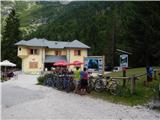 2
2 3
3 4
4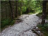 5
5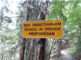 6
6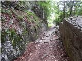 7
7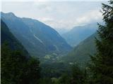 8
8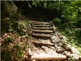 9
9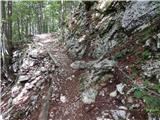 10
10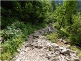 11
11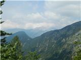 12
12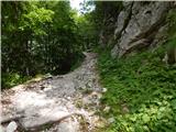 13
13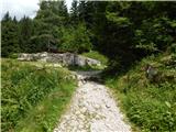 14
14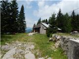 15
15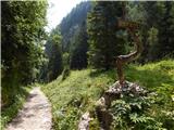 16
16 17
17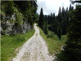 18
18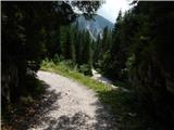 19
19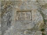 20
20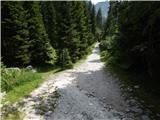 21
21 22
22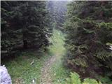 23
23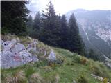 24
24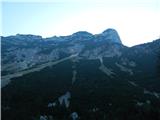 25
25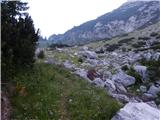 26
26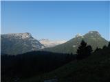 27
27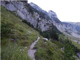 28
28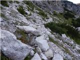 29
29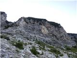 30
30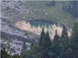 31
31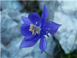 32
32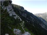 33
33 34
34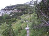 35
35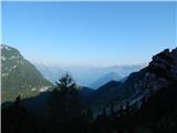 36
36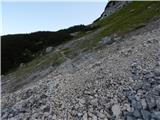 37
37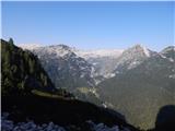 38
38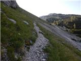 39
39 40
40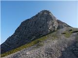 41
41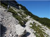 42
42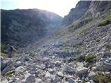 43
43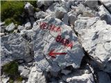 44
44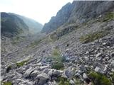 45
45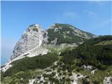 46
46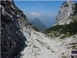 47
47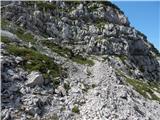 48
48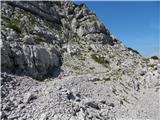 49
49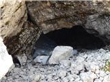 50
50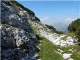 51
51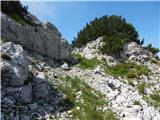 52
52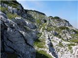 53
53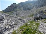 54
54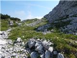 55
55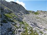 56
56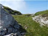 57
57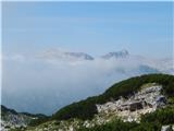 58
58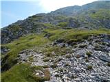 59
59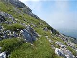 60
60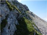 61
61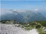 62
62 63
63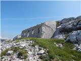 64
64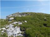 65
65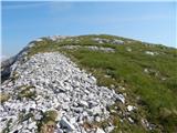 66
66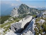 67
67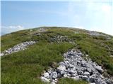 68
68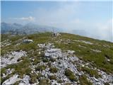 69
69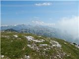 70
70
Discussion about the trip Dom v Lepeni - Velika Montura
|
| darinka414. 09. 2019 |
Yesterday we hiked the tour from Lepena to V. Montura. With a view of old Italian karavle from the time of the Rapallo border. After so many years the walls are preserved, although slowly deteriorating. We descended the old path past the remains of buildings near Lepoče, which the Italians built between the two wars for guarding the Rapallo border.
|
|
|
|
| glorija20. 06. 2025 17:03:16 |
Wonderful tour with the previous summit V. babe conquered. Below the wall over scree nice view of Dupeljsko jezero, higher on Krnsko jezero and Koča pri Krnskem jezeru. Magnificent views from the summit to Kaninsko pogorje, Julijce, Bohinjce.. with many alpine flowers on the summit itself and other flowers along the path. Set up cairns to make it easier for others. Interesting karavle unfortunately damaged by time. Descent from Babe to Montura moderate walking ca. 1.30h. Enjoy and all the best!
|
|
|
To post a comment you must log in:
If you do not yet have a username, you must first
register.