Dom v Lepeni - Mali Šmohor
Starting point: Dom v Lepeni (700 m)
| Latitude/Longitude: | 46,3037°N 13,6814°E |
| |
Walking time: 4 h
Difficulty: easy marked way
Elevation gain: 1239 m
Elevation difference along the route: 1239 m
Map: Julijske Alpe - zahodni del 1:50.000
Recommended equipment (summer): helmet
Recommended equipment (winter): helmet, ice axe, crampons
Views: 9.833
 | 1 person like this post |
Access to starting point:
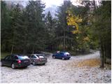
Between Trenta and Bovec, at the village of Soča, a road to Lepena branches off. We follow this fully asphalted road to the parking lot at the Dom v Lepeni mountain hut.
Route description:
From the Dr. Klement Jug House in Lepena we continue on a wide marked path in the direction of the Krn Lakes. The wide and not too steep path splits into two parts after a few minutes of walking. The left one, which is somewhat steeper, is the usual way; the right one, gentler and somewhat longer, is suitable for small children and the elderly. Both paths mostly ascend through the forest to the upper station of the cableway and cross each other several times along the way. From the upper station of the cargo cableway we continue on the same path, which gently ascends along the wide transport road that quickly brings us to the snow height measurement (every year in April). From here the road starts to descend and takes us past the turn-off to Velika Baba quickly to the next junction, where we leave the road and continue left downhill on the footpath that brings us to the Dom pri Krnskih jezerih mountain hut in a few minutes (if we continue on the road, we bypass the mountain hut).
From the mountain hut we continue straight in the direction of Krn and Krn Lake on a gentle path to which the path bypassing the mountain hut soon joins. We continue past the shepherd's hut, behind which we reach the next junction, where we continue left in the direction of Komna and Mali Šmohor (right to Krn). The wide and gentle path then directs us right in the direction of Mali Šmohor after a few minutes of gentle ascent (straight to Bogatinsko sedlo and Komna).
Further we first continue across a small meadow, after which the path leads us into the dwarf pines. After a short ascent through the dwarf pines the path brings us to the old partly overgrown military mule track, along which we then ascend over increasingly less vegetated slopes. The pleasant and little-visited path, along which we can observe numerous remains of the Soča Front, brings us in a moderate ascent below the steep walls of Mali Šmohor. Here, due to the danger of falling rocks, it is recommended to put on a helmet. Further we ascend transversely across the scree, at the end of which the path turns left onto the grassy slopes. Along the path we then again notice numerous war remains (trenches, shovels and other iron, which is neatly stacked). The path then ascends to the summit ridge, where it turns right and brings us to the summit after a short ascent.
Lepena - Dom pri Krnskih jezerih 2:00, Dom pri Krnskih jezerih - Mali Šmohor 2:00.

Photos:
 1
1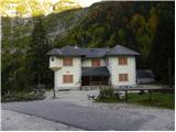 2
2 3
3 4
4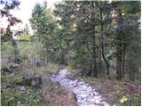 5
5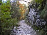 6
6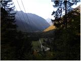 7
7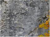 8
8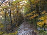 9
9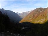 10
10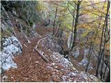 11
11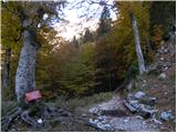 12
12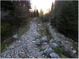 13
13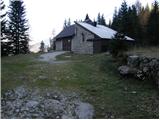 14
14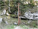 15
15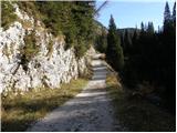 16
16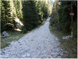 17
17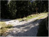 18
18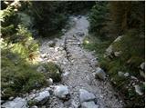 19
19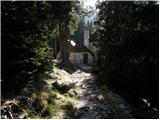 20
20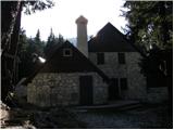 21
21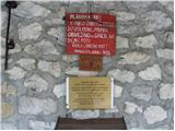 22
22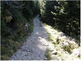 23
23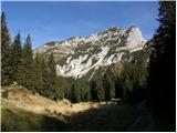 24
24 25
25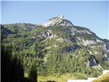 26
26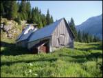 27
27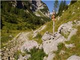 28
28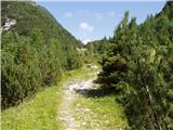 29
29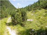 30
30 31
31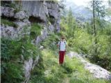 32
32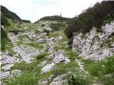 33
33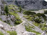 34
34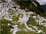 35
35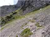 36
36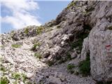 37
37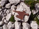 38
38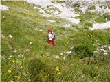 39
39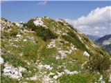 40
40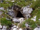 41
41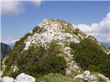 42
42 43
43
Discussion about the trip Dom v Lepeni - Mali Šmohor
|
| darh13. 08. 2012 |
Yesterday we ascended Mali Šmohor via this path. In contrast to the crowd on Krn, we were completely alone here. Too bad only for the fogs that lingered over the peaks and deprived us of better views. More details about our path and impressions here.
|
|
|
|
| darinka431. 01. 2021 |
Interesting path, which is not marked but still visible if you go further from the lake in the direction towards Krn. If you find the start of the path then the once military path is visible all the way to the top.
|
|
|
|
| mirank31. 01. 2021 |
Darinka, that "if" is superfluous; that mule track starts in the SE corner of the plain at Polje, 50-100m left (north) of the clearly visible pronounced gully that descends from the saddle between Šmohorji and Vel. peski. It leads along this slightly overgrown track to the mentioned saddle, from where it's not far anymore to the ruins of It barracks.
|
|
|
|
| darinka431. 01. 2021 |
But you have to find the cairn. Which is placed by the path, where the old military path begins.
|
|
|
|
| BorStenar28. 11. 2022 21:47:40 |
Is there a stamp at the top?
|
|
|
|
| franca28. 11. 2022 22:06:00 |
Yes; the stamp says Šmohor and 1944 m
|
|
|
|
| BorStenar29. 11. 2022 17:41:37 |
That's enough for one stamp.
Thanks
|
|
|
|
| franca29. 11. 2022 20:57:12 |
I wrote this because there's confusion with names and elevations; this is Veliki Šmohor on the map, 1939 m high; south of it is Mali Šmohor, 1944 m. The stamp is obviously combined data, common name and height of the higher one 
|
|
|
|
| BorStenar1. 12. 2022 20:20:30 |
So Mali Šmohor is cartographically the big one, which doesn't have a stamp
|
|
|
To post a comment you must log in:
If you do not yet have a username, you must first
register.