Dom v Dragi - Čisovec (via Luknja)
Starting point: Dom v Dragi (689 m)
| Latitude/Longitude: | 46,39500°N 14,21830°E |
| |
Route name: via Luknja
Walking time: 2 h
Difficulty: partly demanding marked way, easy unmarked way
Elevation gain: 730 m
Elevation difference along the route: 740 m
Map: Karavanke - osrednji del 1:50.000
Recommended equipment (summer): helmet
Recommended equipment (winter): helmet, ice axe, crampons
Views: 2.460
 | 2 people like this post |
Access to starting point:
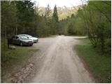
From the Ljubljana-Jesenice motorway, take the Radovljica exit (from the Gorenjska side, Lesce exit) and follow the road ahead towards Begunje. At the end of Begunje village, turn left towards Dom v Dragi (right to Tržič). The asphalt road then takes us to the parking lot near Dom v Dragi. We park a little further ahead, as parking in front of Dom v Dragi is allowed only for guests.
Route description:
From the parking lot we continue along the road, which past a bee house brings us to a junction in a few minutes of walking, where we continue right towards the Preval mountain pasture over Luknja (left Planinca mountain pasture, Poljška mountain pasture and Roblekov dom). The path ahead crosses the stream and then gently ascends along the valley bottom for some time.
Further on the valley narrows, and the path brings us in a moderate ascent to a narrow gully, up which we ascend steeply with the aid of fixed protection.
The short secured section is technically not particularly demanding, but it is exposed to falling rocks.
Higher up the path takes us out of the gully, where it then continues along the stream for some time. This is followed by an ascent up a short ladder (undemanding), after which the path enters the forest and continues to a poorer road.
We follow the mentioned road for only a few steps, after which the markers direct us right onto a marked footpath that continues on and beside the cart track. Higher up the cart track finally turns into a footpath, which heads somewhat more to the right and begins to ascend ever more steeply. We follow this relatively steep path in its final part all the way to the Preval-e mountain pasture, which we reach after a few minutes of further walking. Upon reaching the mountain pasture, only a short walk to the Pastirska koča remains.
We bypass the hut, from which a beautiful view opens up reaching all the way to Triglav, on the left side, while we continue the path towards Dobrča. The marked path towards Dobrča, which we follow, further bypasses an unnamed peak on the left side, and when the path returns to the ridge, we reach it at the saddle between Čisovec and the unnamed peak.
At the mentioned saddle the marked path towards Dobrča turns right downhill, while we continue along a poorer track that follows the ridge (one track also leads left from the ridge). Along the ridge we ascend steeply several times, and the poorer track due to fallen trees disappears completely several times, but there are no orientation problems since we stick to the ridge the whole time. When the forest thins out we quickly reach the panoramic summit of Čisovec.
Dom v Dragi - Preval-a 1:30, Preval-a - Čisovec 30 minutes.

Photos:
 1
1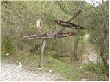 2
2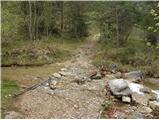 3
3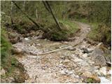 4
4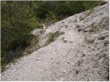 5
5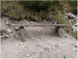 6
6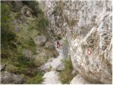 7
7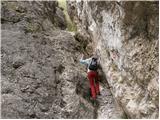 8
8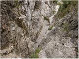 9
9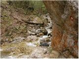 10
10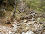 11
11 12
12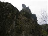 13
13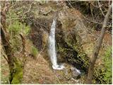 14
14 15
15 16
16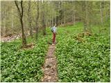 17
17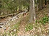 18
18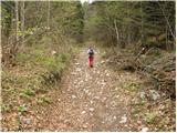 19
19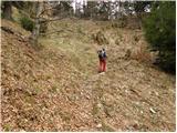 20
20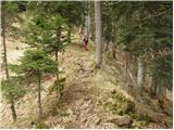 21
21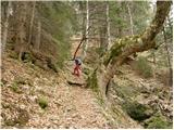 22
22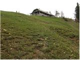 23
23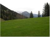 24
24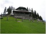 25
25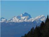 26
26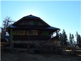 27
27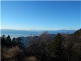 28
28 29
29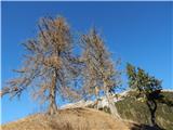 30
30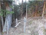 31
31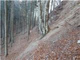 32
32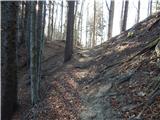 33
33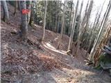 34
34 35
35 36
36 37
37 38
38 39
39 40
40 41
41 42
42 43
43
Discussion about the trip Dom v Dragi - Čisovec (via Luknja)
|
| grega_p13. 10. 2024 19:08:20 |
The summit is starting to overgrow a bit (spruces), but it will still offer a nice view towards Košuta for a few more years.
If you want to make a circular route and descend to the marked path to Dobrča, continuing along the ridge you'll face a slightly more difficult (steep, slippery) descent to the right downward. The unmarked junction from this path to Draga is at the point of the pass Vrh Luž, where the path from Podljubelj comes from the left. We turn right downward and through a path (sometimes a bit harder to follow, but not a difficult descent) after about 40 min descend to the gravel road, which later joins the asphalt a little below the Dom v Dragi.
Good luck to all!
|
|
|
To post a comment you must log in:
If you do not yet have a username, you must first
register.