Dom Trilobit - Weinasch/Vajnež (via Rida)
Starting point: Dom Trilobit (939 m)
| Latitude/Longitude: | 46,4579°N 14,1031°E |
| |
Route name: via Rida
Walking time: 4 h
Difficulty: easy unmarked way
Elevation gain: 1165 m
Elevation difference along the route: 1200 m
Map: Karavanke - osrednji del 1:50.000
Recommended equipment (summer):
Recommended equipment (winter): ice axe, crampons
Views: 17.680
 | 3 people like this post |
Access to starting point:
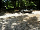
From the Ljubljana–Jesenice highway, take the Lipce exit and follow the road ahead towards Jesenice. When we reach the traffic-light intersection where we join the old road, continue right towards Žirovnica. Follow this road only briefly, as at the next somewhat larger intersection (traffic lights) we continue left towards Javorniški Rovt. The road then goes through the underpass (railway) and then turns left (right Koroška Bela). Follow the road, which higher up starts to ascend steeply, towards Javorniški Rovt, but only to the intersection where, in a sharp left bend, the road branches off to the right (straight ahead) towards the Dom Trilobit mountain hut and the Javornik spring (prohibited for buses). A little further, the road brings us to the mentioned mountain hut and the accumulation lake at HE Javornik. We park on the informal parking lot behind the lake and the Dom Trilobit mountain hut (parking in front of the mountain hut is not allowed).
Route description:
From the parking lot, we head onto the cart track in the direction of the natural and mining learning trail. The cart track immediately starts to ascend quite steeply on the left side of the stream, which we hear nearby. Soon the path brings us to a wooden pole on which the signpost for mountain pasture Seča directs us slightly left (right to the Javornik spring and mountain pasture Stamare). The cart track then brings us near the stream, along which we ascend to the spring (one of the springs of the Javornik stream). After the spring, the cart track turns into a footpath that ascends quite steeply in places through mostly quite overgrown forest. The path then approaches a wall and turns left in front of it. A less steep ascent follows to a bench that is not in the best condition. The path continues ascending through increasingly sparse forest, so that nice views of the surroundings occasionally open up. A little further on, we will notice on the right side a kind of amphitheater named Rida (right leads an unmarked and quite overgrown path towards Belščica). Our path turns left and after a short not-too-steep ascent we reach the signposts at the beginning of mountain pasture Seča.
Here we continue right in the direction of Stol and Vajnež (left Struška and Golica) along the path that continues gently ascending over partly grassy and dwarf pine slopes. A short descent follows and the path brings us to the screes that surround the cirque Rida. Next, in a gentle traversing ascent, we cross landslide slopes (in the central part there is danger of falling rocks on a short section) and on the other side of Rida we ascend one level higher. Ahead the steepness eases and the increasingly panoramic path brings us past the summit of the almost unnoticeable Kamnitnik (1 minute). The path ahead in a gentle ascent crosses the slopes towards the east and a little further crosses a somewhat more pronounced gully.
Still gentle and increasingly panoramic, the path then brings us after a while to a marked junction where an unmarked path branches off left upward to Vajnež (straight ahead Stol and Potoški Stol). Here we continue left upward in the direction of Vajnež and continue the ascent along a barely visible track that after a short ascent brings us to the edge of the main Karawanks ridge. We then follow this path, which gradually turns into easier pathless terrain, to the panoramic summit.
Dom Trilobit - Seča 2:00, Seča - Vajnež 2:00.

Photos:
 1
1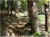 2
2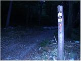 3
3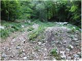 4
4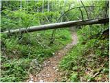 5
5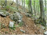 6
6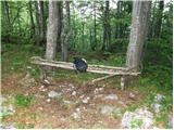 7
7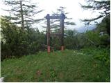 8
8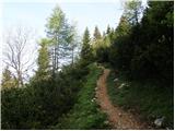 9
9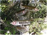 10
10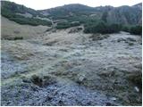 11
11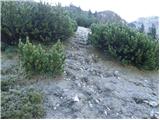 12
12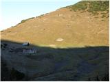 13
13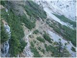 14
14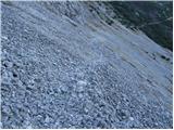 15
15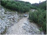 16
16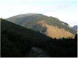 17
17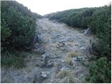 18
18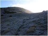 19
19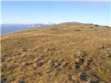 20
20 21
21 22
22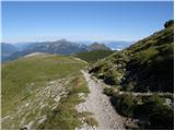 23
23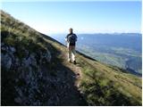 24
24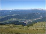 25
25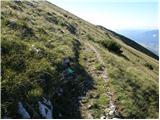 26
26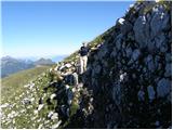 27
27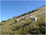 28
28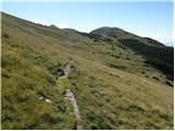 29
29 30
30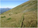 31
31 32
32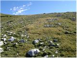 33
33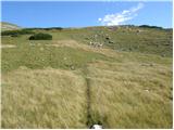 34
34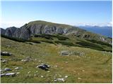 35
35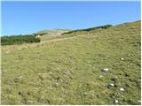 36
36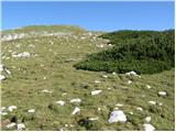 37
37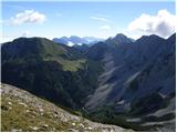 38
38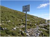 39
39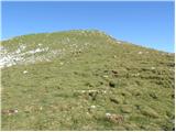 40
40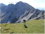 41
41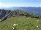 42
42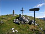 43
43 44
44
Discussion about the trip Dom Trilobit - Weinasch/Vajnež (via Rida)
|
| Micky28. 06. 2010 |
Yesterday we visited Vajnež. Gorgeous day, bit of "breeze" at top but sun still nicely tanned me. Definitely spent a gorgeous day, total 6 hours hiking. Recommended.
|
|
|
|
| Čebela7. 10. 2010 |
I'm just wondering what it means that it's unmarked and if there's still no problem finding it if you have just a little sense of orientation. We're seriously considering going to this Vajnež, but I wouldn't want to be responsible for the loss of four people.
|
|
|
|
| heinz8. 10. 2010 |
Čebela, believe me, you won't lose any person up there, because it's a marked path that leads from the same starting point to Stol, only the last meters of the path to Vajnež, mentioned in the last paragraph above, are not marked, that's why the path is treated as unmarked. Otherwise, from there, if you're already that far, you can continue to Stol (you won't regret it) and then back the same way. Read also the description of the path to Stol (through Medji dol)! Vajnež is basically, like Mali vrh and Potoški Stol, just an intermediate station..
|
|
|
|
| Čebela8. 10. 2010 |
Thanks for such a quick reply and for the additional suggestion. I'll pass it on to the team.
Have a nice weekend also to all who read this, I wish.
|
|
|
|
| darh18. 08. 2012 |
On Tuesday we ascended to Vajnež along the path described here. On our side we enjoyed the sun and beautiful views, while the Austrian side was shrouded in fog the whole time. We were alone for most of the path, only on the return did we meet some Austrian and Czech hikers. More about our impressions here.
|
|
|
|
| Majdag18. 08. 2012 |
...Let me add this - the path is cleared, fallen trees have been sawn, scree trimmed all the way to Kamnitnik, and there are lots of new markings...
|
|
|
|
| zajko12. 06. 2017 |
Yesterday via the described path to Vajnež, circular via Planina Stamare back. Nice sunny day and very nice views. Among plenty of flowers already some
edelweiss.
|
|
|
To post a comment you must log in:
If you do not yet have a username, you must first
register.