Dom Trilobit - Planina Seča
Starting point: Dom Trilobit (939 m)
| Latitude/Longitude: | 46,4579°N 14,1031°E |
| |
Walking time: 2 h
Difficulty: easy marked way
Elevation gain: 759 m
Elevation difference along the route: 741 m
Map: Karavanke - osrednji del 1:50.000
Recommended equipment (summer):
Recommended equipment (winter): ice axe, crampons
Views: 11.948
 | 2 people like this post |
Access to starting point:
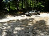
From the Ljubljana-Jesenice highway, take the Lipce exit and follow the road ahead in the direction of Jesenice. When we come to the traffic-light crossroads, where we join the old road, we continue right in the direction of Žirovnica. We follow this road only a short time, because at the next slightly larger crossroads (traffic lights) we continue left in the direction of Javorniški Rovt. The road then goes through the underpass (railway) and then turns left (right Koroška Bela). We follow the road that higher starts ascending steeply in the direction of Javorniški Rovt, but only to the crossroads, where in a sharp left turn the road branches off to the right (straight) towards the Dom Trilobit mountain hut and the Javornik source (prohibited for buses). A little further, the road brings us to the mentioned mountain hut and accumulation lake at the Javornik hydropower plant. We park on the unarranged parking lot, which is situated behind the lake and Dom Trilobit mountain hut (parking in front of the mountain hut isn't allowed).
Route description:
From the parking lot, we head onto the cart track in the direction of the natural science and mining educational trail. The cart track immediately starts to ascend quite steeply on the left side of the stream that we hear nearby. Soon the path brings us to a wooden post on which the signpost for Planina Seča directs us slightly to the left (right to the Javornik source and Planina Stamare). The cart track then brings us near the stream along which we ascend to the source (one of the sources of the Javornik stream). After the source, the cart track turns into a footpath that ascends quite steeply in places, mostly through quite overgrown forest. The path then approaches a wall and turns left in front of it. There follows a less steep ascent to a bench, which is not in the best condition. The path ahead ascends through increasingly sparse forest so that we occasionally get nice views of the surroundings. A little further on, we will notice on the right side a kind of amphitheatre named Rida (right leads an unmarked and quite overgrown path towards Belščica). Our path turns left and after a short not-steep ascent we reach the signposts at the start of Planina Seča. We head left towards Golica and in a few minutes reach the shepherd's hut on Planina Seča.

Photos:
 1
1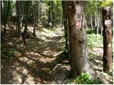 2
2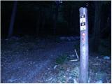 3
3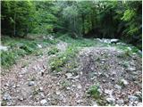 4
4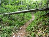 5
5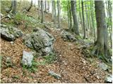 6
6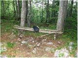 7
7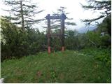 8
8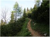 9
9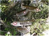 10
10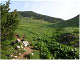 11
11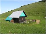 12
12
Discussion about the trip Dom Trilobit - Planina Seča
|
| heinz21. 10. 2008 |
Under: "The trip can be extended to the following destinations", I would add - Stol, Vajnež, Bivak na Belščiici, planina Stamare, Potoška planina, Hrašenska, Valvazor.
|
|
|
|
| misace25. 02. 2018 |
Yesterday, full postholing (average knee  ) in heavy snow below, powdery above. ) in heavy snow below, powdery above.
Some wind and drifts in the upper part, fog and clouds. Quiet.
|
|
|
|
| Jusk1. 05. 2020 |
Today all clear of snow, just some snow patches here and there near Seča. But it was windy and foggy, from Medji dol to Seča and on to Belska planina no views, just fog. Extended the path to Suha, back past Križovec on the road. Area around Pristava blanketed with narcissus
|
|
|
To post a comment you must log in:
If you do not yet have a username, you must first
register.