Dom Trilobit - Barentaler Kotschna/Struška
Starting point: Dom Trilobit (939 m)
| Latitude/Longitude: | 46,4579°N 14,1031°E |
| |
Walking time: 3 h
Difficulty: easy marked way
Elevation gain: 1005 m
Elevation difference along the route: 1050 m
Map: Karavanke - osrednji del 1:50.000
Recommended equipment (summer):
Recommended equipment (winter): ice axe, crampons
Views: 34.049
 | 2 people like this post |
Access to starting point:
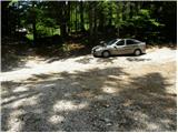
From the Ljubljana - Jesenice highway, we take the Lipce exit and follow the road ahead in the direction of Jesenice. When we come to the traffic-light intersection, where we join the old road, we continue right in the direction of Žirovnica. We follow this road only a short time, because at the next somewhat larger intersection (traffic lights) we continue left in the direction of Javorniški Rovt. The road then goes through the underpass (railway) and then turns left (right Koroška Bela). We follow the road, which higher up starts ascending steeply, in the direction of Javorniški Rovt, but only to the intersection, where in a sharp left turn to the right (straight ahead) the road branches off towards the mountain hut Dom Trilobit and the source of Javornik (prohibited for buses). A little further, the road brings us to the mentioned mountain hut and accumulation lake at hydropower plant Javornik. We park on the informal parking lot, which is situated behind the lake and mountain hut Dom Trilobit (parking in front of the mountain hut isn't allowed).
Route description:
From the parking lot, we head onto the cart track in the direction of the natural and mining learning trail. The cart track immediately starts to ascend quite steeply on the left side of the stream, which we hear nearby. Soon the path brings us to a wooden pole on which the signpost for mountain pasture Seča directs us onto the slightly left path (right to the Javornik spring and mountain pasture Stamare). The cart track then brings us near the stream, along which it ascends to the spring (one of the springs of the Javornik stream). After the spring, the cart track turns into a footpath, which ascends quite steeply in places, mostly through quite overgrown forest. The path then approaches a wall and turns left in front of it. There follows a less steep ascent to a bench, which is not in the best condition. The path continues ascending through increasingly sparse forest so that we occasionally get nice views of the surroundings. A little further on, we will notice on the right side a kind of amphitheater named Rida (right leads an unmarked and quite overgrown path towards Belščica). Our path turns left and after a short not-too-steep ascent we reach the signposts at the beginning of mountain pasture Seča. We head left towards Golica and in a few minutes reach the shepherd's hut on mountain pasture Seča.
From the mountain pasture, where we leave the marked path to Golica, we continue somewhat right to the saddle where we see some signs. In fog, we will hardly notice the saddle. At the saddle, we head left towards the west and continue the ascent along the border line between Slovenia and Austria. The path ahead is marked and signed with Austrian markings, which are like a flag (red, white and red). Further, we ascend partly over grasses, where the little path is somewhat harder to follow, partly among dwarf pines, where it is partly overgrown. After half an hour of ascent from the saddle, we reach the forepeak from which we descend almost 50 elevation meters. After this descent, we cross a small valley and after a few steep steps ascend to the ridge, which we follow through dwarf pines to the grassy and panoramic summit on which a cross stands.
Starting point - Seča 2:00, Seča - Struška 1:00.

Photos:
 1
1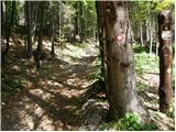 2
2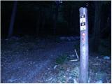 3
3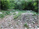 4
4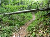 5
5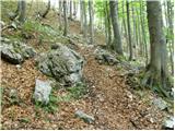 6
6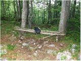 7
7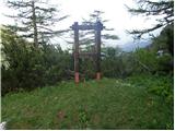 8
8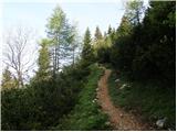 9
9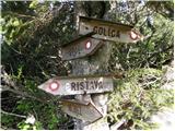 10
10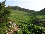 11
11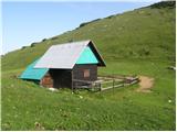 12
12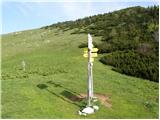 13
13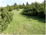 14
14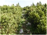 15
15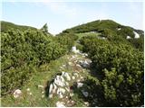 16
16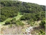 17
17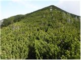 18
18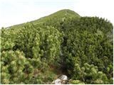 19
19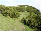 20
20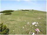 21
21 22
22
Discussion about the trip Dom Trilobit - Barentaler Kotschna/Struška
|
| Gost31. 10. 2007 |
Moderate hike offering exceptional views of the Julian Alps. I recommend visiting in May when Struška is all in bloom.
|
|
|
|
| Gost8. 11. 2007 |
it's very good there 
|
|
|
|
| Okmodko19. 12. 2009 |
I'm going there tomorrow. Maybe won't return. Good luck.
|
|
|
|
| Natasha22. 01. 2010 |
We're making a plan for 2010. And this will be our first venture.
Is it suitable for snow conditions? How is it there with avalanching? Who can tell more?
Thanks in advance!
|
|
|
|
| heinz22. 01. 2010 |
Along the route described above there won't be problems. Struška is quite wind-swept, so it's not very pleasant for ski touring either. The only thing I'm a bit doubtful about is if this path over Seča and further along the border line (or the usual one to Golica) is much trodden, so I'd recommend Pusti Rovt or Križovec as starting point.
For trail-breaking there's still quite a lot of snow, plus it's forming icy crust these days.
Avalanche danger - low (officially 2nd degree too)
|
|
|
|
| klavdipo17. 02. 2010 |
Is there a stamp on this summit too?
|
|
|
|
| viharnik17. 02. 2010 |
On Struška summit there is only a container of the radio amateurs club. Keys are kept only by the relevant members, who usually sign the arrivals booklet.
|
|
|
|
| heinz17. 02. 2010 |
Go to Struška in May or June, when auricula and gentian bloom so abundantly there, more than anywhere else, and you'll get a mark that no one will ever be able to erase from you forever.
|
|
|
|
| Gorazd G17. 02. 2010 |
Heinz, I completely agree. Excellently written
|
|
|
|
| klavdipo17. 02. 2010 |
Thanks for the information.
Regards
|
|
|
|
| grega_p10. 02. 2011 |
I also got that Heinz stamp today, as I slept up there by the container.
Started at 6 pm in front of CŠOD and through Medji dol, where there is occasionally frozen ice (ice), higher up at planina Seča the snow is already crusty and walking is easier. The moon lit the whole path, helped by numerous stars, which I don't remember seeing so many ever. So the headlamp was almost not needed, of course the tracks of predecessors helped too. Clear and cold night, some time by a pleasant fire and emergency shelter, when it went out then forced morning exercise and back the same way at 4 am. MORE THAN RECOMMENDED!
You will need good equipment, some knife for the pines (underlay or fire) and shovel for snow, if you dig a snow hole or just for a windbreak wall.
|
|
|
|
| heinz10. 02. 2011 |
Your experience, Grega, seems to prove to me that you are very well prepared and in control of things.
Certainly, this is not for everyone. Personally, I like such an action!
|
|
|
|
| grega_p11. 02. 2011 |
More than preparation, it's about desire to feel nature in night silence. The rest regarding equipment and fitness comes spontaneously. Everyone can "master" it if there are not too many negative thoughts in the head.
If by chance it tempts you -
up there I left a bed from pines, snow rim (needs to be raised a bit because of wind) and fireplace...
|
|
|
|
| heinz11. 02. 2011 |
Cool. But with virus that's just now "burning" me well, risky for now. Unless you want to stay up there.. (like my fellow villager Beg,- btw has memorial plaque near container)
Otherwise, - gotta try it sometime..
|
|
|
|
| marezt7. 06. 2012 |
when you reach Planina Seča...and go straight up...what's the name of that hill (before Struška)...?
|
|
|
|
| Majdag31. 05. 2014 |
... The path is pleasant, no fallen trees through the forest. From Planina Seča along the old border path. You start at border stone 197, end at 216. On sunny spots primroses are blooming, gentians are also found among them. On the summit there are already some alpine roses, on the slope towards the hut none yet, still cold winter. Then there are alpine roses again, everything is blooming.
|
|
|
|
| velkavrh13. 06. 2014 |
I was already here this spring and I know it's really nice.
|
|
|
|
| miri13. 06. 2014 |
Shame, because the surroundings of Dom Trilobit are so neglected.
|
|
|
|
| sirt113. 06. 2014 |
It can't be different, since they manage it from Lublajna(CŠOD Lublajna)!
|
|
|
|
| J.P.7. 11. 2021 10:20:09 |
The path is currently without any special features. The wooden cross at the top is no longer there, but there is a summit logbook with a stamp and one container/bivouac. LP
|
|
|
|
| jprim11. 06. 2023 22:49:53 |
Current status - this is not a bivouac, but a telecommunications facility, at least that's what I think.
However, it would be possible to place a bench on top of Struška, maybe more  , that's just how it is in Slovenia, ... , that's just how it is in Slovenia, ...
LP!
|
|
|
|
| Jusk14. 06. 2023 16:58:54 |
That container at the top is a radio amateur station, something like that, definitely related to amateur radio.
|
|
|
To post a comment you must log in:
If you do not yet have a username, you must first
register.