Dom pod Storžičem - Veliki Javornik (Ženiklovec)
Starting point: Dom pod Storžičem (1123 m)
| Latitude/Longitude: | 46,3586°N 14,3906°E |
| |
Walking time: 1 h 50 min
Difficulty: easy unmarked way
Elevation gain: 593 m
Elevation difference along the route: 595 m
Map: Karavanke - osrednji del 1:50.000
Recommended equipment (summer):
Recommended equipment (winter): ice axe, crampons
Views: 27.657
 | 3 people like this post |
Access to starting point:
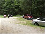
From the Ljubljana–Jesenice motorway take the Ljubelj exit. From this road turn right into Tržič just before the petrol station. Follow the road through Tržič and on the other side of Tržič turn right towards Lom pod Storžičem. Follow this road further towards the signs for Dom pod Storžičem. Park in the parking area a few metres before the mountain hut.
Route description:
From the parking lot near Dom pod Storžičem continue on the left road towards Javorniško sedlo, Planina Javornik, Jezersko, Pavšel, Tič, Tržič and NOB monument. Already after a few metres of walking the road splits into two parts, we choose the upper right road (left Tič and NOB monument). Continue along the mentioned road, which after approximately 20 minutes of walking turns into a cart track. At the place where the road turns into a cart track we have two options for continuing. The ascent can be continued along the steep and quite overgrown footpath, or along the somewhat less steep cart track, which is not marked but is even somewhat easier orientation-wise than the marked footpath. The cart track and footpath merge higher up and lead us to Javorniški preval, where there is a signposted junction.
Here continue left (right Kanonir, sharp right Storžič), where after some 10 steps we arrive at the next junction. The right path leads towards Močnikovo sedlo, we continue along the left path towards Planina Javornik. The path continues along a wide and gentle cart track, which for a while crosses the slopes towards the northwest. After a few minutes the forest thins and the increasingly scenic path leads us to Planina Javornik, from which a fine view opens up.
From the planina continue right (left downhill Koča pri Zdravc, straight Stegovnik) along a moderately steep grassy slope, where initially we can still follow the path, which however is no longer marked from the planina onwards, and higher up turns into easy pathless terrain. When the track ends, continue across the grassy slope, which quite resembles a ski slope. Follow this "path" from which the views become ever finer, all the way to the logbook box on Veliki Javornik or Ženiklovec, reaching it after less than 30 minutes ascent from Planina Javornik.
Starting point - Javorniško sedlo 1:00, Javorniško sedlo - Planina Javornik 0:20, Planina Javornik - Ženiklovec 0:30.

Photos:
 1
1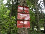 2
2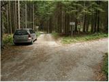 3
3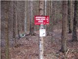 4
4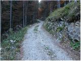 5
5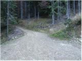 6
6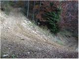 7
7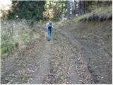 8
8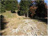 9
9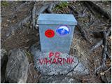 10
10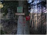 11
11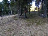 12
12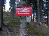 13
13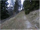 14
14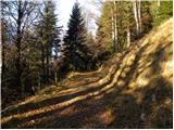 15
15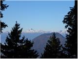 16
16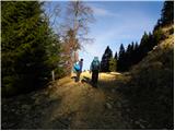 17
17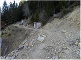 18
18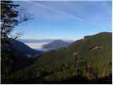 19
19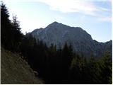 20
20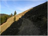 21
21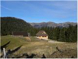 22
22 23
23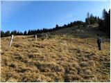 24
24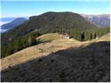 25
25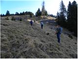 26
26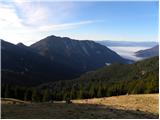 27
27 28
28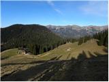 29
29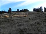 30
30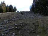 31
31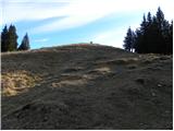 32
32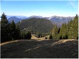 33
33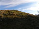 34
34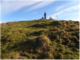 35
35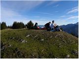 36
36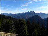 37
37 38
38
Discussion about the trip Dom pod Storžičem - Veliki Javornik (Ženiklovec)
|
| Gost26. 01. 2007 |
I recommend winter sledding on the forest road turned into a sledding slope! Awesome! Best regards Zigy 
|
|
|
|
| andrej jerina16. 11. 2008 |
Today my son Jošt and I set off along the above-described path towards the Javornik summit. In the middle section, the path was still quite soggy due to abundant recent rainfall, but at the top wonderful views of sunlit mountains. For the descent, we used the forest logging trail, from which you can't go wrong and which takes you to the forest road, where the marked path turns right, steeply uphill. Wonderful views, recommended. LP Andrej
|
|
|
|
| Ukec29. 12. 2010 |
What are the current conditions up there? Is there enough snow for ski touring?
|
|
|
|
| Parkeljc6. 03. 2011 |
Today I headed to Ženiklovec. By car only to the barrier, from there by road or path to Dom pod Storžičem. I took the road, which is "reserved for sledding". Path to Javorniški preval is fairly well trodden, from there to planina Javornik only one track, sinking up to 20 cm. From planina to summit again fairly well trodden from Bela peči and Stegovnik directions. Morning was really fantastic, then fog appeared very quickly, which (after I was back at start) soon thickened and views ended. From summit to pass I took a shortcut, but caution needed. Praise to friendly hut staff where I stopped on return. Currently ideal sledding conditions. Sunshine scarce in these parts though.
|
|
|
|
| Lunca3. 06. 2011 |
In these days I was at Ženiklovec... appealing to PD Tržič... the stamp is damaged, it should be replaced.
|
|
|
|
| robter13. 06. 2011 |
The stamp is still damaged, and there was no view from the top today.
|
|
|
|
| klavdipo22. 02. 2012 |
How is it with the stamp? Is it still damaged or is there a new one already? Please reply! Regards
|
|
|
|
| Zvonček31. 08. 2012 |
Tomorrow I'm planning to go to Veliki Javornik, so I went to check the trail a bit. And I see that Lunca and klavdipo have already asked if the stamp has been changed. I'm really curious if PD Tržič has managed to do something in this "short time".
|
|
|
|
| keti111. 07. 2021 20:28:59 |
Today I went on this trail to Javornik, everything well marked, logbook and stamp at the top. Only, it's no longer allowed to drive by car to Dom pod Storžičem, I didn't know that before. Still, quite a few drove there.
|
|
|
|
| hribovc7623. 02. 2022 20:51:02 |
Hello!
Does anyone know what the road to the hut is like?
Thanks and best, Jan
|
|
|
|
| _sandra_24. 02. 2022 06:51:38 |
On Sunday, 20.2., it was icy below, higher up there was snow.
|
|
|
To post a comment you must log in:
If you do not yet have a username, you must first
register.