Dom pod Storžičem - Stegovnik (western way)
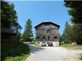
Starting point: Dom pod Storžičem (1123 m)
| Latitude/Longitude: | 46,3586°N 14,3906°E |
| |
Route name: western way
Walking time: 4 h
Difficulty: partly demanding marked way
Elevation gain: 569 m
Elevation difference along the route: 800 m
Map: Karavanke - osrednji del 1:50.000
Recommended equipment (summer): helmet
Recommended equipment (winter): helmet, ice axe, crampons
Views: 14.425
 | 1 person like this post |
Access to starting point:
From the Ljubljana - Jesenice motorway, take the Ljubelj exit. From this road, just before the petrol station, turn right into Tržič. Follow the road through Tržič and on the other side of Tržič turn right towards Lom pod Storžičem. Follow this road further towards the signs for Dom pod Storžičem. Park in the parking lot a few metres before the mountain hut.
Route description:
From the parking lot near Dom pod Storžičem, head to the left road in the direction of Javorniško sedlo, Jezersko, Tič, Rekar and Grahovše. After a few steps, the road forks, and we continue slightly right towards Javorniški preval and gradually begin a moderate ascent.
Higher up, when the road turns into a cart track, leave it and continue right on the marked path, which begins to ascend more steeply; before Javorniški preval, it crosses the cart track twice more, and it is also possible to reach Javorniški preval along it. After about 1 hour of walking, we reach the mentioned pass, where there is a signpost and a logbook box, and it is a junction of several paths.
Here continue left (right Kanonir, sharply right Storžič), where after some 10 steps we arrive at the next junction. The right path leads towards Močnikovo sedlo, we continue on the left path in the direction of Planina Javornik. The path ahead continues along a wide and gentle cart track, which for some time traverses the slopes towards the northwest. After a few minutes, the forest thins out and the increasingly scenic path leads us to Planina Javornik, from which a nice view opens up.
On the pasture, at one of the huts, we reach the road, and we continue north along it (left downhill Koča pri Zdravcu, right uphill Ženiklovec); at a few more huts, the road turns right and heads east. This is followed by some traverse descent through the forest; when we leave the forest, the road reaches a small intersection, but before it we continue straight onto the mountain path, beside which there are signs for Stegovnik (here, from the left, an unmarked path joins in the lower part, starting from Planina Vetrh).
The path ahead crosses a meadow; on the other side of the meadow, we return to the forest, and the path continues along a cart track that mostly descends easily. Later, the cart track turns into a trail that partly ascends, partly descends, mainly leading along the western slopes. During the traverse, views open up only occasionally, mainly towards Košuta; later, the path leads past a pleasant bench. When we leave the area of Mali Javornik, the slope gradually becomes less steep, and we occasionally leave the forest and cross some overgrown clearing.
As we approach the Stegovnik massif, at a small saddle we reach a junction where the path from Jezersko joins from the right; it is possible to switch from the eastern path to the western one, or vice versa.
Continue straight ahead, or stick to the western direction of the ridge; a little further on, the slope becomes quite steep, and the path leads us to the first fixed rope, with whose help we enter Okno v Stegovniku. In the middle of the window, a passage opens to the left towards the second window, to which we descend via a short ladder; from there, we continue right through a smaller window, behind which we step onto the other side of the ridge.
On the other side of the window, with the help of a short fixed rope, we descend to the slope, along which we then ascend relatively steeply. Further on, the steep path leads under cliffs (danger of falling rocks), then gradually we arrive at the main ridge of Stegovnik. Here the path turns left and ascends to the southwest subpeak amid ever better views; from it follows a short indistinct descent along a locally narrow ridge. We continue along a very scenic and in places exposed ridge, along which in a few minutes of gentle ascent we reach the 1692 m high summit.
Descent is possible via the eastern path.
Starting point - Javorniško sedlo 1:00, Javorniško sedlo - Planina Javornik 0:20, Planina Javornik - Strženica 0:15, Strženica - junction before the window 1:15, junction before the window - Stegovnik ridge 0:45, Stegovnik ridge - Stegovnik 0:25.

Photos:
 1
1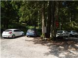 2
2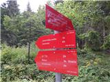 3
3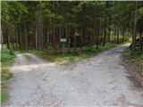 4
4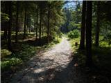 5
5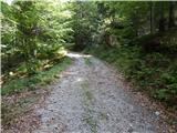 6
6 7
7 8
8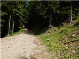 9
9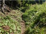 10
10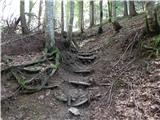 11
11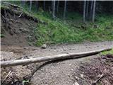 12
12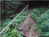 13
13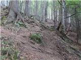 14
14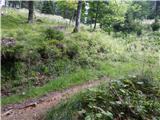 15
15 16
16 17
17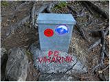 18
18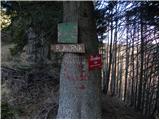 19
19 20
20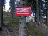 21
21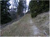 22
22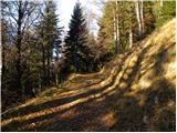 23
23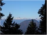 24
24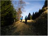 25
25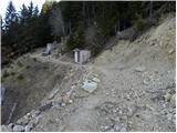 26
26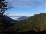 27
27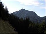 28
28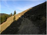 29
29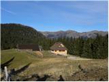 30
30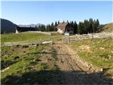 31
31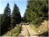 32
32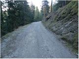 33
33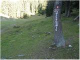 34
34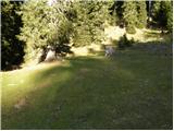 35
35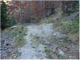 36
36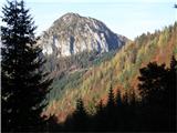 37
37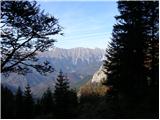 38
38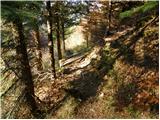 39
39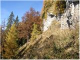 40
40 41
41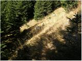 42
42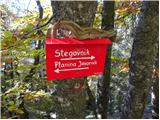 43
43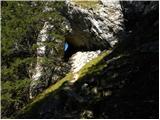 44
44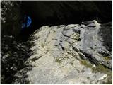 45
45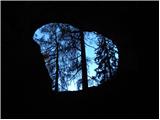 46
46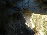 47
47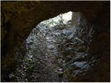 48
48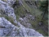 49
49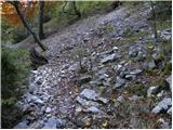 50
50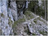 51
51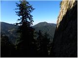 52
52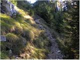 53
53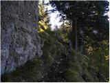 54
54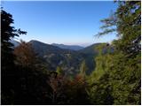 55
55 56
56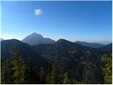 57
57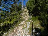 58
58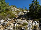 59
59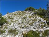 60
60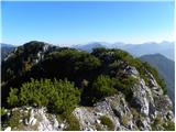 61
61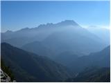 62
62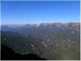 63
63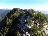 64
64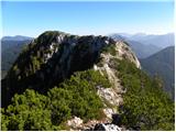 65
65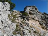 66
66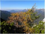 67
67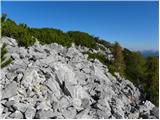 68
68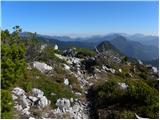 69
69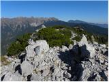 70
70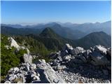 71
71
Discussion about the trip Dom pod Storžičem - Stegovnik (western way)
|
| Tadej22. 10. 2008 |
The path through the window is very picturesque and worth seeing. The upper part of the path is also interesting, as the ridge is very panoramic.
|
|
|
|
| asde14. 03. 2011 |
Hello,
on Saturday, 12.03.2011 we set off for Stegovnik. Trail start at Dom pod Storžičem, over Javorniško sedlo, then under M. Javornik.
Snow in shady spots up to 30cm, elsewhere 5-10cm.
Stegovnik itself is completely bare, but we couldn't find the path to the summit, markers are obviously on the ground covered by snow. The trail is otherwise very hard to follow, a bit of criticism for PD Tržič and the markers.
|
|
|
|
| Zasavčan14. 03. 2011 |
Does anyone know what the path through the gorge is like???
|
|
|
|
| Zasavčan15. 03. 2011 |
I know that, but the conditions, if someone has passed through here recently
|
|
|
|
| robter13. 06. 2011 |
Today I did a circular tour from Dom pod Storžičem to Javorniški preval and then along the western path towards Stegovnik. Along the way visited Ženiklovec. At the tree where you need to cross the meadow, I wasn't attentive enough and continued along the road, but after about 10 minutes without markers I realized something was wrong and returned.
The path is otherwise well marked.
I returned to Javorniški preval along the eastern path, where in the grass you need to be careful with markers, as the path is hard to follow in places.
|
|
|
|
| VanSims4. 05. 2020 |
True, the eastern trail (at least on the return) is in places (still) quite poorly marked and you have to be a bit of a detective. The above description is also somewhat incomplete or already outdated and needs renewal.
|
|
|
To post a comment you must log in:
If you do not yet have a username, you must first
register.