Dom pod Storžičem - Stegovnik (eastern way)
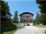
Starting point: Dom pod Storžičem (1123 m)
| Latitude/Longitude: | 46,3586°N 14,3906°E |
| |
Route name: eastern way
Walking time: 4 h
Difficulty: partly demanding marked way
Elevation gain: 569 m
Elevation difference along the route: 800 m
Map: Karavanke - osrednji del 1:50.000
Recommended equipment (summer): helmet
Recommended equipment (winter): helmet, ice axe, crampons
Views: 11.478
 | 1 person like this post |
Access to starting point:
From the Ljubljana-Jesenice motorway take the Ljubelj exit. From this road turn right into Tržič just before the petrol station. Follow the road through Tržič and on the other side of Tržič turn right towards Lom pod Storžičem. Follow this road following the signs to Dom pod Storžičem. Park in the parking lot a few metres before the mountain hut.
Route description:
From the parking lot near Dom pod Storžičem head to the left road towards Javorniško sedlo, Jezersko, Tič, Rekar and Grahovš. After a few steps the road forks, we continue slightly right towards Javorniški preval and gradually begin a moderate ascent.
Higher up, where the road turns into a cart track, leave it and continue right on the marked path which starts to ascend more steeply, crossing the cart track twice before Javorniški preval, by which it is also possible to reach Javorniški preval. After about 1 hour of walking reach the mentioned pass where there is a signpost and summit log box and a junction of several paths.
Here continue left (right Kanonir, sharply right Storžič), after some 10 steps arrive at the next junction. Continue on the slightly right path towards Stegovnik and Močnikovo sedlo (slightly left Planina Javornik).
Continue along the cart track crossing the eastern slopes in front of the Ženiklovec subpeak. After a few minutes of traversing the cart track joins another somewhat wider one, continue straight or slightly right and moderately downhill. The cart track soon levels and the path past a collapsing water trough leads to a scenic grassy slope where we encounter an orienteering loop. At the often overturned signpost leave the cart track and continue left up the grassy slope. After a short ascent the path turns right continuing through spruce forest. The hiking trail soon widens into a cart track which we follow for some time (markings here are sparse and faded). After a while the cart track turns back into a footpath leading through forest to the southern slopes of Mali Javornik.
At the spot where the marked trail to Mačensko sedlo becomes less visible a passage opens left towards Mali Javornik, we continue straight on the marked path which continues crossing the slopes of Mali Javornik on the right side.
The occasionally very scenic path soon returns to the forest where from southern slopes it passes to eastern. The path which ahead mostly gently descends leads us after some time to the pass between Mali Javornik and Stegovnik where there is also a junction.
Continue left towards Stegovnik (straight Mačensko sedlo) on the path crossing a belt of tall grass. The path ahead starts gently descending leading us in a few minutes to a parallel path running along the western slopes of Ženiklovec and Mali Javornik.
Here continue right towards Stegovnik (left Planina Javornik) keeping the western ridge direction, the slope soon becomes quite steep, the path leads to the first wire rope with whose help we enter Okno v Stegovniku. In the middle of the window a passage opens left to the second window down which we descend via short ladder, from there continue right through smaller window after which we step to the other side of the ridge.
On the other side of the window descend to the slope with short wire rope help after which we ascend relatively steeply. Continuing the steep path leads under cliffs (danger of falling rocks), then gradually arrive at the main ridge of Stegovnik. Here the path turns left ascending to the southwest subpeak with ever better views from which follows a short indistinct descent along locally narrow ridge. Continue along very scenic and at places precipitous ridge along which in a few minutes of gentle ascent arrive at the 1692 metre high summit.
Descent possible via western path.
Starting point - Javorniško sedlo 1:00, Javorniško sedlo - junction to Mali Javornik 1:15, junction to Mali Javornik - junction at saddle below Stegovnik 0:30, junction at saddle below Stegovnik - junction before window 0:05, junction before window - Stegovnik ridge 0:45, Stegovnik ridge - Stegovnik 0:25.

Along the route: Javorniški preval (1465m), Odcep proti Malemu Javorniku (1637m), Sedlo pod Stegovnikom (1490m), Razpotje pod Oknom v Stegovniku (1473m),
Okno v Stegovniku (1476m), Greben Stegovnika (1684m)
Photos:
 1
1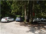 2
2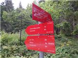 3
3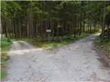 4
4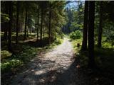 5
5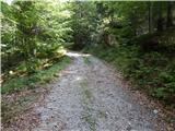 6
6 7
7 8
8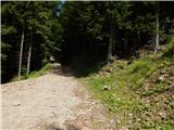 9
9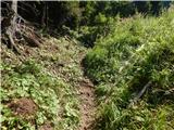 10
10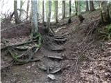 11
11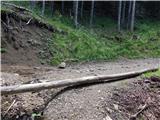 12
12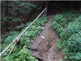 13
13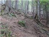 14
14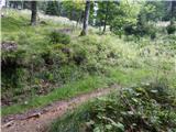 15
15 16
16 17
17 18
18 19
19 20
20 21
21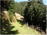 22
22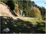 23
23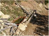 24
24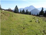 25
25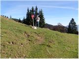 26
26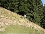 27
27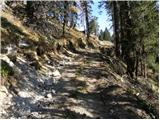 28
28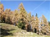 29
29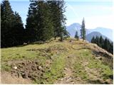 30
30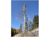 31
31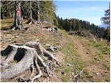 32
32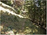 33
33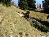 34
34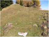 35
35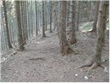 36
36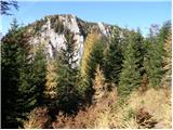 37
37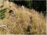 38
38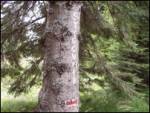 39
39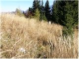 40
40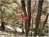 41
41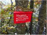 42
42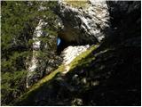 43
43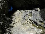 44
44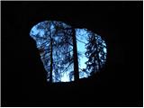 45
45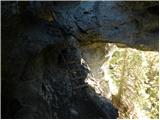 46
46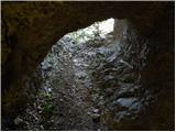 47
47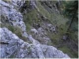 48
48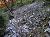 49
49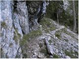 50
50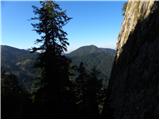 51
51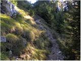 52
52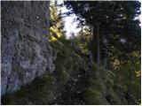 53
53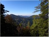 54
54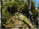 55
55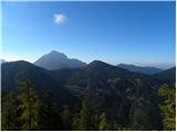 56
56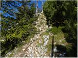 57
57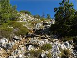 58
58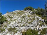 59
59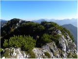 60
60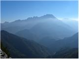 61
61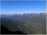 62
62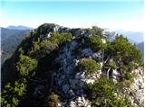 63
63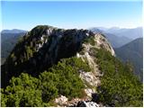 64
64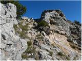 65
65 66
66 67
67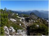 68
68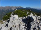 69
69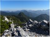 70
70
Discussion about the trip Dom pod Storžičem - Stegovnik (eastern way)
|
| asde14. 03. 2011 |
Hello,
on Saturday, 12.03.2011 we headed to Stegovnik. Start of the path Dom pod Storžičem, over Javorniško sedlo, then under M. Javornik.
Snow in shady areas up to 30cm, elsewhere 5-10cm.
Stegovnik itself is completely bare, but we didn't find the path to the summit, the markers are obviously on the ground, covered with snow. The path is otherwise very hard to follow, a bit of criticism for PD Tržič and the markers.
|
|
|
|
| Tinca52. 04. 2011 |
On the eastern and western paths to Stegovnik there is still some snow in shady spots. Need to follow the markers closely to avoid getting into an orienteering loop  . Otherwise scenic, not too demanding path (elevation gain). . Otherwise scenic, not too demanding path (elevation gain).
|
|
|
|
| UB7711. 05. 2014 |
Hello,
if anyone has been there recently, I'm interested in the condition or passability of the path from Javorniško sedlo to Okno.
Well, I know one has been, because we met under Mali Javornik.
|
|
|
|
| keti110. 07. 2018 |
Hi, on Sunday 8.7. I was at Stegovnik, ascent from Dol pod Pl. Javornik along the marked path through the western slopes of Javorniki through the window, path ok, markings good. I descended to preval Pri lojtri, from there towards Javorniški preval across the eastern slopes of Stegovnik and Javorniki. This crossing path is very problematic, although marked as easy marked on maps. Markings are really quite good and frequent, but the path is obviously very little visited, quite overgrown, enormous large trees downed everywhere, where bypasses are nowhere possible or safe, because the slope is steep, often have to climb over downed spruces through dense and sharp branches, crawl underneath... in short problematic path. Also orientationally in many places you don't know exactly where, and I'm used to unmarked terrain and pathless areas. I think the markers (probably PD Tržič?) should clean it or close it or at least put warning signs that due to downed trees it is locally difficult to pass. The most problematic is the section under Stegovnik, that's about 1 hour walk.
Nice regards and good luck!
|
|
|
|
| djimuzl10. 07. 2018 |
Keti1, you can report obstacles on the path to PZS - poskodbe.poti@pzs.si - they will notify the appropriate PD. A photo wouldn't hurt either.
|
|
|
|
| keti110. 07. 2018 |
Thanks for the advice! Regards
|
|
|
|
| VanSims4. 05. 2020 |
The trail is now obviously already cleared since there were no major problems with any fallen trees. But it is still quite poorly marked in places. At least on the return you can somehow (with a bit of detective work) catch the marks. The description is also deficient or already outdated regarding the conditions on the ground.
|
|
|
|
| alči2. 08. 2022 23:30:57 |
On August 1, 22, the trail under Stegovnik (from Mali Javornik along the marked trail under Stegovnik) was difficult to pass due to fallen spruces uprooted with roots (on the eastern part of the marked trail under Stegovnik).
I missed the marking under Mali Javornik and climbed to the top of Mali Javornik (360-degree view) and then by the nearest path to the foot of Stegovnik. From there I walked mostly above the scree fields. I reached the marked trail on the last third of the trail under Stegovnik. On this section there are really many uprooted spruces lying on the trail, also on steep terrain.
Stegovnik is always unforgettable.
The trail along the Stegovnik ridge is beautiful, worth all the effort. A nice detail is the passage through the rock on the descent from the mountain towards the Javornik pasture. The trail to Javornik pasture and further to Javorniško sedlo is not problematic, although the markings are sparse.
|
|
|
To post a comment you must log in:
If you do not yet have a username, you must first
register.